Property/Postcode Data Search:
DE6 9DR maps, stats, and open data
DE6 9DR is located in the Ashbourne South electoral ward, within the local authority district of Derbyshire Dales and the English Parliamentary constituency of Derbyshire Dales. The Sub Integrated Care Board (ICB) Location is NHS Derby and Derbyshire ICB - 15M and the police force is Derbyshire. This postcode has been in use since March 2018.
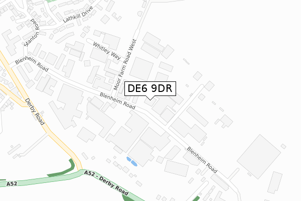
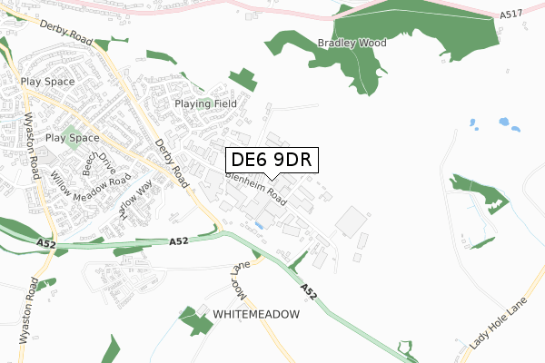
DE6 9DR maps


Source: OS Open Zoomstack (Ordnance Survey)
Licence: Open Government Licence (requires attribution)
Attribution: Contains OS data © Crown copyright and database right 2025
Source: Open Postcode Geo
Licence: Open Government Licence (requires attribution)
Attribution: Contains OS data © Crown copyright and database right 2025; Contains Royal Mail data © Royal Mail copyright and database right 2025; Source: Office for National Statistics licensed under the Open Government Licence v.3.0
Licence: Open Government Licence (requires attribution)
Attribution: Contains OS data © Crown copyright and database right 2025
Source: Open Postcode Geo
Licence: Open Government Licence (requires attribution)
Attribution: Contains OS data © Crown copyright and database right 2025; Contains Royal Mail data © Royal Mail copyright and database right 2025; Source: Office for National Statistics licensed under the Open Government Licence v.3.0
DE6 9DR geodata
| Easting | 419422 |
| Northing | 345486 |
| Latitude | 53.006357 |
| Longitude | -1.712007 |
Where is DE6 9DR?
| Country | England |
| Postcode District | DE6 |
Politics
| Ward | Ashbourne South |
|---|---|
| Constituency | Derbyshire Dales |
Transport
Nearest bus stops to DE6 9DR
| Moy Park (Blenheim Road) | Spitalhill | 139m |
| Moor Farm Road West (Blenheim Road) | Spitalhill | 152m |
| Snipesmoor Lane (Derby Road) | Spitalhill | 328m |
| Snipesmoor Lane (Derby Road) | Spitalhill | 343m |
| Derby Road | Spitalhill | 416m |
Deprivation
11.3% of English postcodes are less deprived than DE6 9DR:Food Standards Agency
Three nearest food hygiene ratings to DE6 9DR (metres)
Runway Cafe

Blenheim Road
76m
Moy Park Ashbourne P1 Canteen

Moy Park
76m
Queens Fish and Chips

Unit 6.3
107m
➜ Get more ratings from the Food Standards Agency
Nearest post box to DE6 9DR
| Last Collection | |||
|---|---|---|---|
| Location | Mon-Fri | Sat | Distance |
| Ashbourne Pdo | 17:30 | 12:30 | 40m |
| Blenheim Road | 18:30 | 106m | |
| Osmaston Turn | 17:30 | 07:00 | 373m |
DE6 9DR ITL and DE6 9DR LAU
The below table lists the International Territorial Level (ITL) codes (formerly Nomenclature of Territorial Units for Statistics (NUTS) codes) and Local Administrative Units (LAU) codes for DE6 9DR:
| ITL 1 Code | Name |
|---|---|
| TLF | East Midlands (England) |
| ITL 2 Code | Name |
| TLF1 | Derbyshire and Nottinghamshire |
| ITL 3 Code | Name |
| TLF13 | South and West Derbyshire |
| LAU 1 Code | Name |
| E07000035 | Derbyshire Dales |
DE6 9DR census areas
The below table lists the Census Output Area (OA), Lower Layer Super Output Area (LSOA), and Middle Layer Super Output Area (MSOA) for DE6 9DR:
| Code | Name | |
|---|---|---|
| OA | E00099116 | |
| LSOA | E01019597 | Derbyshire Dales 009C |
| MSOA | E02004076 | Derbyshire Dales 009 |
Nearest postcodes to DE6 9DR
| DE6 1HA | Blenheim Road | 147m |
| DE6 1LZ | Derby Road | 243m |
| DE6 1LG | Whitley Way | 344m |
| DE6 1LY | Snipes Moor Lane | 374m |
| DE6 1SW | Lathkill Drive | 405m |
| DE6 1SJ | Ashmeadow Court | 498m |
| DE6 1SR | Cavendish Drive | 535m |
| DE6 1SH | Stanton Road | 557m |
| DE6 1DJ | Derwent Gardens | 565m |
| DE6 1SP | Haddon Court | 600m |