Property/Postcode Data Search:
DE6 3GW maps, stats, and open data
DE6 3GW is located in the Brailsford electoral ward, within the local authority district of Derbyshire Dales and the English Parliamentary constituency of Derbyshire Dales. The Sub Integrated Care Board (ICB) Location is NHS Derby and Derbyshire ICB - 15M and the police force is Derbyshire. This postcode has been in use since December 2019.
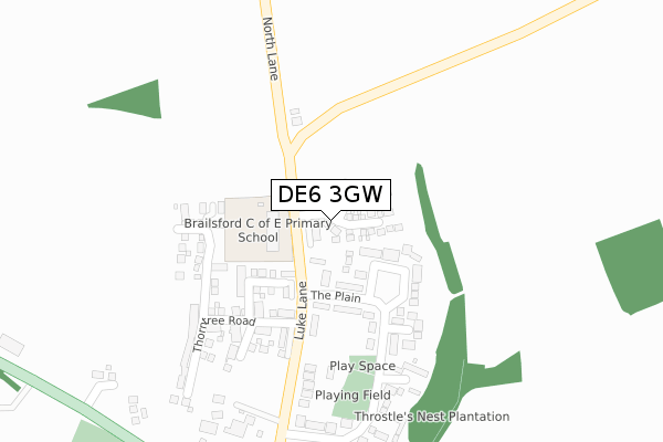
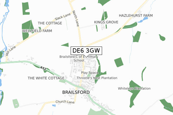
DE6 3GW maps


Source: OS Open Zoomstack (Ordnance Survey)
Licence: Open Government Licence (requires attribution)
Attribution: Contains OS data © Crown copyright and database right 2025
Source: Open Postcode Geo
Licence: Open Government Licence (requires attribution)
Attribution: Contains OS data © Crown copyright and database right 2025; Contains Royal Mail data © Royal Mail copyright and database right 2025; Source: Office for National Statistics licensed under the Open Government Licence v.3.0
Licence: Open Government Licence (requires attribution)
Attribution: Contains OS data © Crown copyright and database right 2025
Source: Open Postcode Geo
Licence: Open Government Licence (requires attribution)
Attribution: Contains OS data © Crown copyright and database right 2025; Contains Royal Mail data © Royal Mail copyright and database right 2025; Source: Office for National Statistics licensed under the Open Government Licence v.3.0
DE6 3GW geodata
| Easting | 425544 |
| Northing | 341992 |
| Latitude | 52.974694 |
| Longitude | -1.621050 |
Where is DE6 3GW?
| Country | England |
| Postcode District | DE6 |
Politics
| Ward | Brailsford |
|---|---|
| Constituency | Derbyshire Dales |
House Prices
Sales of detached houses in DE6 3GW
2025 17 APR £450,000 |
2024 23 JUL £275,000 |
10, BLACKTHORN CLOSE, BRAILSFORD, ASHBOURNE, DE6 3GW 2021 11 MAR £354,995 |
8, BLACKTHORN CLOSE, BRAILSFORD, ASHBOURNE, DE6 3GW 2020 15 DEC £372,000 |
2, BLACKTHORN CLOSE, BRAILSFORD, ASHBOURNE, DE6 3GW 2020 27 NOV £239,995 |
12, BLACKTHORN CLOSE, BRAILSFORD, ASHBOURNE, DE6 3GW 2020 26 NOV £399,995 |
2020 19 OCT £379,995 |
7, BLACKTHORN CLOSE, BRAILSFORD, ASHBOURNE, DE6 3GW 2020 18 SEP £379,995 |
4, BLACKTHORN CLOSE, BRAILSFORD, ASHBOURNE, DE6 3GW 2020 31 JUL £229,995 |
2020 10 JUL £230,000 |
Source: HM Land Registry Price Paid Data
Licence: Contains HM Land Registry data © Crown copyright and database right 2025. This data is licensed under the Open Government Licence v3.0.
Licence: Contains HM Land Registry data © Crown copyright and database right 2025. This data is licensed under the Open Government Licence v3.0.
Transport
Nearest bus stops to DE6 3GW
| Luke Lane (Main Road) | Brailsford | 471m |
| Luke Lane (Main Road) | Brailsford | 479m |
| The White Cottage (Main Road) | Brailsford | 532m |
| The White Cottage (Main Road) | Brailsford | 568m |
| School (Main Road) | Brailsford | 571m |
Deprivation
21.9% of English postcodes are less deprived than DE6 3GW:Food Standards Agency
Three nearest food hygiene ratings to DE6 3GW (metres)
Brailsford Church Of England Controlled Primary

Luke Lane
185m
Rose And Crown

Main Road
569m
Brailsford Pre-School

Brailsford And Ednaston Institute
569m
➜ Get more ratings from the Food Standards Agency
Nearest post box to DE6 3GW
| Last Collection | |||
|---|---|---|---|
| Location | Mon-Fri | Sat | Distance |
| The Plains | 16:30 | 07:00 | 154m |
| Brailsford Stores | 16:00 | 11:00 | 580m |
| Brailsford Green | 16:00 | 09:30 | 582m |
DE6 3GW ITL and DE6 3GW LAU
The below table lists the International Territorial Level (ITL) codes (formerly Nomenclature of Territorial Units for Statistics (NUTS) codes) and Local Administrative Units (LAU) codes for DE6 3GW:
| ITL 1 Code | Name |
|---|---|
| TLF | East Midlands (England) |
| ITL 2 Code | Name |
| TLF1 | Derbyshire and Nottinghamshire |
| ITL 3 Code | Name |
| TLF13 | South and West Derbyshire |
| LAU 1 Code | Name |
| E07000035 | Derbyshire Dales |
DE6 3GW census areas
The below table lists the Census Output Area (OA), Lower Layer Super Output Area (LSOA), and Middle Layer Super Output Area (MSOA) for DE6 3GW:
| Code | Name | |
|---|---|---|
| OA | E00099150 | |
| LSOA | E01019603 | Derbyshire Dales 010A |
| MSOA | E02004077 | Derbyshire Dales 010 |
Nearest postcodes to DE6 3GW
| DE6 3BY | Luke Lane | 133m |
| DE6 3BZ | The Plain | 172m |
| DE6 3BS | The Spinney | 289m |
| DE6 3BR | The Plain | 319m |
| DE6 3DB | Throstle Nest Way | 418m |
| DE6 3BQ | Corner Farm | 431m |
| DE6 3DP | Sundial Close | 441m |
| DE6 3DQ | Sundial Walk | 446m |
| DE6 3DA | Main Road | 583m |
| DE6 3DX | Saracens Court | 619m |