DE6 3GT maps, stats, and open data
DE6 3GT is located in the Brailsford electoral ward, within the local authority district of Derbyshire Dales and the English Parliamentary constituency of Derbyshire Dales. The Sub Integrated Care Board (ICB) Location is NHS Derby and Derbyshire ICB - 15M and the police force is Derbyshire. This postcode has been in use since July 2019.
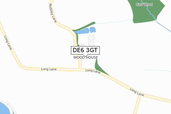
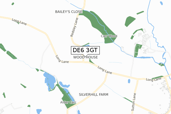
DE6 3GT maps


Licence: Open Government Licence (requires attribution)
Attribution: Contains OS data © Crown copyright and database right 2025
Source: Open Postcode Geo
Licence: Open Government Licence (requires attribution)
Attribution: Contains OS data © Crown copyright and database right 2025; Contains Royal Mail data © Royal Mail copyright and database right 2025; Source: Office for National Statistics licensed under the Open Government Licence v.3.0
DE6 3GT geodata
| Easting | 425191 |
| Northing | 341781 |
| Latitude | 52.972814 |
| Longitude | -1.626323 |
Where is DE6 3GT?
| Country | England |
| Postcode District | DE6 |
Politics
| Ward | Brailsford |
|---|---|
| Constituency | Derbyshire Dales |
House Prices
Sales of detached houses in DE6 3GT
2025 26 MAR £600,000 |
44, WALLEF ROAD, BRAILSFORD, ASHBOURNE, DE6 3GT 2025 24 FEB £435,000 |
2024 12 SEP £430,000 |
2024 26 JAN £415,000 |
2023 14 DEC £475,000 |
2023 8 DEC £368,500 |
2023 4 DEC £250,000 |
42, WALLEF ROAD, BRAILSFORD, ASHBOURNE, DE6 3GT 2023 10 NOV £410,000 |
26, WALLEF ROAD, BRAILSFORD, ASHBOURNE, DE6 3GT 2023 6 NOV £400,000 |
2023 18 MAY £299,000 |
Licence: Contains HM Land Registry data © Crown copyright and database right 2025. This data is licensed under the Open Government Licence v3.0.
Transport
Nearest bus stops to DE6 3GT
| The White Cottage (Main Road) | Brailsford | 122m |
| The White Cottage (Main Road) | Brailsford | 159m |
| Luke Lane (Main Road) | Brailsford | 313m |
| Luke Lane (Main Road) | Brailsford | 321m |
| Chapel House (Painters Lane) | Brailsford | 413m |
Broadband
Broadband access in DE6 3GT (2020 data)
| Percentage of properties with Next Generation Access | 0.0% |
| Percentage of properties with Superfast Broadband | 0.0% |
| Percentage of properties with Ultrafast Broadband | 0.0% |
| Percentage of properties with Full Fibre Broadband | 0.0% |
Superfast Broadband is between 30Mbps and 300Mbps
Ultrafast Broadband is > 300Mbps
Broadband limitations in DE6 3GT (2020 data)
| Percentage of properties unable to receive 2Mbps | 0.0% |
| Percentage of properties unable to receive 5Mbps | 0.0% |
| Percentage of properties unable to receive 10Mbps | 0.0% |
| Percentage of properties unable to receive 30Mbps | 100.0% |
Deprivation
21.9% of English postcodes are less deprived than DE6 3GT:Food Standards Agency
Three nearest food hygiene ratings to DE6 3GT (metres)


➜ Get more ratings from the Food Standards Agency
Nearest post box to DE6 3GT
| Last Collection | |||
|---|---|---|---|
| Location | Mon-Fri | Sat | Distance |
| Brailsford Green | 16:00 | 09:30 | 374m |
| The Plains | 16:30 | 07:00 | 396m |
| Brailsford Stores | 16:00 | 11:00 | 504m |
DE6 3GT ITL and DE6 3GT LAU
The below table lists the International Territorial Level (ITL) codes (formerly Nomenclature of Territorial Units for Statistics (NUTS) codes) and Local Administrative Units (LAU) codes for DE6 3GT:
| ITL 1 Code | Name |
|---|---|
| TLF | East Midlands (England) |
| ITL 2 Code | Name |
| TLF1 | Derbyshire and Nottinghamshire |
| ITL 3 Code | Name |
| TLF13 | South and West Derbyshire |
| LAU 1 Code | Name |
| E07000035 | Derbyshire Dales |
DE6 3GT census areas
The below table lists the Census Output Area (OA), Lower Layer Super Output Area (LSOA), and Middle Layer Super Output Area (MSOA) for DE6 3GT:
| Code | Name | |
|---|---|---|
| OA | E00099151 | |
| LSOA | E01019603 | Derbyshire Dales 010A |
| MSOA | E02004077 | Derbyshire Dales 010 |
Nearest postcodes to DE6 3GT
| DE6 3BQ | Corner Farm | 238m |
| DE6 3BS | The Spinney | 290m |
| DE6 3BY | Luke Lane | 317m |
| DE6 3DP | Sundial Close | 349m |
| DE6 3BZ | The Plain | 376m |
| DE6 3BX | Church Lane | 386m |
| DE6 3DQ | Sundial Walk | 389m |
| DE6 3BR | The Plain | 410m |
| DE6 3DB | Throstle Nest Way | 436m |
| DE6 3DA | Main Road | 539m |