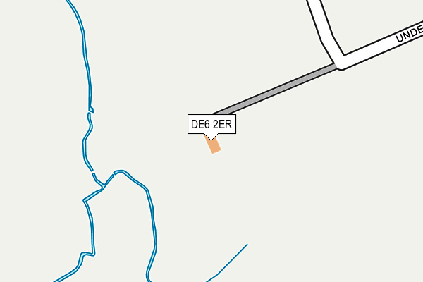
DE6 2ER is located in the Norbury electoral ward, within the local authority district of Derbyshire Dales and the English Parliamentary constituency of Derbyshire Dales. The Sub Integrated Care Board (ICB) Location is NHS Derby and Derbyshire ICB - 15M and the police force is Derbyshire. This postcode has been in use since March 2017.


GetTheData
Source: OS OpenMap – Local (Ordnance Survey)
Source: OS VectorMap District (Ordnance Survey)
Licence: Open Government Licence (requires attribution)
| Easting | 412340 |
| Northing | 340722 |
| Latitude | 52.963741 |
| Longitude | -1.817727 |
GetTheData
Source: Open Postcode Geo
Licence: Open Government Licence
| Country | England |
| Postcode District | DE6 |
➜ See where DE6 is on a map | |
GetTheData
Source: Land Registry Price Paid Data
Licence: Open Government Licence
| Ward | Norbury |
| Constituency | Derbyshire Dales |
GetTheData
Source: ONS Postcode Database
Licence: Open Government Licence
| Roston Inn (Mill Lane) | Roston | 590m |
| Roston Inn (Mill Lane) | Roston | 595m |
| Shawley Farm (Mill Lane) | Roston | 875m |
| Shawley Farm (Mill Lane) | Roston | 883m |
| The Hollow | Roston | 1,245m |
GetTheData
Source: NaPTAN
Licence: Open Government Licence
GetTheData
Source: ONS Postcode Database
Licence: Open Government Licence


➜ Get more ratings from the Food Standards Agency
GetTheData
Source: Food Standards Agency
Licence: FSA terms & conditions
| Last Collection | |||
|---|---|---|---|
| Location | Mon-Fri | Sat | Distance |
| Roston | 16:45 | 09:45 | 984m |
| Norbury | 16:45 | 09:00 | 1,589m |
| Ellaston Post Office | 16:45 | 10:00 | 1,994m |
GetTheData
Source: Dracos
Licence: Creative Commons Attribution-ShareAlike
The below table lists the International Territorial Level (ITL) codes (formerly Nomenclature of Territorial Units for Statistics (NUTS) codes) and Local Administrative Units (LAU) codes for DE6 2ER:
| ITL 1 Code | Name |
|---|---|
| TLF | East Midlands (England) |
| ITL 2 Code | Name |
| TLF1 | Derbyshire and Nottinghamshire |
| ITL 3 Code | Name |
| TLF13 | South and West Derbyshire |
| LAU 1 Code | Name |
| E07000035 | Derbyshire Dales |
GetTheData
Source: ONS Postcode Directory
Licence: Open Government Licence
The below table lists the Census Output Area (OA), Lower Layer Super Output Area (LSOA), and Middle Layer Super Output Area (MSOA) for DE6 2ER:
| Code | Name | |
|---|---|---|
| OA | E00099313 | |
| LSOA | E01019629 | Derbyshire Dales 010D |
| MSOA | E02004077 | Derbyshire Dales 010 |
GetTheData
Source: ONS Postcode Directory
Licence: Open Government Licence
| DE6 2EF | 488m | |
| DE6 2EE | 739m | |
| DE6 2EG | 984m | |
| ST14 5BX | Barrow Hill | 985m |
| ST14 5BY | 1371m | |
| ST14 5BZ | Doveleys Manor Park | 1448m |
| DE6 2EH | 1494m | |
| ST14 5NA | Woodseat Grove | 1561m |
| ST14 5LB | Dove Lane | 1615m |
| ST14 5LA | Dove Lane | 1674m |
GetTheData
Source: Open Postcode Geo; Land Registry Price Paid Data
Licence: Open Government Licence