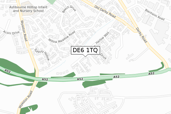
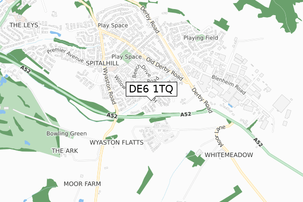
DE6 1TQ is located in the Ashbourne South electoral ward, within the local authority district of Derbyshire Dales and the English Parliamentary constituency of Derbyshire Dales. The Sub Integrated Care Board (ICB) Location is NHS Derby and Derbyshire ICB - 15M and the police force is Derbyshire. This postcode has been in use since November 2019.


GetTheData
Source: OS Open Zoomstack (Ordnance Survey)
Licence: Open Government Licence (requires attribution)
Attribution: Contains OS data © Crown copyright and database right 2025
Source: Open Postcode Geo
Licence: Open Government Licence (requires attribution)
Attribution: Contains OS data © Crown copyright and database right 2025; Contains Royal Mail data © Royal Mail copyright and database right 2025; Source: Office for National Statistics licensed under the Open Government Licence v.3.0
| Easting | 418637 |
| Northing | 345261 |
| Latitude | 53.004362 |
| Longitude | -1.723718 |
GetTheData
Source: Open Postcode Geo
Licence: Open Government Licence
| Country | England |
| Postcode District | DE6 |
➜ See where DE6 is on a map ➜ Where is Ashbourne? | |
GetTheData
Source: Land Registry Price Paid Data
Licence: Open Government Licence
| Ward | Ashbourne South |
| Constituency | Derbyshire Dales |
GetTheData
Source: ONS Postcode Database
Licence: Open Government Licence
2024 23 AUG £527,000 |
2022 20 MAY £545,000 |
9, DAVENPORT GROVE, ASHBOURNE, DE6 1TQ 2021 28 MAY £537,495 |
8, DAVENPORT GROVE, ASHBOURNE, DE6 1TQ 2021 20 MAY £549,995 |
2021 1 APR £509,995 |
10, DAVENPORT GROVE, ASHBOURNE, DE6 1TQ 2021 26 MAR £514,995 |
6, DAVENPORT GROVE, ASHBOURNE, DE6 1TQ 2021 25 FEB £499,995 |
5, DAVENPORT GROVE, ASHBOURNE, DE6 1TQ 2021 22 JAN £549,995 |
4, DAVENPORT GROVE, ASHBOURNE, DE6 1TQ 2020 11 DEC £499,995 |
2020 9 OCT £554,995 |
GetTheData
Source: HM Land Registry Price Paid Data
Licence: Contains HM Land Registry data © Crown copyright and database right 2025. This data is licensed under the Open Government Licence v3.0.
| Cedar Close (Willow Meadow Road) | Spitalhill | 196m |
| Cedar Close (Willow Meadow Road) | Spitalhill | 204m |
| Pine Croft (Willow Meadow Road) | Spitalhill | 252m |
| Pine Croft (Willow Meadow Road) | Spitalhill | 275m |
| Beech Drive (Willow Meadow Road) | Spitalhill | 315m |
GetTheData
Source: NaPTAN
Licence: Open Government Licence
GetTheData
Source: ONS Postcode Database
Licence: Open Government Licence


➜ Get more ratings from the Food Standards Agency
GetTheData
Source: Food Standards Agency
Licence: FSA terms & conditions
| Last Collection | |||
|---|---|---|---|
| Location | Mon-Fri | Sat | Distance |
| Beech Drive | 17:30 | 07:30 | 187m |
| Wyaston Road | 17:30 | 07:30 | 451m |
| Mumford Road | 17:30 | 07:45 | 536m |
GetTheData
Source: Dracos
Licence: Creative Commons Attribution-ShareAlike
The below table lists the International Territorial Level (ITL) codes (formerly Nomenclature of Territorial Units for Statistics (NUTS) codes) and Local Administrative Units (LAU) codes for DE6 1TQ:
| ITL 1 Code | Name |
|---|---|
| TLF | East Midlands (England) |
| ITL 2 Code | Name |
| TLF1 | Derbyshire and Nottinghamshire |
| ITL 3 Code | Name |
| TLF13 | South and West Derbyshire |
| LAU 1 Code | Name |
| E07000035 | Derbyshire Dales |
GetTheData
Source: ONS Postcode Directory
Licence: Open Government Licence
The below table lists the Census Output Area (OA), Lower Layer Super Output Area (LSOA), and Middle Layer Super Output Area (MSOA) for DE6 1TQ:
| Code | Name | |
|---|---|---|
| OA | E00099120 | |
| LSOA | E01019597 | Derbyshire Dales 009C |
| MSOA | E02004076 | Derbyshire Dales 009 |
GetTheData
Source: ONS Postcode Directory
Licence: Open Government Licence
| DE6 1HT | Chestnut Drive | 125m |
| DE6 1FJ | Cedar Close | 146m |
| DE6 1TD | Tutbury Hollow | 181m |
| DE6 1HS | Pine Croft | 219m |
| DE6 1HJ | Willow Meadow Road | 227m |
| DE6 1TB | Saxon Close | 228m |
| DE6 1HH | Wyaston Gardens | 233m |
| DE6 1HU | Maple Drive | 245m |
| DE6 1HN | Holly Close | 261m |
| DE6 1HL | Beech Drive | 296m |
GetTheData
Source: Open Postcode Geo; Land Registry Price Paid Data
Licence: Open Government Licence