Property/Postcode Data Search:
DE55 6NG maps, stats, and open data
DE55 6NG is located in the Shirland electoral ward, within the local authority district of North East Derbyshire and the English Parliamentary constituency of Bolsover. The Sub Integrated Care Board (ICB) Location is NHS Derby and Derbyshire ICB - 15M and the police force is Derbyshire. This postcode has been in use since December 2019.
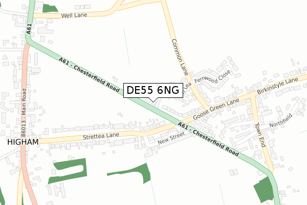
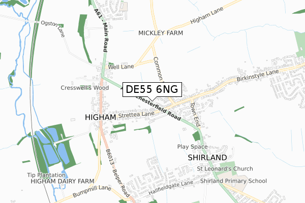
DE55 6NG maps


Source: OS Open Zoomstack (Ordnance Survey)
Licence: Open Government Licence (requires attribution)
Attribution: Contains OS data © Crown copyright and database right 2025
Source: Open Postcode Geo
Licence: Open Government Licence (requires attribution)
Attribution: Contains OS data © Crown copyright and database right 2025; Contains Royal Mail data © Royal Mail copyright and database right 2025; Source: Office for National Statistics licensed under the Open Government Licence v.3.0
Licence: Open Government Licence (requires attribution)
Attribution: Contains OS data © Crown copyright and database right 2025
Source: Open Postcode Geo
Licence: Open Government Licence (requires attribution)
Attribution: Contains OS data © Crown copyright and database right 2025; Contains Royal Mail data © Royal Mail copyright and database right 2025; Source: Office for National Statistics licensed under the Open Government Licence v.3.0
DE55 6NG geodata
| Easting | 439424 |
| Northing | 359038 |
| Latitude | 53.127077 |
| Longitude | -1.412285 |
Where is DE55 6NG?
| Country | England |
| Postcode District | DE55 |
Politics
| Ward | Shirland |
|---|---|
| Constituency | Bolsover |
House Prices
Sales of detached houses in DE55 6NG
2021 30 SEP £390,000 |
6, THE WILLOWS, SHIRLAND, ALFRETON, DE55 6NG 2020 10 DEC £530,000 |
4, THE WILLOWS, SHIRLAND, ALFRETON, DE55 6NG 2020 9 SEP £550,000 |
2020 10 JUL £245,000 |
7, THE WILLOWS, ALFRETON, DE55 6NG 2019 19 DEC £340,000 |
Source: HM Land Registry Price Paid Data
Licence: Contains HM Land Registry data © Crown copyright and database right 2025. This data is licensed under the Open Government Licence v3.0.
Licence: Contains HM Land Registry data © Crown copyright and database right 2025. This data is licensed under the Open Government Licence v3.0.
Transport
Nearest bus stops to DE55 6NG
| Strettea Lane (Chesterfield Road) | Shirland | 40m |
| Strettea Lane (Chesterfield Road) | Shirland | 89m |
| Common Lane (Goose Green Lane) | Shirland | 158m |
| Common Lane (Goose Green Lane) | Shirland | 159m |
| Crown Inn (Belper Road) | Higham | 409m |
Nearest railway stations to DE55 6NG
| Alfreton Station | 4.1km |
Deprivation
78.3% of English postcodes are less deprived than DE55 6NG:Food Standards Agency
Three nearest food hygiene ratings to DE55 6NG (metres)
Higham Food And Wine
49 - 51 Chesterfield Road
118m
Santo's Higham Farm Ltd

Santos Higham Farm Hotel
398m
The Greyhound

Main Road
490m
➜ Get more ratings from the Food Standards Agency
Nearest post box to DE55 6NG
| Last Collection | |||
|---|---|---|---|
| Location | Mon-Fri | Sat | Distance |
| Shirland | 16:00 | 08:00 | 117m |
| Town End | 16:00 | 08:00 | 377m |
| Higham So | 16:00 | 09:30 | 430m |
DE55 6NG ITL and DE55 6NG LAU
The below table lists the International Territorial Level (ITL) codes (formerly Nomenclature of Territorial Units for Statistics (NUTS) codes) and Local Administrative Units (LAU) codes for DE55 6NG:
| ITL 1 Code | Name |
|---|---|
| TLF | East Midlands (England) |
| ITL 2 Code | Name |
| TLF1 | Derbyshire and Nottinghamshire |
| ITL 3 Code | Name |
| TLF12 | East Derbyshire |
| LAU 1 Code | Name |
| E07000038 | North East Derbyshire |
DE55 6NG census areas
The below table lists the Census Output Area (OA), Lower Layer Super Output Area (LSOA), and Middle Layer Super Output Area (MSOA) for DE55 6NG:
| Code | Name | |
|---|---|---|
| OA | E00100304 | |
| LSOA | E01019818 | North East Derbyshire 013C |
| MSOA | E02004117 | North East Derbyshire 013 |
Nearest postcodes to DE55 6NG
| DE55 6BQ | Strettea Lane | 92m |
| DE55 6EP | Fern Lea | 105m |
| DE55 6BN | Chesterfield Road | 118m |
| DE55 6BP | New Street | 154m |
| DE55 6BU | Common Lane | 173m |
| DE55 6BR | Goose Green Lane | 241m |
| DE55 6BW | Fernwood Close | 251m |
| DE55 6EJ | Strettea Lane | 269m |
| DE55 6EY | The Croft | 283m |
| DE55 6BL | Town End | 377m |