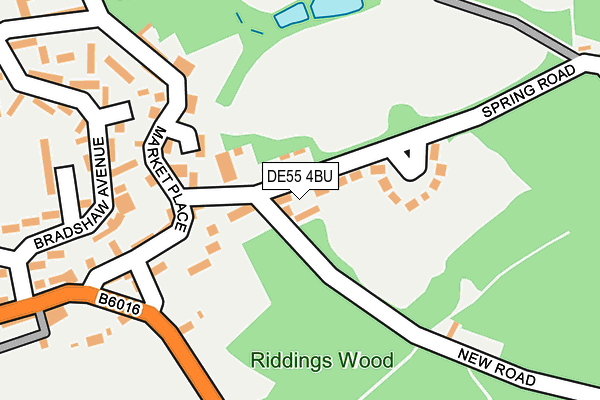
DE55 4BU is located in the Ironville & Riddings electoral ward, within the local authority district of Amber Valley and the English Parliamentary constituency of Amber Valley. The Sub Integrated Care Board (ICB) Location is NHS Derby and Derbyshire ICB - 15M and the police force is Derbyshire. This postcode has been in use since July 2017.


GetTheData
Source: OS OpenMap – Local (Ordnance Survey)
Source: OS VectorMap District (Ordnance Survey)
Licence: Open Government Licence (requires attribution)
| Easting | 443219 |
| Northing | 352575 |
| Latitude | 53.068691 |
| Longitude | -1.356442 |
GetTheData
Source: Open Postcode Geo
Licence: Open Government Licence
| Country | England |
| Postcode District | DE55 |
➜ See where DE55 is on a map | |
GetTheData
Source: Land Registry Price Paid Data
Licence: Open Government Licence
| Ward | Ironville & Riddings |
| Constituency | Amber Valley |
GetTheData
Source: ONS Postcode Database
Licence: Open Government Licence
| Bypass (Bullock Lane) | Riddings | 196m |
| Bypass (Bullock Lane) | Riddings | 226m |
| Riddings Wood (Bullock Lane) | Riddings | 352m |
| Riddings Wood (Bullock Lane) | Riddings | 380m |
| George Street (High Street) | Riddings | 441m |
| Alfreton Station | 3.6km |
GetTheData
Source: NaPTAN
Licence: Open Government Licence
GetTheData
Source: ONS Postcode Database
Licence: Open Government Licence


➜ Get more ratings from the Food Standards Agency
GetTheData
Source: Food Standards Agency
Licence: FSA terms & conditions
| Last Collection | |||
|---|---|---|---|
| Location | Mon-Fri | Sat | Distance |
| Market Place | 17:30 | 08:00 | 110m |
| Riddings Post Office | 17:30 | 09:30 | 629m |
| Lower Somercotes | 17:30 | 08:00 | 780m |
GetTheData
Source: Dracos
Licence: Creative Commons Attribution-ShareAlike
The below table lists the International Territorial Level (ITL) codes (formerly Nomenclature of Territorial Units for Statistics (NUTS) codes) and Local Administrative Units (LAU) codes for DE55 4BU:
| ITL 1 Code | Name |
|---|---|
| TLF | East Midlands (England) |
| ITL 2 Code | Name |
| TLF1 | Derbyshire and Nottinghamshire |
| ITL 3 Code | Name |
| TLF13 | South and West Derbyshire |
| LAU 1 Code | Name |
| E07000032 | Amber Valley |
GetTheData
Source: ONS Postcode Directory
Licence: Open Government Licence
The below table lists the Census Output Area (OA), Lower Layer Super Output Area (LSOA), and Middle Layer Super Output Area (MSOA) for DE55 4BU:
| Code | Name | |
|---|---|---|
| OA | E00098338 | |
| LSOA | E01019444 | Amber Valley 003B |
| MSOA | E02004031 | Amber Valley 003 |
GetTheData
Source: ONS Postcode Directory
Licence: Open Government Licence
| DE55 4BS | Spring Road | 24m |
| DE55 4DG | Manor Court | 104m |
| DE55 4BQ | Market Place | 129m |
| DE55 4DH | Vicarage Gardens | 184m |
| DE55 4BT | Nottingham Lane | 201m |
| DE55 4BX | Vicarage Mews | 206m |
| DE55 4BP | Bullock Lane | 208m |
| DE55 4BN | High Street | 274m |
| DE55 4DD | Park Mews | 335m |
| DE55 4BZ | Hollyhurst Court | 398m |
GetTheData
Source: Open Postcode Geo; Land Registry Price Paid Data
Licence: Open Government Licence