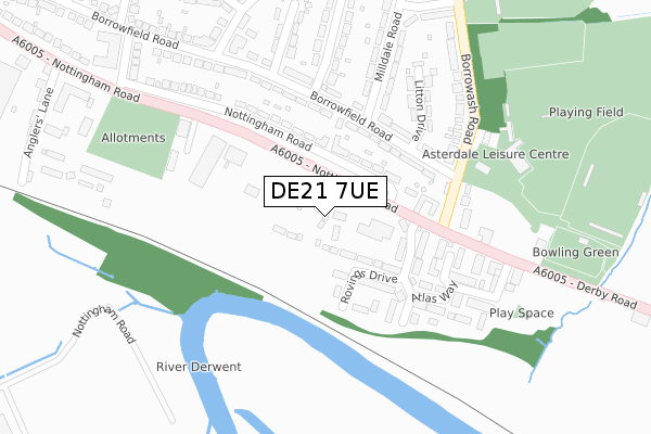
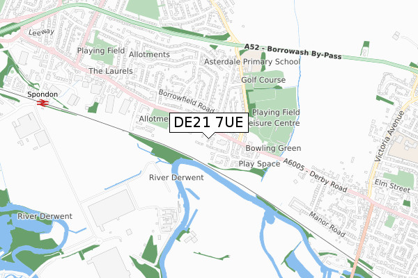
DE21 7UE is located in the Spondon electoral ward, within the unitary authority of Derby and the English Parliamentary constituency of Mid Derbyshire. The Sub Integrated Care Board (ICB) Location is NHS Derby and Derbyshire ICB - 15M and the police force is Derbyshire. This postcode has been in use since October 2019.


GetTheData
Source: OS Open Zoomstack (Ordnance Survey)
Licence: Open Government Licence (requires attribution)
Attribution: Contains OS data © Crown copyright and database right 2025
Source: Open Postcode Geo
Licence: Open Government Licence (requires attribution)
Attribution: Contains OS data © Crown copyright and database right 2025; Contains Royal Mail data © Royal Mail copyright and database right 2025; Source: Office for National Statistics licensed under the Open Government Licence v.3.0
| Easting | 440686 |
| Northing | 334921 |
| Latitude | 52.910203 |
| Longitude | -1.396456 |
GetTheData
Source: Open Postcode Geo
Licence: Open Government Licence
| Country | England |
| Postcode District | DE21 |
➜ See where DE21 is on a map ➜ Where is Derby? | |
GetTheData
Source: Land Registry Price Paid Data
Licence: Open Government Licence
| Ward | Spondon |
| Constituency | Mid Derbyshire |
GetTheData
Source: ONS Postcode Database
Licence: Open Government Licence
12, HALING WAY, SPONDON, DERBY, DE21 7UE 2023 29 SEP £274,950 |
9, HALING WAY, SPONDON, DERBY, DE21 7UE 2023 22 SEP £334,950 |
10, HALING WAY, SPONDON, DERBY, DE21 7UE 2023 11 SEP £318,450 |
8, HALING WAY, SPONDON, DERBY, DE21 7UE 2023 21 JUL £324,950 |
6, HALING WAY, SPONDON, DERBY, DE21 7UE 2023 31 MAY £324,950 |
4, HALING WAY, SPONDON, DERBY, DE21 7UE 2023 25 MAY £246,950 |
7, HALING WAY, SPONDON, DERBY, DE21 7UE 2022 16 DEC £246,450 |
5, HALING WAY, SPONDON, DERBY, DE21 7UE 2022 14 DEC £261,900 |
2, HALING WAY, SPONDON, DERBY, DE21 7UE 2021 17 DEC £204,950 |
17, HALING WAY, SPONDON, DERBY, DE21 7UE 2020 21 SEP £224,950 |
GetTheData
Source: HM Land Registry Price Paid Data
Licence: Contains HM Land Registry data © Crown copyright and database right 2025. This data is licensed under the Open Government Licence v3.0.
| Borrowfield Road | Spondon | 175m |
| Clock Garage (Nottingham Road) | Spondon | 178m |
| Borrowfield Road | Spondon | 183m |
| Borrowash Road (Nottingham Road) | Spondon | 246m |
| Borrowash Road (Nottingham Road) | Spondon | 260m |
| Spondon Station | 1km |
| Derby Station | 4.6km |
GetTheData
Source: NaPTAN
Licence: Open Government Licence
GetTheData
Source: ONS Postcode Database
Licence: Open Government Licence


➜ Get more ratings from the Food Standards Agency
GetTheData
Source: Food Standards Agency
Licence: FSA terms & conditions
| Last Collection | |||
|---|---|---|---|
| Location | Mon-Fri | Sat | Distance |
| Silverhill Road | 17:30 | 11:30 | 351m |
| Craddock Avenue | 17:30 | 11:30 | 468m |
| Nottingham Road Post Office | 17:30 | 11:30 | 722m |
GetTheData
Source: Dracos
Licence: Creative Commons Attribution-ShareAlike
The below table lists the International Territorial Level (ITL) codes (formerly Nomenclature of Territorial Units for Statistics (NUTS) codes) and Local Administrative Units (LAU) codes for DE21 7UE:
| ITL 1 Code | Name |
|---|---|
| TLF | East Midlands (England) |
| ITL 2 Code | Name |
| TLF1 | Derbyshire and Nottinghamshire |
| ITL 3 Code | Name |
| TLF11 | Derby |
| LAU 1 Code | Name |
| E06000015 | Derby |
GetTheData
Source: ONS Postcode Directory
Licence: Open Government Licence
The below table lists the Census Output Area (OA), Lower Layer Super Output Area (LSOA), and Middle Layer Super Output Area (MSOA) for DE21 7UE:
| Code | Name | |
|---|---|---|
| OA | E00171226 | |
| LSOA | E01013595 | Derby 014B |
| MSOA | E02002809 | Derby 014 |
GetTheData
Source: ONS Postcode Directory
Licence: Open Government Licence
| DE21 7GW | Nottingham Road | 116m |
| DE21 7GZ | Nottingham Road | 142m |
| DE21 7TR | Rovings Drive | 150m |
| DE21 7HG | Borrowfield Road | 150m |
| DE21 7SN | Canalgate Park | 164m |
| DE21 7SJ | Burrowfield Mews | 191m |
| DE21 7TQ | Falconside Drive | 199m |
| DE21 7HF | Borrowfield Road | 201m |
| DE21 7TT | Atlas Way | 255m |
| DE21 7HN | Monsal Drive | 278m |
GetTheData
Source: Open Postcode Geo; Land Registry Price Paid Data
Licence: Open Government Licence