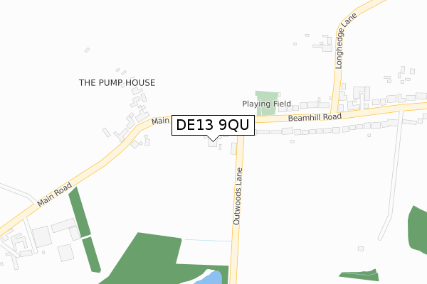
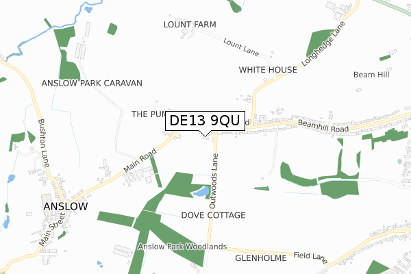
DE13 9QU is located in the Dove electoral ward, within the local authority district of East Staffordshire and the English Parliamentary constituency of Burton. The Sub Integrated Care Board (ICB) Location is NHS Staffordshire and Stoke-on-Trent ICB - 05D and the police force is Staffordshire. This postcode has been in use since July 2018.


GetTheData
Source: OS Open Zoomstack (Ordnance Survey)
Licence: Open Government Licence (requires attribution)
Attribution: Contains OS data © Crown copyright and database right 2025
Source: Open Postcode Geo
Licence: Open Government Licence (requires attribution)
Attribution: Contains OS data © Crown copyright and database right 2025; Contains Royal Mail data © Royal Mail copyright and database right 2025; Source: Office for National Statistics licensed under the Open Government Licence v.3.0
| Easting | 422062 |
| Northing | 325774 |
| Latitude | 52.829061 |
| Longitude | -1.673997 |
GetTheData
Source: Open Postcode Geo
Licence: Open Government Licence
| Country | England |
| Postcode District | DE13 |
➜ See where DE13 is on a map ➜ Where is Burton upon Trent? | |
GetTheData
Source: Land Registry Price Paid Data
Licence: Open Government Licence
| Ward | Dove |
| Constituency | Burton |
GetTheData
Source: ONS Postcode Database
Licence: Open Government Licence
| Long Hedge Lane (Beamhill Rd) | Beam Hill | 204m |
| Long Hedge Lane (Beamhill Road) | Anslow | 319m |
| Anslow Park Farm (Main Road) | Anslow | 509m |
| Anslow Park Farm (Main Road) | Anslow | 525m |
| No 102 (Beamhill Road) | Beam Hill | 831m |
| Burton-on-Trent Station | 3.3km |
| Tutbury & Hatton Station | 3.9km |
GetTheData
Source: NaPTAN
Licence: Open Government Licence
| Percentage of properties with Next Generation Access | 100.0% |
| Percentage of properties with Superfast Broadband | 100.0% |
| Percentage of properties with Ultrafast Broadband | 0.0% |
| Percentage of properties with Full Fibre Broadband | 0.0% |
Superfast Broadband is between 30Mbps and 300Mbps
Ultrafast Broadband is > 300Mbps
| Percentage of properties unable to receive 2Mbps | 0.0% |
| Percentage of properties unable to receive 5Mbps | 0.0% |
| Percentage of properties unable to receive 10Mbps | 0.0% |
| Percentage of properties unable to receive 30Mbps | 0.0% |
GetTheData
Source: Ofcom
Licence: Ofcom Terms of Use (requires attribution)
GetTheData
Source: ONS Postcode Database
Licence: Open Government Licence


➜ Get more ratings from the Food Standards Agency
GetTheData
Source: Food Standards Agency
Licence: FSA terms & conditions
| Last Collection | |||
|---|---|---|---|
| Location | Mon-Fri | Sat | Distance |
| Upper Outwoods | 17:30 | 07:30 | 304m |
| Main Street | 16:00 | 07:30 | 911m |
| Burton Road (Lodge Hill) | 17:30 | 08:15 | 1,331m |
GetTheData
Source: Dracos
Licence: Creative Commons Attribution-ShareAlike
The below table lists the International Territorial Level (ITL) codes (formerly Nomenclature of Territorial Units for Statistics (NUTS) codes) and Local Administrative Units (LAU) codes for DE13 9QU:
| ITL 1 Code | Name |
|---|---|
| TLG | West Midlands (England) |
| ITL 2 Code | Name |
| TLG2 | Shropshire and Staffordshire |
| ITL 3 Code | Name |
| TLG24 | Staffordshire CC |
| LAU 1 Code | Name |
| E07000193 | East Staffordshire |
GetTheData
Source: ONS Postcode Directory
Licence: Open Government Licence
The below table lists the Census Output Area (OA), Lower Layer Super Output Area (LSOA), and Middle Layer Super Output Area (MSOA) for DE13 9QU:
| Code | Name | |
|---|---|---|
| OA | E00150113 | |
| LSOA | E01029463 | East Staffordshire 004C |
| MSOA | E02006134 | East Staffordshire 004 |
GetTheData
Source: ONS Postcode Directory
Licence: Open Government Licence
| DE13 9QJ | Anslow Park Cottages | 60m |
| DE13 9QP | Beamhill Road | 200m |
| DE13 9QR | Long Hedge Lane | 346m |
| DE13 9QW | Beamhill Road | 379m |
| DE13 0AB | Outwoods Lane | 476m |
| DE13 9QE | Main Road | 512m |
| DE13 9QN | Beamhill Road | 604m |
| DE13 9QS | Lount Lane | 674m |
| DE13 9QH | Walton Villas | 833m |
| DE13 9QQ | Jubilee Cottages | 859m |
GetTheData
Source: Open Postcode Geo; Land Registry Price Paid Data
Licence: Open Government Licence