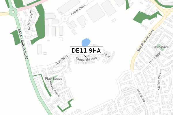
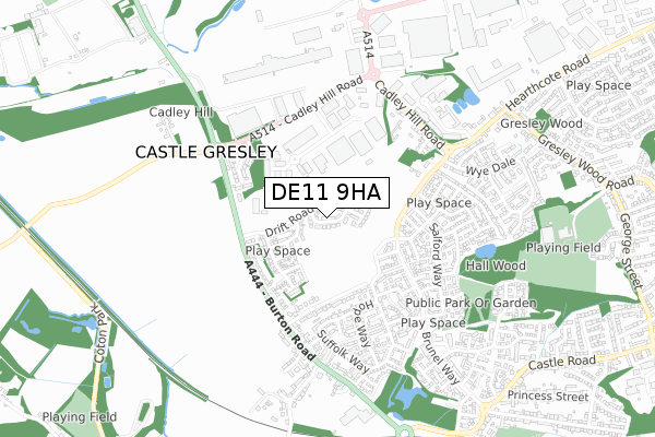
DE11 9HA is located in the Church Gresley electoral ward, within the local authority district of South Derbyshire and the English Parliamentary constituency of South Derbyshire. The Sub Integrated Care Board (ICB) Location is NHS Derby and Derbyshire ICB - 15M and the police force is Derbyshire. This postcode has been in use since January 2018.


GetTheData
Source: OS Open Zoomstack (Ordnance Survey)
Licence: Open Government Licence (requires attribution)
Attribution: Contains OS data © Crown copyright and database right 2025
Source: Open Postcode Geo
Licence: Open Government Licence (requires attribution)
Attribution: Contains OS data © Crown copyright and database right 2025; Contains Royal Mail data © Royal Mail copyright and database right 2025; Source: Office for National Statistics licensed under the Open Government Licence v.3.0
| Easting | 428023 |
| Northing | 318638 |
| Latitude | 52.764638 |
| Longitude | -1.586134 |
GetTheData
Source: Open Postcode Geo
Licence: Open Government Licence
| Country | England |
| Postcode District | DE11 |
➜ See where DE11 is on a map | |
GetTheData
Source: Land Registry Price Paid Data
Licence: Open Government Licence
| Ward | Church Gresley |
| Constituency | South Derbyshire |
GetTheData
Source: ONS Postcode Database
Licence: Open Government Licence
| Salford Way (Swadlincote Lane) | Church Gresley | 281m |
| Salford Way (Swadlincote Lane) | Church Gresley | 306m |
| Meynell House (Burton Road) | Castle Gresley | 361m |
| Meynell House (Burton Road) | Castle Gresley | 374m |
| De Montfort Close (Brunel Way) | Church Gresley | 380m |
| Burton-on-Trent Station | 6km |
GetTheData
Source: NaPTAN
Licence: Open Government Licence
| Percentage of properties with Next Generation Access | 100.0% |
| Percentage of properties with Superfast Broadband | 100.0% |
| Percentage of properties with Ultrafast Broadband | 100.0% |
| Percentage of properties with Full Fibre Broadband | 100.0% |
Superfast Broadband is between 30Mbps and 300Mbps
Ultrafast Broadband is > 300Mbps
| Percentage of properties unable to receive 2Mbps | 0.0% |
| Percentage of properties unable to receive 5Mbps | 0.0% |
| Percentage of properties unable to receive 10Mbps | 0.0% |
| Percentage of properties unable to receive 30Mbps | 0.0% |
GetTheData
Source: Ofcom
Licence: Ofcom Terms of Use (requires attribution)
GetTheData
Source: ONS Postcode Database
Licence: Open Government Licence


➜ Get more ratings from the Food Standards Agency
GetTheData
Source: Food Standards Agency
Licence: FSA terms & conditions
| Last Collection | |||
|---|---|---|---|
| Location | Mon-Fri | Sat | Distance |
| Appleby Glade | 16:00 | 10:45 | 438m |
| Wye Dale | 16:00 | 11:00 | 526m |
| Burton Road (Castle Gresley) | 16:00 | 12:30 | 584m |
GetTheData
Source: Dracos
Licence: Creative Commons Attribution-ShareAlike
The below table lists the International Territorial Level (ITL) codes (formerly Nomenclature of Territorial Units for Statistics (NUTS) codes) and Local Administrative Units (LAU) codes for DE11 9HA:
| ITL 1 Code | Name |
|---|---|
| TLF | East Midlands (England) |
| ITL 2 Code | Name |
| TLF1 | Derbyshire and Nottinghamshire |
| ITL 3 Code | Name |
| TLF13 | South and West Derbyshire |
| LAU 1 Code | Name |
| E07000039 | South Derbyshire |
GetTheData
Source: ONS Postcode Directory
Licence: Open Government Licence
The below table lists the Census Output Area (OA), Lower Layer Super Output Area (LSOA), and Middle Layer Super Output Area (MSOA) for DE11 9HA:
| Code | Name | |
|---|---|---|
| OA | E00174587 | |
| LSOA | E01033531 | South Derbyshire 012C |
| MSOA | E02006919 | South Derbyshire 012 |
GetTheData
Source: ONS Postcode Directory
Licence: Open Government Licence
| DE11 9FW | Drift Road | 135m |
| DE11 9FY | Headstock Drive | 169m |
| DE11 9TD | Guildhall Close | 254m |
| DE11 9FX | Hewer Drive | 273m |
| DE11 9TH | Portsmouth Close | 313m |
| DE11 9EW | Burton Road | 320m |
| DE11 9FF | Paisley Walk | 320m |
| DE11 9FS | Bexley Drive | 324m |
| DE11 9EG | Swadlincote Lane | 340m |
| DE11 9TE | Cranfield Avenue | 368m |
GetTheData
Source: Open Postcode Geo; Land Registry Price Paid Data
Licence: Open Government Licence