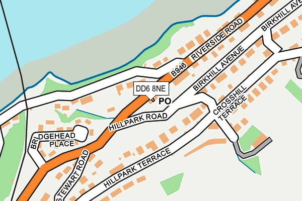
DD6 8NE is located in the Tay Bridgehead electoral ward, within the council area of Fife and the Scottish Parliamentary constituency of North East Fife. The Community Health Partnership is Glenrothes & North East Fife Community Health Partnership and the police force is Scotland. This postcode has been in use since January 1980.


GetTheData
Source: OS OpenMap – Local (Ordnance Survey)
Source: OS VectorMap District (Ordnance Survey)
Licence: Open Government Licence (requires attribution)
| Easting | 339820 |
| Northing | 726346 |
| Latitude | 56.425458 |
| Longitude | -2.977258 |
GetTheData
Source: Open Postcode Geo
Licence: Open Government Licence
| Country | Scotland |
| Postcode District | DD6 |
➜ See where DD6 is on a map ➜ Where is Newport-on-Tay? | |
GetTheData
Source: Land Registry Price Paid Data
Licence: Open Government Licence
| Ward | Tay Bridgehead |
| Constituency | North East Fife |
GetTheData
Source: ONS Postcode Database
Licence: Open Government Licence
| Post Office (Naughton Road) | Wormit | 43m |
| Hillpark Road | Wormit | 47m |
| Mount Stewart Road (Naughton Road) | Wormit | 145m |
| Riverside Road | Wormit | 170m |
| Riverside Road | Wormit | 201m |
| Dundee Station | 3.5km |
| Invergowrie Station | 6km |
GetTheData
Source: NaPTAN
Licence: Open Government Licence
GetTheData
Source: ONS Postcode Database
Licence: Open Government Licence


➜ Get more ratings from the Food Standards Agency
GetTheData
Source: Food Standards Agency
Licence: FSA terms & conditions
| Last Collection | |||
|---|---|---|---|
| Location | Mon-Fri | Sat | Distance |
| Woodhaven | 16:45 | 11:45 | 1,054m |
| Newport On Tay Post Office | 17:30 | 11:45 | 2,780m |
| Youngsdale Place | 17:00 | 11:45 | 2,914m |
GetTheData
Source: Dracos
Licence: Creative Commons Attribution-ShareAlike
The below table lists the International Territorial Level (ITL) codes (formerly Nomenclature of Territorial Units for Statistics (NUTS) codes) and Local Administrative Units (LAU) codes for DD6 8NE:
| ITL 1 Code | Name |
|---|---|
| TLM | Scotland |
| ITL 2 Code | Name |
| TLM7 | Eastern Scotland |
| ITL 3 Code | Name |
| TLM72 | Clackmannanshire and Fife |
| LAU 1 Code | Name |
| S30000042 | Fife |
GetTheData
Source: ONS Postcode Directory
Licence: Open Government Licence
The below table lists the Census Output Area (OA), Lower Layer Super Output Area (LSOA), and Middle Layer Super Output Area (MSOA) for DD6 8NE:
| Code | Name | |
|---|---|---|
| OA | S00111226 | |
| LSOA | S01009757 | Wormit West |
| MSOA | S02001841 | Newport and Wormit |
GetTheData
Source: ONS Postcode Directory
Licence: Open Government Licence