Property/Postcode Data Search:
CW8 1HW maps, stats, and open data
CW8 1HW is located in the Hartford & Greenbank electoral ward, within the unitary authority of Cheshire West and Chester and the English Parliamentary constituency of Weaver Vale. The Sub Integrated Care Board (ICB) Location is NHS Cheshire and Merseyside ICB - 27D and the police force is Cheshire. This postcode has been in use since April 2020.
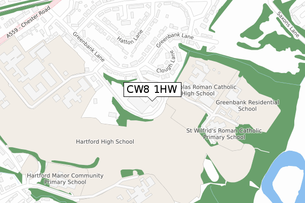
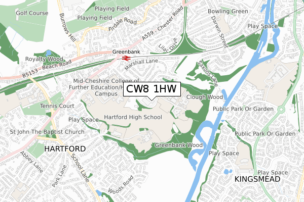
CW8 1HW maps


Source: OS Open Zoomstack (Ordnance Survey)
Licence: Open Government Licence (requires attribution)
Attribution: Contains OS data © Crown copyright and database right 2025
Source: Open Postcode Geo
Licence: Open Government Licence (requires attribution)
Attribution: Contains OS data © Crown copyright and database right 2025; Contains Royal Mail data © Royal Mail copyright and database right 2025; Source: Office for National Statistics licensed under the Open Government Licence v.3.0
Licence: Open Government Licence (requires attribution)
Attribution: Contains OS data © Crown copyright and database right 2025
Source: Open Postcode Geo
Licence: Open Government Licence (requires attribution)
Attribution: Contains OS data © Crown copyright and database right 2025; Contains Royal Mail data © Royal Mail copyright and database right 2025; Source: Office for National Statistics licensed under the Open Government Licence v.3.0
CW8 1HW geodata
| Easting | 364677 |
| Northing | 372492 |
| Latitude | 53.248276 |
| Longitude | -2.530827 |
Where is CW8 1HW?
| Country | England |
| Postcode District | CW8 |
Politics
| Ward | Hartford & Greenbank |
|---|---|
| Constituency | Weaver Vale |
Transport
Nearest bus stops to CW8 1HW
| St Nicholas Rc High School (Grounds) | Greenbank | 47m |
| St Nicholas Rc High School (Grounds) | Greenbank | 47m |
| St Nicholas Rc High School (Grounds) | Greenbank | 49m |
| St Nicholas Rc High School (Grounds) | Greenbank | 50m |
| St Nicholas Rc High School (Grounds) | Greenbank | 52m |
Nearest railway stations to CW8 1HW
| Greenbank Station | 0.4km |
| Hartford Station | 1.7km |
| Northwich Station | 2.7km |
Deprivation
79.9% of English postcodes are less deprived than CW8 1HW:Food Standards Agency
Three nearest food hygiene ratings to CW8 1HW (metres)
Campus & Co Your Superstore

Hartford Manor Greenbank Lane
0m
OneSchoolGlobal Northwich Campus

Hartford Manor Greenbank Lane
0m
St Wilfrid's Preschool

St Wilfrids Roman Catholic Primary School Greenbank Lane
160m
➜ Get more ratings from the Food Standards Agency
Nearest post box to CW8 1HW
| Last Collection | |||
|---|---|---|---|
| Location | Mon-Fri | Sat | Distance |
| Kingsmead Square | 16:00 | 11:30 | 965m |
| Hartford Road | 17:30 | 08:00 | 1,300m |
| Hartford Station | 17:30 | 11:30 | 1,715m |
CW8 1HW ITL and CW8 1HW LAU
The below table lists the International Territorial Level (ITL) codes (formerly Nomenclature of Territorial Units for Statistics (NUTS) codes) and Local Administrative Units (LAU) codes for CW8 1HW:
| ITL 1 Code | Name |
|---|---|
| TLD | North West (England) |
| ITL 2 Code | Name |
| TLD6 | Cheshire |
| ITL 3 Code | Name |
| TLD63 | Cheshire West and Chester |
| LAU 1 Code | Name |
| E06000050 | Cheshire West and Chester |
CW8 1HW census areas
The below table lists the Census Output Area (OA), Lower Layer Super Output Area (LSOA), and Middle Layer Super Output Area (MSOA) for CW8 1HW:
| Code | Name | |
|---|---|---|
| OA | E00094439 | |
| LSOA | E01018710 | Cheshire West and Chester 020B |
| MSOA | E02003881 | Cheshire West and Chester 020 |
Nearest postcodes to CW8 1HW
| CW8 1JR | Clough Lane | 129m |
| CW8 1JP | Greenbank Lane | 172m |
| CW8 1JQ | Greenbank Lane | 219m |
| CW8 1JZ | Hatton Lane | 228m |
| CW8 1JY | Hatton Lane | 252m |
| CW8 1JX | The Close | 274m |
| CW8 1JS | Greenbank Lane | 278m |
| CW8 1JT | Marshall Lane | 354m |
| CW8 1JU | Marshall Lane | 356m |
| CW8 1LA | Marshall Lane | 373m |