Property/Postcode Data Search:
CW5 5XU maps, stats, and open data
CW5 5XU is located in the Wrenbury electoral ward, within the unitary authority of Cheshire East and the English Parliamentary constituency of Eddisbury. The Sub Integrated Care Board (ICB) Location is NHS Cheshire and Merseyside ICB - 27D and the police force is Cheshire. This postcode has been in use since November 2019.
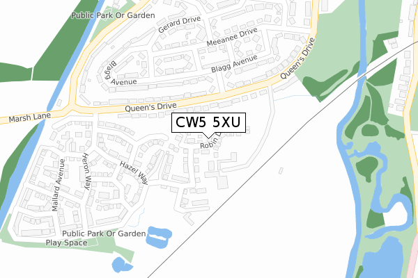
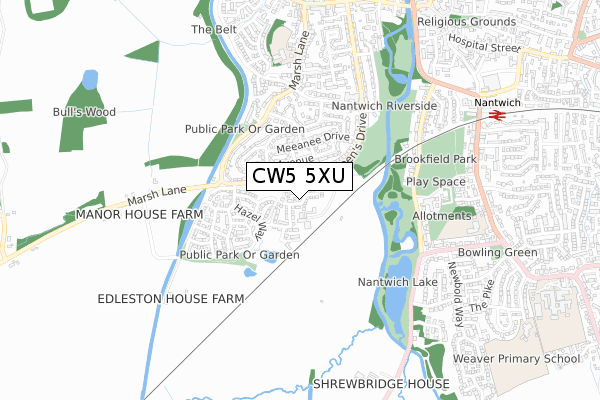
CW5 5XU maps


Source: OS Open Zoomstack (Ordnance Survey)
Licence: Open Government Licence (requires attribution)
Attribution: Contains OS data © Crown copyright and database right 2025
Source: Open Postcode Geo
Licence: Open Government Licence (requires attribution)
Attribution: Contains OS data © Crown copyright and database right 2025; Contains Royal Mail data © Royal Mail copyright and database right 2025; Source: Office for National Statistics licensed under the Open Government Licence v.3.0
Licence: Open Government Licence (requires attribution)
Attribution: Contains OS data © Crown copyright and database right 2025
Source: Open Postcode Geo
Licence: Open Government Licence (requires attribution)
Attribution: Contains OS data © Crown copyright and database right 2025; Contains Royal Mail data © Royal Mail copyright and database right 2025; Source: Office for National Statistics licensed under the Open Government Licence v.3.0
CW5 5XU geodata
| Easting | 364550 |
| Northing | 351593 |
| Latitude | 53.060417 |
| Longitude | -2.530411 |
Where is CW5 5XU?
| Country | England |
| Postcode District | CW5 |
Politics
| Ward | Wrenbury |
|---|---|
| Constituency | Eddisbury |
House Prices
Sales of detached houses in CW5 5XU
44, ROBIN DRIVE, EDLESTON, NANTWICH, CW5 5XU 2021 29 JUN £349,950 |
42, ROBIN DRIVE, EDLESTON, NANTWICH, CW5 5XU 2021 25 JUN £349,995 |
46, ROBIN DRIVE, EDLESTON, NANTWICH, CW5 5XU 2021 18 JUN £349,995 |
48, ROBIN DRIVE, EDLESTON, NANTWICH, CW5 5XU 2021 30 APR £239,996 |
40, ROBIN DRIVE, EDLESTON, NANTWICH, CW5 5XU 2021 30 APR £239,996 |
39, ROBIN DRIVE, EDLESTON, NANTWICH, CW5 5XU 2020 11 DEC £211,996 |
41, ROBIN DRIVE, EDLESTON, NANTWICH, CW5 5XU 2020 11 DEC £211,996 |
43, ROBIN DRIVE, EDLESTON, NANTWICH, CW5 5XU 2020 11 DEC £239,996 |
36, ROBIN DRIVE, EDLESTON, NANTWICH, CW5 5XU 2020 11 DEC £239,996 |
38, ROBIN DRIVE, EDLESTON, NANTWICH, CW5 5XU 2020 11 DEC £237,996 |
Source: HM Land Registry Price Paid Data
Licence: Contains HM Land Registry data © Crown copyright and database right 2025. This data is licensed under the Open Government Licence v3.0.
Licence: Contains HM Land Registry data © Crown copyright and database right 2025. This data is licensed under the Open Government Licence v3.0.
Transport
Nearest bus stops to CW5 5XU
| Cope Avenue (Queen's Drive) | Nantwich | 99m |
| Cope Avenue (Queen's Drive) | Nantwich | 112m |
| Marsh Lane (Queen's Drive) | Nantwich | 284m |
| Marsh Lane (Queen's Drive) | Nantwich | 287m |
| Marsh Lane | Nantwich | 381m |
Nearest railway stations to CW5 5XU
| Nantwich Station | 0.8km |
| Wrenbury Station | 6.3km |
Deprivation
53.6% of English postcodes are less deprived than CW5 5XU:Food Standards Agency
Three nearest food hygiene ratings to CW5 5XU (metres)
Morrisons Daily

23 Meeanee Drive
231m
Millfields Primary School

Marsh Lane
384m
BROOKFIELD HOUSE

Brookfield House
491m
➜ Get more ratings from the Food Standards Agency
Nearest post box to CW5 5XU
| Last Collection | |||
|---|---|---|---|
| Location | Mon-Fri | Sat | Distance |
| Millfields S0 | 17:00 | 11:15 | 237m |
| Shrewbridge Road | 17:45 | 08:30 | 424m |
| Marsh Lane | 17:00 | 08:30 | 454m |
CW5 5XU ITL and CW5 5XU LAU
The below table lists the International Territorial Level (ITL) codes (formerly Nomenclature of Territorial Units for Statistics (NUTS) codes) and Local Administrative Units (LAU) codes for CW5 5XU:
| ITL 1 Code | Name |
|---|---|
| TLD | North West (England) |
| ITL 2 Code | Name |
| TLD6 | Cheshire |
| ITL 3 Code | Name |
| TLD62 | Cheshire East |
| LAU 1 Code | Name |
| E06000049 | Cheshire East |
CW5 5XU census areas
The below table lists the Census Output Area (OA), Lower Layer Super Output Area (LSOA), and Middle Layer Super Output Area (MSOA) for CW5 5XU:
| Code | Name | |
|---|---|---|
| OA | E00093065 | |
| LSOA | E01018444 | Cheshire East 049A |
| MSOA | E02003837 | Cheshire East 049 |
Nearest postcodes to CW5 5XU
| CW5 5JL | 62m | |
| CW5 5JJ | Queens Drive | 148m |
| CW5 5LB | Queens Drive | 156m |
| CW5 5JX | Blagg Avenue | 172m |
| CW5 5JF | Blagg Avenue | 203m |
| CW5 5JW | Harding Road | 204m |
| CW5 5LA | Queens Drive | 211m |
| CW5 5JG | Meeanee Drive | 233m |
| CW5 5JU | Lea Drive | 244m |
| CW5 5JN | Meeanee Drive | 250m |