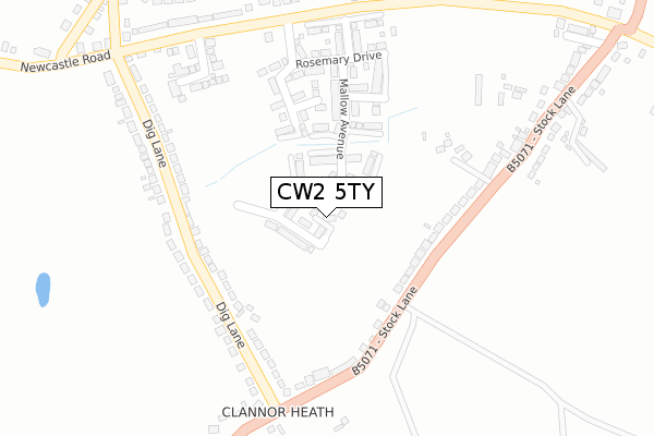
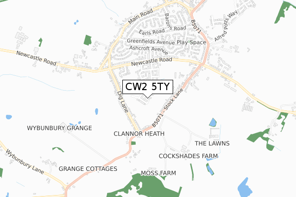
CW2 5TY is located in the Wybunbury electoral ward, within the unitary authority of Cheshire East and the English Parliamentary constituency of Crewe and Nantwich. The Sub Integrated Care Board (ICB) Location is NHS Cheshire and Merseyside ICB - 27D and the police force is Cheshire. This postcode has been in use since December 2018.


GetTheData
Source: OS Open Zoomstack (Ordnance Survey)
Licence: Open Government Licence (requires attribution)
Attribution: Contains OS data © Crown copyright and database right 2025
Source: Open Postcode Geo
Licence: Open Government Licence (requires attribution)
Attribution: Contains OS data © Crown copyright and database right 2025; Contains Royal Mail data © Royal Mail copyright and database right 2025; Source: Office for National Statistics licensed under the Open Government Licence v.3.0
| Easting | 369750 |
| Northing | 351028 |
| Latitude | 53.055659 |
| Longitude | -2.452769 |
GetTheData
Source: Open Postcode Geo
Licence: Open Government Licence
| Country | England |
| Postcode District | CW2 |
➜ See where CW2 is on a map ➜ Where is Shavington? | |
GetTheData
Source: Land Registry Price Paid Data
Licence: Open Government Licence
| Ward | Wybunbury |
| Constituency | Crewe And Nantwich |
GetTheData
Source: ONS Postcode Database
Licence: Open Government Licence
2023 6 JAN £292,000 |
6, BURNET CLOSE, SHAVINGTON, CREWE, CW2 5TY 2018 21 DEC £239,995 |
2, BURNET CLOSE, SHAVINGTON, CREWE, CW2 5TY 2018 21 DEC £379,995 |
5, BURNET CLOSE, SHAVINGTON, CREWE, CW2 5TY 2018 20 DEC £269,995 |
2018 20 DEC £269,995 |
GetTheData
Source: HM Land Registry Price Paid Data
Licence: Contains HM Land Registry data © Crown copyright and database right 2025. This data is licensed under the Open Government Licence v3.0.
| Stock Lane | Shavington | 222m |
| Stock Lane | Shavington | 231m |
| Dig Lane (Stock Lane) | Wybunbury | 254m |
| Huntersfield (Newcastle Road) | Shavington | 312m |
| Huntersfield (Newcastle Road) | Shavington | 329m |
| Crewe Station | 4km |
| Nantwich Station | 4.5km |
GetTheData
Source: NaPTAN
Licence: Open Government Licence
| Percentage of properties with Next Generation Access | 100.0% |
| Percentage of properties with Superfast Broadband | 100.0% |
| Percentage of properties with Ultrafast Broadband | 0.0% |
| Percentage of properties with Full Fibre Broadband | 0.0% |
Superfast Broadband is between 30Mbps and 300Mbps
Ultrafast Broadband is > 300Mbps
| Median download speed | 51.1Mbps |
| Average download speed | 43.7Mbps |
| Maximum download speed | 55.00Mbps |
| Median upload speed | 9.9Mbps |
| Average upload speed | 8.7Mbps |
| Maximum upload speed | 10.21Mbps |
| Percentage of properties unable to receive 2Mbps | 0.0% |
| Percentage of properties unable to receive 5Mbps | 0.0% |
| Percentage of properties unable to receive 10Mbps | 0.0% |
| Percentage of properties unable to receive 30Mbps | 0.0% |
GetTheData
Source: Ofcom
Licence: Ofcom Terms of Use (requires attribution)
GetTheData
Source: ONS Postcode Database
Licence: Open Government Licence


➜ Get more ratings from the Food Standards Agency
GetTheData
Source: Food Standards Agency
Licence: FSA terms & conditions
| Last Collection | |||
|---|---|---|---|
| Location | Mon-Fri | Sat | Distance |
| Dig Lane | 16:00 | 08:30 | 293m |
| Marina Terrace | 17:30 | 10:15 | 420m |
| Shavington So | 17:30 | 11:30 | 805m |
GetTheData
Source: Dracos
Licence: Creative Commons Attribution-ShareAlike
The below table lists the International Territorial Level (ITL) codes (formerly Nomenclature of Territorial Units for Statistics (NUTS) codes) and Local Administrative Units (LAU) codes for CW2 5TY:
| ITL 1 Code | Name |
|---|---|
| TLD | North West (England) |
| ITL 2 Code | Name |
| TLD6 | Cheshire |
| ITL 3 Code | Name |
| TLD62 | Cheshire East |
| LAU 1 Code | Name |
| E06000049 | Cheshire East |
GetTheData
Source: ONS Postcode Directory
Licence: Open Government Licence
The below table lists the Census Output Area (OA), Lower Layer Super Output Area (LSOA), and Middle Layer Super Output Area (MSOA) for CW2 5TY:
| Code | Name | |
|---|---|---|
| OA | E00093442 | |
| LSOA | E01018516 | Cheshire East 049D |
| MSOA | E02003837 | Cheshire East 049 |
GetTheData
Source: ONS Postcode Directory
Licence: Open Government Licence
| CW5 7EX | Stock Lane | 153m |
| CW5 7EY | Dig Lane | 189m |
| CW5 7EZ | Dig Lane | 278m |
| CW2 5FB | Huntersfield | 304m |
| CW2 5EA | Newcastle Road | 355m |
| CW2 5ED | Stock Lane | 369m |
| CW2 5HR | Cameron Avenue | 376m |
| CW2 5HF | Regent Close | 386m |
| CW2 5HP | Page Grove | 393m |
| CW2 5HS | Enfield Close | 398m |
GetTheData
Source: Open Postcode Geo; Land Registry Price Paid Data
Licence: Open Government Licence