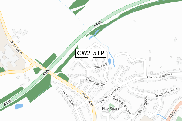
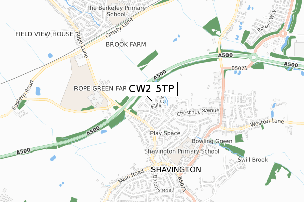
CW2 5TP is located in the Willaston and Rope electoral ward, within the unitary authority of Cheshire East and the English Parliamentary constituency of Crewe and Nantwich. The Sub Integrated Care Board (ICB) Location is NHS Cheshire and Merseyside ICB - 27D and the police force is Cheshire. This postcode has been in use since December 2018.


GetTheData
Source: OS Open Zoomstack (Ordnance Survey)
Licence: Open Government Licence (requires attribution)
Attribution: Contains OS data © Crown copyright and database right 2025
Source: Open Postcode Geo
Licence: Open Government Licence (requires attribution)
Attribution: Contains OS data © Crown copyright and database right 2025; Contains Royal Mail data © Royal Mail copyright and database right 2025; Source: Office for National Statistics licensed under the Open Government Licence v.3.0
| Easting | 369887 |
| Northing | 352361 |
| Latitude | 53.067649 |
| Longitude | -2.450851 |
GetTheData
Source: Open Postcode Geo
Licence: Open Government Licence
| Country | England |
| Postcode District | CW2 |
➜ See where CW2 is on a map ➜ Where is Shavington? | |
GetTheData
Source: Land Registry Price Paid Data
Licence: Open Government Licence
| Ward | Willaston And Rope |
| Constituency | Crewe And Nantwich |
GetTheData
Source: ONS Postcode Database
Licence: Open Government Licence
2023 24 MAR £250,000 |
12, RUTTER CLOSE, SHAVINGTON, CREWE, CW2 5TP 2019 24 JUN £289,950 |
11, RUTTER CLOSE, SHAVINGTON, CREWE, CW2 5TP 2019 14 JUN £262,950 |
2018 7 DEC £214,950 |
GetTheData
Source: HM Land Registry Price Paid Data
Licence: Contains HM Land Registry data © Crown copyright and database right 2025. This data is licensed under the Open Government Licence v3.0.
| Woodnoth Drive (Chestnut Avenue) | Shavington | 231m |
| Rope Lane (Vine Tree Avenue) | Shavington | 244m |
| Woodnoth Drive (Chestnut Avenue) | Shavington | 249m |
| Rope Lane (Vine Tree Avenue) | Shavington | 257m |
| The Vine (Rope Lane) | Shavington | 300m |
| Crewe Station | 2.7km |
| Nantwich Station | 4.6km |
GetTheData
Source: NaPTAN
Licence: Open Government Licence
| Percentage of properties with Next Generation Access | 100.0% |
| Percentage of properties with Superfast Broadband | 100.0% |
| Percentage of properties with Ultrafast Broadband | 0.0% |
| Percentage of properties with Full Fibre Broadband | 0.0% |
Superfast Broadband is between 30Mbps and 300Mbps
Ultrafast Broadband is > 300Mbps
| Median download speed | 6.4Mbps |
| Average download speed | 17.7Mbps |
| Maximum download speed | 55.00Mbps |
| Median upload speed | 0.8Mbps |
| Average upload speed | 3.3Mbps |
| Maximum upload speed | 10.00Mbps |
| Percentage of properties unable to receive 2Mbps | 0.0% |
| Percentage of properties unable to receive 5Mbps | 0.0% |
| Percentage of properties unable to receive 10Mbps | 0.0% |
| Percentage of properties unable to receive 30Mbps | 0.0% |
GetTheData
Source: Ofcom
Licence: Ofcom Terms of Use (requires attribution)
GetTheData
Source: ONS Postcode Database
Licence: Open Government Licence


➜ Get more ratings from the Food Standards Agency
GetTheData
Source: Food Standards Agency
Licence: FSA terms & conditions
| Last Collection | |||
|---|---|---|---|
| Location | Mon-Fri | Sat | Distance |
| Shavington So | 17:30 | 11:30 | 542m |
| Ropebank Avenue | 17:30 | 12:30 | 953m |
| Gresty | 17:00 | 10:15 | 1,147m |
GetTheData
Source: Dracos
Licence: Creative Commons Attribution-ShareAlike
The below table lists the International Territorial Level (ITL) codes (formerly Nomenclature of Territorial Units for Statistics (NUTS) codes) and Local Administrative Units (LAU) codes for CW2 5TP:
| ITL 1 Code | Name |
|---|---|
| TLD | North West (England) |
| ITL 2 Code | Name |
| TLD6 | Cheshire |
| ITL 3 Code | Name |
| TLD62 | Cheshire East |
| LAU 1 Code | Name |
| E06000049 | Cheshire East |
GetTheData
Source: ONS Postcode Directory
Licence: Open Government Licence
The below table lists the Census Output Area (OA), Lower Layer Super Output Area (LSOA), and Middle Layer Super Output Area (MSOA) for CW2 5TP:
| Code | Name | |
|---|---|---|
| OA | E00093380 | |
| LSOA | E01018505 | Cheshire East 046D |
| MSOA | E02003835 | Cheshire East 046 |
GetTheData
Source: ONS Postcode Directory
Licence: Open Government Licence
| CW2 5SX | Ellis Close | 46m |
| CW2 5SW | Broomhall Drive | 92m |
| CW2 5SZ | Well Close | 164m |
| CW2 5BL | Northfield Place | 187m |
| CW2 5BS | Vine Tree Avenue | 240m |
| CW2 5DA | Rope Lane | 241m |
| CW2 5BZ | Burlea Drive | 291m |
| CW2 5BT | Edwards Avenue | 294m |
| CW2 5BU | Edwards Close | 306m |
| CW2 5BN | Woodnoth Drive | 308m |
GetTheData
Source: Open Postcode Geo; Land Registry Price Paid Data
Licence: Open Government Licence