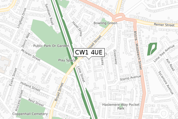
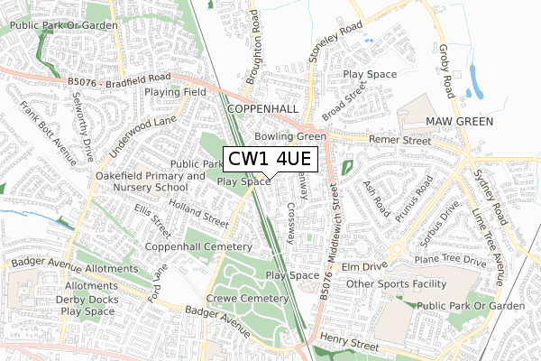
CW1 4UE is located in the Crewe East electoral ward, within the unitary authority of Cheshire East and the English Parliamentary constituency of Crewe and Nantwich. The Sub Integrated Care Board (ICB) Location is NHS Cheshire and Merseyside ICB - 27D and the police force is Cheshire. This postcode has been in use since February 2020.


GetTheData
Source: OS Open Zoomstack (Ordnance Survey)
Licence: Open Government Licence (requires attribution)
Attribution: Contains OS data © Crown copyright and database right 2025
Source: Open Postcode Geo
Licence: Open Government Licence (requires attribution)
Attribution: Contains OS data © Crown copyright and database right 2025; Contains Royal Mail data © Royal Mail copyright and database right 2025; Source: Office for National Statistics licensed under the Open Government Licence v.3.0
| Easting | 370450 |
| Northing | 356952 |
| Latitude | 53.108948 |
| Longitude | -2.442873 |
GetTheData
Source: Open Postcode Geo
Licence: Open Government Licence
| Country | England |
| Postcode District | CW1 |
➜ See where CW1 is on a map ➜ Where is Crewe? | |
GetTheData
Source: Land Registry Price Paid Data
Licence: Open Government Licence
| Ward | Crewe East |
| Constituency | Crewe And Nantwich |
GetTheData
Source: ONS Postcode Database
Licence: Open Government Licence
5, BRITANNIA CLOSE, CREWE, CW1 4UE 2020 20 NOV £229,500 |
12, BRITANNIA CLOSE, CREWE, CW1 4UE 2020 5 JUN £139,500 |
8, BRITANNIA CLOSE, CREWE, CW1 4UE 2020 12 MAY £147,150 |
9, BRITANNIA CLOSE, CREWE, CW1 4UE 2020 1 MAY £144,000 |
GetTheData
Source: HM Land Registry Price Paid Data
Licence: Contains HM Land Registry data © Crown copyright and database right 2025. This data is licensed under the Open Government Licence v3.0.
| The Bridge Inn (Broad Street) | Coppenhall | 61m |
| The Bridge Inn (Broad Street) | Coppenhall | 89m |
| Primary School (Broad Street) | Coppenhall | 190m |
| North Street (Broad Street) | Coppenhall | 210m |
| North Street (Broad Street) | Coppenhall | 242m |
| Crewe Station | 2.2km |
| Sandbach Station | 5.7km |
GetTheData
Source: NaPTAN
Licence: Open Government Licence
GetTheData
Source: ONS Postcode Database
Licence: Open Government Licence


➜ Get more ratings from the Food Standards Agency
GetTheData
Source: Food Standards Agency
Licence: FSA terms & conditions
| Last Collection | |||
|---|---|---|---|
| Location | Mon-Fri | Sat | Distance |
| Ford Lane | 17:30 | 12:00 | 945m |
| Bus Station | 17:25 | 12:30 | 1,177m |
| Earle Street | 17:30 | 13:00 | 1,298m |
GetTheData
Source: Dracos
Licence: Creative Commons Attribution-ShareAlike
The below table lists the International Territorial Level (ITL) codes (formerly Nomenclature of Territorial Units for Statistics (NUTS) codes) and Local Administrative Units (LAU) codes for CW1 4UE:
| ITL 1 Code | Name |
|---|---|
| TLD | North West (England) |
| ITL 2 Code | Name |
| TLD6 | Cheshire |
| ITL 3 Code | Name |
| TLD62 | Cheshire East |
| LAU 1 Code | Name |
| E06000049 | Cheshire East |
GetTheData
Source: ONS Postcode Directory
Licence: Open Government Licence
The below table lists the Census Output Area (OA), Lower Layer Super Output Area (LSOA), and Middle Layer Super Output Area (MSOA) for CW1 4UE:
| Code | Name | |
|---|---|---|
| OA | E00093240 | |
| LSOA | E01018476 | Cheshire East 035B |
| MSOA | E02003826 | Cheshire East 035 |
GetTheData
Source: ONS Postcode Directory
Licence: Open Government Licence
| CW1 4JW | Crossway | 56m |
| CW1 4JG | Lime Street | 58m |
| CW1 4JH | Broad Street | 120m |
| CW1 3UF | Davenport Street | 134m |
| CW1 4JJ | Broad Street | 155m |
| CW1 4JN | Greenway | 175m |
| CW1 4JU | Greenacres | 183m |
| CW1 3UE | The Retreat | 194m |
| CW1 4SN | Churchmere Drive | 204m |
| CW1 3UD | Broad Street | 221m |
GetTheData
Source: Open Postcode Geo; Land Registry Price Paid Data
Licence: Open Government Licence