CV9 3FB maps, stats, and open data
CV9 3FB is located in the Newton Regis and Warton electoral ward, within the local authority district of North Warwickshire and the English Parliamentary constituency of North Warwickshire. The Sub Integrated Care Board (ICB) Location is NHS Coventry and Warwickshire ICB - B2M3M and the police force is Warwickshire. This postcode has been in use since April 2019.
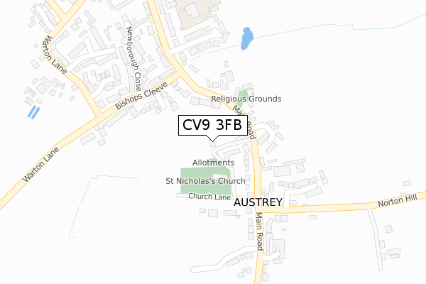
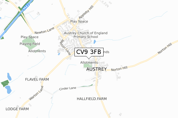
CV9 3FB maps


Licence: Open Government Licence (requires attribution)
Attribution: Contains OS data © Crown copyright and database right 2025
Source: Open Postcode Geo
Licence: Open Government Licence (requires attribution)
Attribution: Contains OS data © Crown copyright and database right 2025; Contains Royal Mail data © Royal Mail copyright and database right 2025; Source: Office for National Statistics licensed under the Open Government Licence v.3.0
CV9 3FB geodata
| Easting | 429562 |
| Northing | 306377 |
| Latitude | 52.654338 |
| Longitude | -1.564425 |
Where is CV9 3FB?
| Country | England |
| Postcode District | CV9 |
Politics
| Ward | Newton Regis And Warton |
|---|---|
| Constituency | North Warwickshire |
House Prices
Sales of detached houses in CV9 3FB
PARISH HOUSE 4, BISHOP MEADOWS, THE GREEN, AUSTREY, ATHERSTONE, CV9 3FB 2021 17 DEC £840,000 |
TRANSEPT HOUSE 3, BISHOP MEADOWS, THE GREEN, AUSTREY, ATHERSTONE, CV9 3FB 2021 30 SEP £560,000 |
SPIRE HOUSE 2, BISHOP MEADOWS, THE GREEN, AUSTREY, ATHERSTONE, CV9 3FB 2020 9 OCT £400,000 |
TRANSEPT HOUSE 3, BISHOP MEADOWS, THE GREEN, AUSTREY, ATHERSTONE, CV9 3FB 2020 12 MAR £499,950 |
4, BISHOP MEADOWS, THE GREEN, AUSTREY, ATHERSTONE, CV9 3FB 2020 9 MAR £770,000 |
Licence: Contains HM Land Registry data © Crown copyright and database right 2025. This data is licensed under the Open Government Licence v3.0.
Transport
Nearest bus stops to CV9 3FB
| Bishops Cleeve (Main Road) | Austrey | 145m |
| Main Road (Bishops Cleeve) | Austrey | 155m |
| Bird In Hand (Main Road) | Austrey | 170m |
| Main Road (Bishops Cleeve) | Austrey | 171m |
| Bird In Hand (Main Road) | Austrey | 181m |
Nearest railway stations to CV9 3FB
| Polesworth Station | 4.4km |
Broadband
Broadband access in CV9 3FB (2020 data)
| Percentage of properties with Next Generation Access | 100.0% |
| Percentage of properties with Superfast Broadband | 100.0% |
| Percentage of properties with Ultrafast Broadband | 0.0% |
| Percentage of properties with Full Fibre Broadband | 0.0% |
Superfast Broadband is between 30Mbps and 300Mbps
Ultrafast Broadband is > 300Mbps
Broadband limitations in CV9 3FB (2020 data)
| Percentage of properties unable to receive 2Mbps | 0.0% |
| Percentage of properties unable to receive 5Mbps | 0.0% |
| Percentage of properties unable to receive 10Mbps | 0.0% |
| Percentage of properties unable to receive 30Mbps | 0.0% |
Deprivation
16.8% of English postcodes are less deprived than CV9 3FB:Food Standards Agency
Three nearest food hygiene ratings to CV9 3FB (metres)


➜ Get more ratings from the Food Standards Agency
Nearest post box to CV9 3FB
| Last Collection | |||
|---|---|---|---|
| Location | Mon-Fri | Sat | Distance |
| Warton Post Office | 16:45 | 07:30 | 2,937m |
| Opp 1 Little Warton Road | 16:45 | 07:00 | 2,951m |
| Appleby Magna P.o. | 16:00 | 12:15 | 4,044m |
CV9 3FB ITL and CV9 3FB LAU
The below table lists the International Territorial Level (ITL) codes (formerly Nomenclature of Territorial Units for Statistics (NUTS) codes) and Local Administrative Units (LAU) codes for CV9 3FB:
| ITL 1 Code | Name |
|---|---|
| TLG | West Midlands (England) |
| ITL 2 Code | Name |
| TLG1 | Herefordshire, Worcestershire and Warwickshire |
| ITL 3 Code | Name |
| TLG13 | Warwickshire CC |
| LAU 1 Code | Name |
| E07000218 | North Warwickshire |
CV9 3FB census areas
The below table lists the Census Output Area (OA), Lower Layer Super Output Area (LSOA), and Middle Layer Super Output Area (MSOA) for CV9 3FB:
| Code | Name | |
|---|---|---|
| OA | E00158217 | |
| LSOA | E01031036 | North Warwickshire 001B |
| MSOA | E02006468 | North Warwickshire 001 |
Nearest postcodes to CV9 3FB
| CV9 3EF | The Green | 61m |
| CV9 3EG | Main Road | 83m |
| CV9 3EE | Church Lane | 129m |
| CV9 3EZ | Kirtland Close | 130m |
| CV9 3EU | Bishops Cleeve | 161m |
| CV9 3EQ | St Nicholas Close | 255m |
| CV9 3EX | Newborough Close | 260m |
| CV9 3EB | Main Road | 275m |
| CV9 3NS | Flavel Court | 285m |
| CV9 3ED | Norton Hill | 306m |