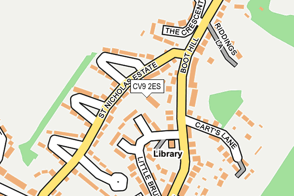
CV9 2ES is located in the Baddesley and Grendon electoral ward, within the local authority district of North Warwickshire and the English Parliamentary constituency of North Warwickshire. The Sub Integrated Care Board (ICB) Location is NHS Coventry and Warwickshire ICB - B2M3M and the police force is Warwickshire. This postcode has been in use since May 2017.


GetTheData
Source: OS OpenMap – Local (Ordnance Survey)
Source: OS VectorMap District (Ordnance Survey)
Licence: Open Government Licence (requires attribution)
| Easting | 427175 |
| Northing | 298911 |
| Latitude | 52.587347 |
| Longitude | -1.600319 |
GetTheData
Source: Open Postcode Geo
Licence: Open Government Licence
| Country | England |
| Postcode District | CV9 |
➜ See where CV9 is on a map ➜ Where is Baddesley Ensor? | |
GetTheData
Source: Land Registry Price Paid Data
Licence: Open Government Licence
| Ward | Baddesley And Grendon |
| Constituency | North Warwickshire |
GetTheData
Source: ONS Postcode Database
Licence: Open Government Licence
1, HAWTHORNE ORCHARD, GRENDON, ATHERSTONE, CV9 2ES 2022 21 NOV £410,000 |
2, HAWTHORNE ORCHARD, GRENDON, ATHERSTONE, CV9 2ES 2018 8 AUG £235,000 |
1, HAWTHORNE ORCHARD, GRENDON, ATHERSTONE, CV9 2ES 2017 10 OCT £283,750 |
3, HAWTHORNE ORCHARD, GRENDON, ATHERSTONE, CV9 2ES 2017 26 APR £235,000 |
➜ Baddesley Ensor house prices
GetTheData
Source: HM Land Registry Price Paid Data
Licence: Contains HM Land Registry data © Crown copyright and database right 2025. This data is licensed under the Open Government Licence v3.0.
| Carts Lane (Boot Hill) | Grendon | 58m |
| St Nicholas Estate | Grendon | 66m |
| Carts Lane (Boot Hill) | Grendon | 73m |
| St Nicholas Estate | Grendon | 110m |
| St Nicholas Estate | Grendon | 189m |
| Atherstone Station | 3.4km |
| Polesworth Station | 4.3km |
GetTheData
Source: NaPTAN
Licence: Open Government Licence
| Percentage of properties with Next Generation Access | 100.0% |
| Percentage of properties with Superfast Broadband | 100.0% |
| Percentage of properties with Ultrafast Broadband | 0.0% |
| Percentage of properties with Full Fibre Broadband | 0.0% |
Superfast Broadband is between 30Mbps and 300Mbps
Ultrafast Broadband is > 300Mbps
| Percentage of properties unable to receive 2Mbps | 0.0% |
| Percentage of properties unable to receive 5Mbps | 0.0% |
| Percentage of properties unable to receive 10Mbps | 0.0% |
| Percentage of properties unable to receive 30Mbps | 0.0% |
GetTheData
Source: Ofcom
Licence: Ofcom Terms of Use (requires attribution)
GetTheData
Source: ONS Postcode Database
Licence: Open Government Licence


➜ Get more ratings from the Food Standards Agency
GetTheData
Source: Food Standards Agency
Licence: FSA terms & conditions
| Last Collection | |||
|---|---|---|---|
| Location | Mon-Fri | Sat | Distance |
| Hill Top | 18:15 | 11:15 | 108m |
| Baddesley Common | 18:15 | 11:15 | 464m |
| Boot Hill | 16:40 | 11:15 | 490m |
GetTheData
Source: Dracos
Licence: Creative Commons Attribution-ShareAlike
The below table lists the International Territorial Level (ITL) codes (formerly Nomenclature of Territorial Units for Statistics (NUTS) codes) and Local Administrative Units (LAU) codes for CV9 2ES:
| ITL 1 Code | Name |
|---|---|
| TLG | West Midlands (England) |
| ITL 2 Code | Name |
| TLG1 | Herefordshire, Worcestershire and Warwickshire |
| ITL 3 Code | Name |
| TLG13 | Warwickshire CC |
| LAU 1 Code | Name |
| E07000218 | North Warwickshire |
GetTheData
Source: ONS Postcode Directory
Licence: Open Government Licence
The below table lists the Census Output Area (OA), Lower Layer Super Output Area (LSOA), and Middle Layer Super Output Area (MSOA) for CV9 2ES:
| Code | Name | |
|---|---|---|
| OA | E00158119 | |
| LSOA | E01031016 | North Warwickshire 002A |
| MSOA | E02006469 | North Warwickshire 002 |
GetTheData
Source: ONS Postcode Directory
Licence: Open Government Licence
| CV9 2EY | St Nicholas Estate | 85m |
| CV9 2EN | Boot Hill | 93m |
| CV9 2ET | Little Brum | 95m |
| CV9 2UA | Orchard Rise | 145m |
| CV9 2EW | Boot Hill | 161m |
| CV9 2EZ | St Nicholas Estate | 162m |
| CV9 2EG | Carts Lane | 187m |
| CV9 2ER | The Crescent | 194m |
| CV9 2EP | Riddings Lane | 199m |
| CV9 2EU | Cooks Lane | 235m |
GetTheData
Source: Open Postcode Geo; Land Registry Price Paid Data
Licence: Open Government Licence