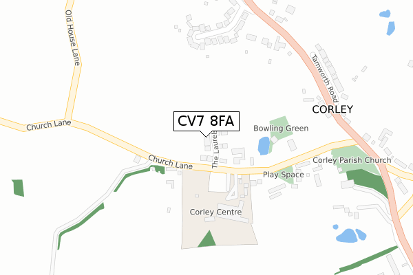
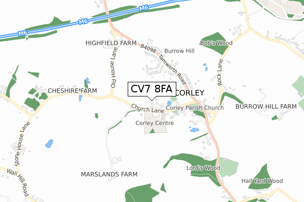
CV7 8FA maps, stats, and open data
CV7 8FA is located in the Fillongley electoral ward, within the local authority district of North Warwickshire and the English Parliamentary constituency of North Warwickshire. The Sub Integrated Care Board (ICB) Location is NHS Coventry and Warwickshire ICB - B2M3M and the police force is Warwickshire. This postcode has been in use since November 2017.
CV7 8FA maps


Licence: Open Government Licence (requires attribution)
Attribution: Contains OS data © Crown copyright and database right 2025
Source: Open Postcode Geo
Licence: Open Government Licence (requires attribution)
Attribution: Contains OS data © Crown copyright and database right 2025; Contains Royal Mail data © Royal Mail copyright and database right 2025; Source: Office for National Statistics licensed under the Open Government Licence v.3.0
CV7 8FA geodata
| Easting | 429818 |
| Northing | 285181 |
| Latitude | 52.463780 |
| Longitude | -1.562536 |
Where is CV7 8FA?
| Country | England |
| Postcode District | CV7 |
Politics
| Ward | Fillongley |
|---|---|
| Constituency | North Warwickshire |
House Prices
Sales of detached houses in CV7 8FA
2022 28 OCT £820,000 |
14, THE LAURELS, CORLEY, COVENTRY, CV7 8FA 2020 2 OCT £220,000 |
3, THE LAURELS, CORLEY, COVENTRY, CV7 8FA 2020 30 JAN £650,000 |
16, THE LAURELS, CORLEY, COVENTRY, CV7 8FA 2019 23 APR £722,000 |
18, THE LAURELS, CORLEY, COVENTRY, CV7 8FA 2019 4 FEB £735,000 |
11, THE LAURELS, CORLEY, COVENTRY, CV7 8FA 2018 11 DEC £755,000 |
9, THE LAURELS, CORLEY, COVENTRY, CV7 8FA 2018 23 NOV £750,000 |
1, THE LAURELS, CORLEY, COVENTRY, CV7 8FA 2018 23 FEB £585,000 |
5, THE LAURELS, CORLEY, COVENTRY, CV7 8FA 2018 22 FEB £585,000 |
2018 26 JAN £725,000 |
Licence: Contains HM Land Registry data © Crown copyright and database right 2025. This data is licensed under the Open Government Licence v3.0.
Transport
Nearest bus stops to CV7 8FA
| The Glebe (Church Lane) | Corley | 228m |
| Church (Tamworth Road) | Corley | 367m |
| Kingswood Avenue (Tamworth Road) | Corley | 378m |
| Kingswood Avenue (Tamworth Road) | Corley Moor | 391m |
| Cheshire Farm (Church Lane) | Corley | 600m |
Nearest railway stations to CV7 8FA
| Coventry Arena Station | 5km |
Broadband
Broadband access in CV7 8FA (2020 data)
| Percentage of properties with Next Generation Access | 100.0% |
| Percentage of properties with Superfast Broadband | 100.0% |
| Percentage of properties with Ultrafast Broadband | 0.0% |
| Percentage of properties with Full Fibre Broadband | 0.0% |
Superfast Broadband is between 30Mbps and 300Mbps
Ultrafast Broadband is > 300Mbps
Broadband speed in CV7 8FA (2019 data)
Download
| Median download speed | 77.6Mbps |
| Average download speed | 55.8Mbps |
| Maximum download speed | 80.00Mbps |
Upload
| Median upload speed | 19.8Mbps |
| Average upload speed | 13.9Mbps |
| Maximum upload speed | 20.00Mbps |
Broadband limitations in CV7 8FA (2020 data)
| Percentage of properties unable to receive 2Mbps | 0.0% |
| Percentage of properties unable to receive 5Mbps | 0.0% |
| Percentage of properties unable to receive 10Mbps | 0.0% |
| Percentage of properties unable to receive 30Mbps | 0.0% |
Deprivation
59.9% of English postcodes are less deprived than CV7 8FA:Food Standards Agency
Three nearest food hygiene ratings to CV7 8FA (metres)


➜ Get more ratings from the Food Standards Agency
Nearest post box to CV7 8FA
| Last Collection | |||
|---|---|---|---|
| Location | Mon-Fri | Sat | Distance |
| Tamworth Road | 17:30 | 11:15 | 316m |
| Bennetts Road North | 16:15 | 11:30 | 1,226m |
| Corley Post Office | 17:15 | 11:00 | 1,789m |
CV7 8FA ITL and CV7 8FA LAU
The below table lists the International Territorial Level (ITL) codes (formerly Nomenclature of Territorial Units for Statistics (NUTS) codes) and Local Administrative Units (LAU) codes for CV7 8FA:
| ITL 1 Code | Name |
|---|---|
| TLG | West Midlands (England) |
| ITL 2 Code | Name |
| TLG1 | Herefordshire, Worcestershire and Warwickshire |
| ITL 3 Code | Name |
| TLG13 | Warwickshire CC |
| LAU 1 Code | Name |
| E07000218 | North Warwickshire |
CV7 8FA census areas
The below table lists the Census Output Area (OA), Lower Layer Super Output Area (LSOA), and Middle Layer Super Output Area (MSOA) for CV7 8FA:
| Code | Name | |
|---|---|---|
| OA | E00158168 | |
| LSOA | E01031027 | North Warwickshire 007C |
| MSOA | E02006474 | North Warwickshire 007 |
Nearest postcodes to CV7 8FA
| CV7 8AZ | Church Lane | 128m |
| CV7 8AY | The Glebe | 223m |
| CV7 8BW | Tamworth Road | 267m |
| CV7 8BU | Kingswood Avenue | 287m |
| CV7 8BX | Tamworth Road | 315m |
| CV7 8BB | Tamworth Road | 358m |
| CV7 8BT | Tamworth Road | 428m |
| CV7 8BD | Rock Lane | 561m |
| CV7 8AA | Tamworth Road | 650m |
| CV7 8BA | Church Lane | 660m |