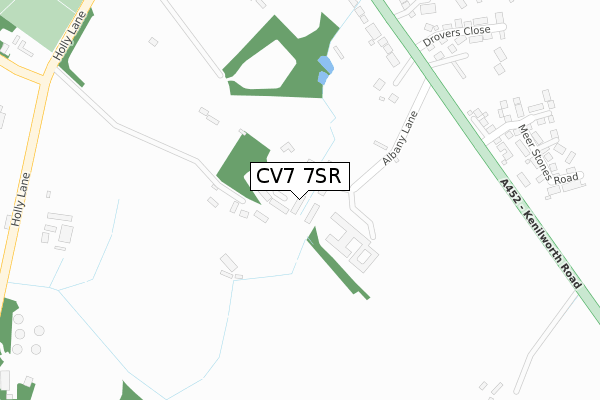
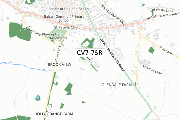
CV7 7SR is located in the Meriden electoral ward, within the metropolitan district of Solihull and the English Parliamentary constituency of Meriden. The Sub Integrated Care Board (ICB) Location is NHS Birmingham and Solihull ICB - 15E and the police force is West Midlands. This postcode has been in use since September 2017.


GetTheData
Source: OS Open Zoomstack (Ordnance Survey)
Licence: Open Government Licence (requires attribution)
Attribution: Contains OS data © Crown copyright and database right 2025
Source: Open Postcode Geo
Licence: Open Government Licence (requires attribution)
Attribution: Contains OS data © Crown copyright and database right 2025; Contains Royal Mail data © Royal Mail copyright and database right 2025; Source: Office for National Statistics licensed under the Open Government Licence v.3.0
| Easting | 424182 |
| Northing | 275825 |
| Latitude | 52.379947 |
| Longitude | -1.646162 |
GetTheData
Source: Open Postcode Geo
Licence: Open Government Licence
| Country | England |
| Postcode District | CV7 |
➜ See where CV7 is on a map ➜ Where is Balsall Common? | |
GetTheData
Source: Land Registry Price Paid Data
Licence: Open Government Licence
| Ward | Meriden |
| Constituency | Meriden |
GetTheData
Source: ONS Postcode Database
Licence: Open Government Licence
| Kenilworth Rd (Alder Lane) | Balsall Common | 438m |
| Kenilworth Rd (Alder Lane) | Balsall Common | 448m |
| Balsall Common Primary School (Balsall Street East) | Balsall Common | 559m |
| Blythe Avenue (Kelsey Lane) | Balsall Common | 579m |
| Balsall Common Primary School (Balsall Street East) | Balsall Common | 585m |
| Berkswell Station | 1.8km |
| Tile Hill Station | 3.8km |
GetTheData
Source: NaPTAN
Licence: Open Government Licence
| Percentage of properties with Next Generation Access | 100.0% |
| Percentage of properties with Superfast Broadband | 100.0% |
| Percentage of properties with Ultrafast Broadband | 95.1% |
| Percentage of properties with Full Fibre Broadband | 95.1% |
Superfast Broadband is between 30Mbps and 300Mbps
Ultrafast Broadband is > 300Mbps
| Percentage of properties unable to receive 2Mbps | 0.0% |
| Percentage of properties unable to receive 5Mbps | 0.0% |
| Percentage of properties unable to receive 10Mbps | 0.0% |
| Percentage of properties unable to receive 30Mbps | 0.0% |
GetTheData
Source: Ofcom
Licence: Ofcom Terms of Use (requires attribution)
GetTheData
Source: ONS Postcode Database
Licence: Open Government Licence


➜ Get more ratings from the Food Standards Agency
GetTheData
Source: Food Standards Agency
Licence: FSA terms & conditions
| Last Collection | |||
|---|---|---|---|
| Location | Mon-Fri | Sat | Distance |
| High Cross | 16:30 | 10:30 | 453m |
| Balsall Common Post Office | 18:30 | 10:45 | 1,350m |
| Balsall Common Post Office | 18:30 | 10:45 | 1,351m |
GetTheData
Source: Dracos
Licence: Creative Commons Attribution-ShareAlike
The below table lists the International Territorial Level (ITL) codes (formerly Nomenclature of Territorial Units for Statistics (NUTS) codes) and Local Administrative Units (LAU) codes for CV7 7SR:
| ITL 1 Code | Name |
|---|---|
| TLG | West Midlands (England) |
| ITL 2 Code | Name |
| TLG3 | West Midlands |
| ITL 3 Code | Name |
| TLG32 | Solihull |
| LAU 1 Code | Name |
| E08000029 | Solihull |
GetTheData
Source: ONS Postcode Directory
Licence: Open Government Licence
The below table lists the Census Output Area (OA), Lower Layer Super Output Area (LSOA), and Middle Layer Super Output Area (MSOA) for CV7 7SR:
| Code | Name | |
|---|---|---|
| OA | E00051400 | |
| LSOA | E01010171 | Solihull 025E |
| MSOA | E02002105 | Solihull 025 |
GetTheData
Source: ONS Postcode Directory
Licence: Open Government Licence
| CV7 7HD | Kenilworth Road | 337m |
| CV7 7HB | Kenilworth Road | 389m |
| CV7 7QZ | Welsh Road | 432m |
| CV7 7DZ | Alder Lane | 441m |
| CV7 7EA | Holly Lane | 446m |
| CV7 7GP | Sedgemere Grove | 539m |
| CV7 7GL | Kelsey Lane | 540m |
| CV7 7DX | Kenilworth Road | 570m |
| CV7 7JF | Kenilworth Road | 571m |
| CV7 7GR | Kelsey Lane | 575m |
GetTheData
Source: Open Postcode Geo; Land Registry Price Paid Data
Licence: Open Government Licence