CV47 7AB maps, stats, and open data
CV47 7AB is located in the Bishop's Itchington, Fenny Compton & Napton electoral ward, within the local authority district of Stratford-on-Avon and the English Parliamentary constituency of Kenilworth and Southam. The Sub Integrated Care Board (ICB) Location is NHS Coventry and Warwickshire ICB - B2M3M and the police force is Warwickshire. This postcode has been in use since May 2019.
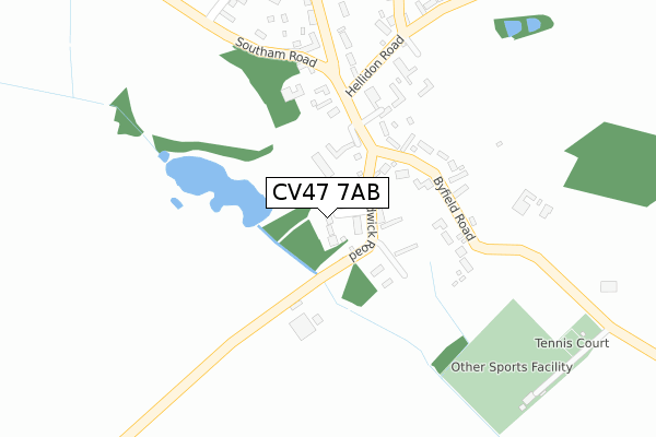
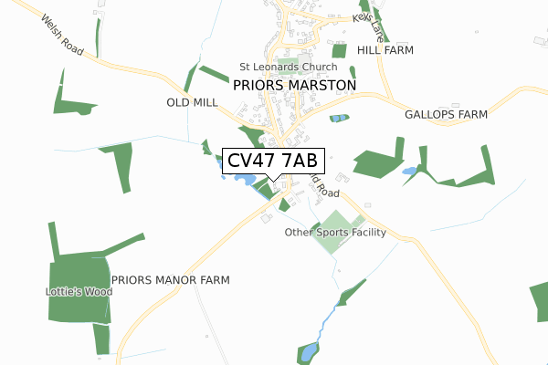
CV47 7AB maps


Licence: Open Government Licence (requires attribution)
Attribution: Contains OS data © Crown copyright and database right 2025
Source: Open Postcode Geo
Licence: Open Government Licence (requires attribution)
Attribution: Contains OS data © Crown copyright and database right 2025; Contains Royal Mail data © Royal Mail copyright and database right 2025; Source: Office for National Statistics licensed under the Open Government Licence v.3.0
CV47 7AB geodata
| Easting | 448861 |
| Northing | 257071 |
| Latitude | 52.209716 |
| Longitude | -1.286340 |
Where is CV47 7AB?
| Country | England |
| Postcode District | CV47 |
Politics
| Ward | Bishop's Itchington, Fenny Compton & Napton |
|---|---|
| Constituency | Kenilworth And Southam |
House Prices
Sales of detached houses in CV47 7AB
ORCHARD HOUSE, MANOR FARM COURT, PRIORS MARSTON, SOUTHAM, CV47 7AB 2019 29 NOV £765,000 |
HAYBARN HOUSE, MANOR FARM COURT, PRIORS MARSTON, SOUTHAM, CV47 7AB 2019 3 SEP £915,000 |
Licence: Contains HM Land Registry data © Crown copyright and database right 2025. This data is licensed under the Open Government Licence v3.0.
Transport
Nearest bus stops to CV47 7AB
| Byfield Road (Shuckburgh Road) | Priors Marston | 135m |
| Hardwick Road (Southam Road) | Priors Marston | 136m |
| Church End (Welsh Road) | Priors Hardwick | 1,674m |
| Crossroads (Hardwick Road) | Priors Hardwick | 1,713m |
| Crossroads (Hardwick Road) | Priors Hardwick | 1,716m |
Broadband
Broadband access in CV47 7AB (2020 data)
| Percentage of properties with Next Generation Access | 100.0% |
| Percentage of properties with Superfast Broadband | 100.0% |
| Percentage of properties with Ultrafast Broadband | 0.0% |
| Percentage of properties with Full Fibre Broadband | 0.0% |
Superfast Broadband is between 30Mbps and 300Mbps
Ultrafast Broadband is > 300Mbps
Broadband limitations in CV47 7AB (2020 data)
| Percentage of properties unable to receive 2Mbps | 0.0% |
| Percentage of properties unable to receive 5Mbps | 0.0% |
| Percentage of properties unable to receive 10Mbps | 0.0% |
| Percentage of properties unable to receive 30Mbps | 0.0% |
Deprivation
25.3% of English postcodes are less deprived than CV47 7AB:Food Standards Agency
Three nearest food hygiene ratings to CV47 7AB (metres)


➜ Get more ratings from the Food Standards Agency
Nearest post box to CV47 7AB
| Last Collection | |||
|---|---|---|---|
| Location | Mon-Fri | Sat | Distance |
| Main Street | 15:30 | 07:30 | 135m |
| Priors Marston Post Office | 15:30 | 07:30 | 695m |
| Hellidon Sub | 16:00 | 09:30 | 2,957m |
CV47 7AB ITL and CV47 7AB LAU
The below table lists the International Territorial Level (ITL) codes (formerly Nomenclature of Territorial Units for Statistics (NUTS) codes) and Local Administrative Units (LAU) codes for CV47 7AB:
| ITL 1 Code | Name |
|---|---|
| TLG | West Midlands (England) |
| ITL 2 Code | Name |
| TLG1 | Herefordshire, Worcestershire and Warwickshire |
| ITL 3 Code | Name |
| TLG13 | Warwickshire CC |
| LAU 1 Code | Name |
| E07000221 | Stratford-on-Avon |
CV47 7AB census areas
The below table lists the Census Output Area (OA), Lower Layer Super Output Area (LSOA), and Middle Layer Super Output Area (MSOA) for CV47 7AB:
| Code | Name | |
|---|---|---|
| OA | E00159047 | |
| LSOA | E01031197 | Stratford-on-Avon 005A |
| MSOA | E02006508 | Stratford-on-Avon 005 |
Nearest postcodes to CV47 7AB
| CV47 7RL | Hardwick Road | 74m |
| CV47 7RH | Priors Court | 185m |
| CV47 7RP | Byfield Road | 202m |
| CV47 7RQ | Southam Road | 262m |
| CV47 7RG | The Holloway | 334m |
| CV47 7RA | Bradshaw Close | 361m |
| CV47 7RN | Hellidon Road | 375m |
| CV47 7RW | Holly Bush Lane | 402m |
| CV47 7RR | School Lane | 475m |
| CV47 7RS | Shuckburgh Road | 633m |