CV47 1AQ maps, stats, and open data
CV47 1AQ is located in the Southam South electoral ward, within the local authority district of Stratford-on-Avon and the English Parliamentary constituency of Kenilworth and Southam. The Sub Integrated Care Board (ICB) Location is NHS Coventry and Warwickshire ICB - B2M3M and the police force is Warwickshire. This postcode has been in use since August 2019.
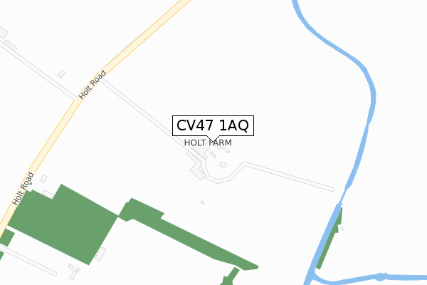
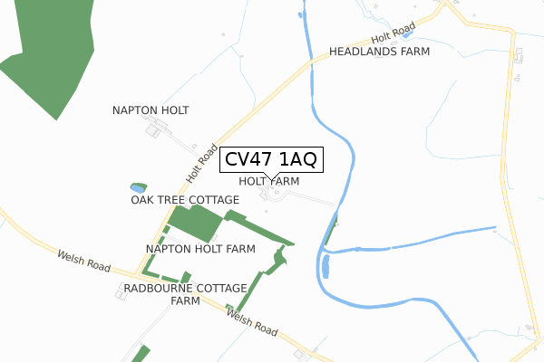
CV47 1AQ maps


Licence: Open Government Licence (requires attribution)
Attribution: Contains OS data © Crown copyright and database right 2025
Source: Open Postcode Geo
Licence: Open Government Licence (requires attribution)
Attribution: Contains OS data © Crown copyright and database right 2025; Contains Royal Mail data © Royal Mail copyright and database right 2025; Source: Office for National Statistics licensed under the Open Government Licence v.3.0
CV47 1AQ geodata
| Easting | 442841 |
| Northing | 261623 |
| Latitude | 52.251139 |
| Longitude | -1.373861 |
Where is CV47 1AQ?
| Country | England |
| Postcode District | CV47 |
Politics
| Ward | Southam South |
|---|---|
| Constituency | Kenilworth And Southam |
House Prices
Sales of detached houses in CV47 1AQ
14, TEMPEST CLOSE, SOUTHAM, CV47 1AQ 2019 12 SEP £314,995 |
1, TEMPEST CLOSE, SOUTHAM, CV47 1AQ 2019 14 AUG £314,995 |
Licence: Contains HM Land Registry data © Crown copyright and database right 2025. This data is licensed under the Open Government Licence v3.0.
Transport
Nearest bus stops to CV47 1AQ
| Priors Meadow (Welsh Road East) | Southam | 555m |
| Surgery (Stowe Drive) | Southam | 808m |
| St. Marys Rc Primary School (Daventry Road) | Southam | 830m |
| Daventry Street (Daventry Road) | Southam | 863m |
| Crown Inn (Daventry Road) | Southam | 880m |
Deprivation
15.2% of English postcodes are less deprived than CV47 1AQ:Food Standards Agency
Three nearest food hygiene ratings to CV47 1AQ (metres)


➜ Get more ratings from the Food Standards Agency
Nearest post box to CV47 1AQ
| Last Collection | |||
|---|---|---|---|
| Location | Mon-Fri | Sat | Distance |
| Coventry Street Post Office | 18:00 | 11:30 | 995m |
| Tollgate Road | 16:00 | 09:00 | 1,131m |
| Warwick Road | 17:00 | 09:00 | 1,335m |
CV47 1AQ ITL and CV47 1AQ LAU
The below table lists the International Territorial Level (ITL) codes (formerly Nomenclature of Territorial Units for Statistics (NUTS) codes) and Local Administrative Units (LAU) codes for CV47 1AQ:
| ITL 1 Code | Name |
|---|---|
| TLG | West Midlands (England) |
| ITL 2 Code | Name |
| TLG1 | Herefordshire, Worcestershire and Warwickshire |
| ITL 3 Code | Name |
| TLG13 | Warwickshire CC |
| LAU 1 Code | Name |
| E07000221 | Stratford-on-Avon |
CV47 1AQ census areas
The below table lists the Census Output Area (OA), Lower Layer Super Output Area (LSOA), and Middle Layer Super Output Area (MSOA) for CV47 1AQ:
| Code | Name | |
|---|---|---|
| OA | E00159171 | |
| LSOA | E01031219 | Stratford-on-Avon 004A |
| MSOA | E02006507 | Stratford-on-Avon 004 |
Nearest postcodes to CV47 1AQ
| CV47 1GN | Napton Rise | 233m |
| CV47 1GL | Rainsbrook Close | 302m |
| CV47 1GD | Shepherds Hill | 338m |
| CV47 1PX | Marston Croft | 352m |
| CV47 1GW | Herdwycke Close | 354m |
| CV47 1ND | Calcutt Meadow | 369m |
| CV47 1NE | Welsh Road East | 411m |
| CV47 1GB | Barkus Close | 416m |
| CV47 1NW | Daventry Road | 420m |
| CV47 1FW | Drovers Way | 426m |