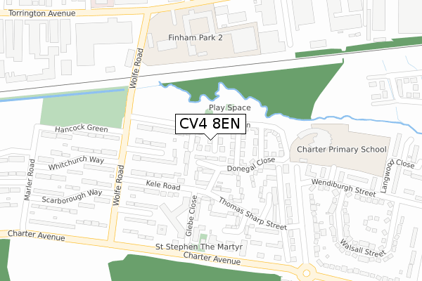
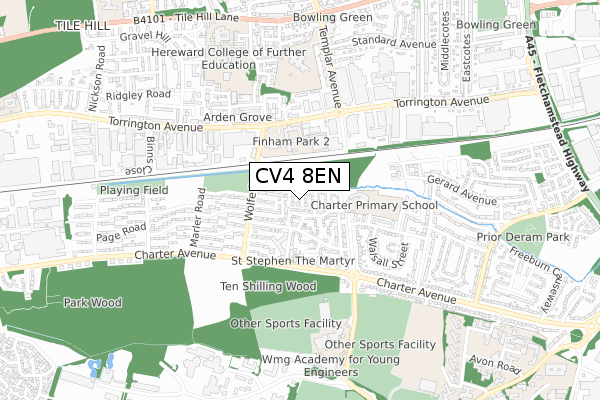
CV4 8EN is located in the Westwood electoral ward, within the metropolitan district of Coventry and the English Parliamentary constituency of Coventry South. The Sub Integrated Care Board (ICB) Location is NHS Coventry and Warwickshire ICB - B2M3M and the police force is West Midlands. This postcode has been in use since March 2018.


GetTheData
Source: OS Open Zoomstack (Ordnance Survey)
Licence: Open Government Licence (requires attribution)
Attribution: Contains OS data © Crown copyright and database right 2025
Source: Open Postcode Geo
Licence: Open Government Licence (requires attribution)
Attribution: Contains OS data © Crown copyright and database right 2025; Contains Royal Mail data © Royal Mail copyright and database right 2025; Source: Office for National Statistics licensed under the Open Government Licence v.3.0
| Easting | 429191 |
| Northing | 277551 |
| Latitude | 52.395221 |
| Longitude | -1.572428 |
GetTheData
Source: Open Postcode Geo
Licence: Open Government Licence
| Country | England |
| Postcode District | CV4 |
➜ See where CV4 is on a map ➜ Where is Coventry? | |
GetTheData
Source: Land Registry Price Paid Data
Licence: Open Government Licence
| Ward | Westwood |
| Constituency | Coventry South |
GetTheData
Source: ONS Postcode Database
Licence: Open Government Licence
2024 17 JAN £337,000 |
9, GREENFINCH ROAD, COVENTRY, CV4 8EN 2018 21 AUG £214,745 |
2018 17 AUG £214,995 |
GetTheData
Source: HM Land Registry Price Paid Data
Licence: Contains HM Land Registry data © Crown copyright and database right 2025. This data is licensed under the Open Government Licence v3.0.
| Wansfell Close (Thomas Sharp St) | Westwood Business Park | 157m |
| Wansfell Close (Thomas Sharp St) | Westwood Business Park | 160m |
| Glebe Close (Kele Rd) | Westwood Business Park | 177m |
| Glebe Close (Kele Rd) | Westwood Business Park | 177m |
| Hancock Green (Wolfe Rd) | Westwood Business Park | 223m |
| Tile Hill Station | 1.7km |
| Canley Station | 1.8km |
| Coventry Station | 4.1km |
GetTheData
Source: NaPTAN
Licence: Open Government Licence
| Percentage of properties with Next Generation Access | 100.0% |
| Percentage of properties with Superfast Broadband | 100.0% |
| Percentage of properties with Ultrafast Broadband | 100.0% |
| Percentage of properties with Full Fibre Broadband | 100.0% |
Superfast Broadband is between 30Mbps and 300Mbps
Ultrafast Broadband is > 300Mbps
| Percentage of properties unable to receive 2Mbps | 0.0% |
| Percentage of properties unable to receive 5Mbps | 0.0% |
| Percentage of properties unable to receive 10Mbps | 0.0% |
| Percentage of properties unable to receive 30Mbps | 0.0% |
GetTheData
Source: Ofcom
Licence: Ofcom Terms of Use (requires attribution)
GetTheData
Source: ONS Postcode Database
Licence: Open Government Licence


➜ Get more ratings from the Food Standards Agency
GetTheData
Source: Food Standards Agency
Licence: FSA terms & conditions
| Last Collection | |||
|---|---|---|---|
| Location | Mon-Fri | Sat | Distance |
| Torrington Avenue | 16:30 | 09:45 | 473m |
| Westwood Way Business Box | 18:30 | 747m | |
| Westwood Way | 18:30 | 11:45 | 751m |
GetTheData
Source: Dracos
Licence: Creative Commons Attribution-ShareAlike
The below table lists the International Territorial Level (ITL) codes (formerly Nomenclature of Territorial Units for Statistics (NUTS) codes) and Local Administrative Units (LAU) codes for CV4 8EN:
| ITL 1 Code | Name |
|---|---|
| TLG | West Midlands (England) |
| ITL 2 Code | Name |
| TLG3 | West Midlands |
| ITL 3 Code | Name |
| TLG33 | Coventry |
| LAU 1 Code | Name |
| E08000026 | Coventry |
GetTheData
Source: ONS Postcode Directory
Licence: Open Government Licence
The below table lists the Census Output Area (OA), Lower Layer Super Output Area (LSOA), and Middle Layer Super Output Area (MSOA) for CV4 8EN:
| Code | Name | |
|---|---|---|
| OA | E00048963 | |
| LSOA | E01032531 | Coventry 036E |
| MSOA | E02001993 | Coventry 036 |
GetTheData
Source: ONS Postcode Directory
Licence: Open Government Licence
| CV4 8BQ | Papenham Green | 35m |
| CV4 8DN | Donegal Close | 55m |
| CV4 8DL | Renfrew Walk | 93m |
| CV4 8DT | Glenrosa Walk | 125m |
| CV4 8DP | Thomas Sharp Street | 144m |
| CV4 8BS | Founder Close | 167m |
| CV4 8DH | Kele Road | 167m |
| CV4 8DQ | Thomas Sharp Street | 176m |
| CV4 8DR | Penrose Close | 185m |
| CV4 8DJ | Glebe Close | 187m |
GetTheData
Source: Open Postcode Geo; Land Registry Price Paid Data
Licence: Open Government Licence