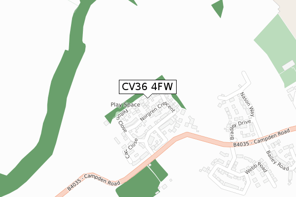
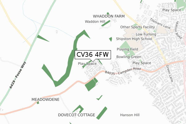
CV36 4FW is located in the Shipston South electoral ward, within the local authority district of Stratford-on-Avon and the English Parliamentary constituency of Stratford-on-Avon. The Sub Integrated Care Board (ICB) Location is NHS Coventry and Warwickshire ICB - B2M3M and the police force is Warwickshire. This postcode has been in use since November 2019.


GetTheData
Source: OS Open Zoomstack (Ordnance Survey)
Licence: Open Government Licence (requires attribution)
Attribution: Contains OS data © Crown copyright and database right 2025
Source: Open Postcode Geo
Licence: Open Government Licence (requires attribution)
Attribution: Contains OS data © Crown copyright and database right 2025; Contains Royal Mail data © Royal Mail copyright and database right 2025; Source: Office for National Statistics licensed under the Open Government Licence v.3.0
| Easting | 424646 |
| Northing | 240533 |
| Latitude | 52.062642 |
| Longitude | -1.641902 |
GetTheData
Source: Open Postcode Geo
Licence: Open Government Licence
| Country | England |
| Postcode District | CV36 |
➜ See where CV36 is on a map ➜ Where is Shipston-on-Stour? | |
GetTheData
Source: Land Registry Price Paid Data
Licence: Open Government Licence
| Ward | Shipston South |
| Constituency | Stratford-on-avon |
GetTheData
Source: ONS Postcode Database
Licence: Open Government Licence
1, ATCHESON CLOSE, SHIPSTON-ON-STOUR, CV36 4FW 2021 12 JAN £476,950 |
2, ATCHESON CLOSE, SHIPSTON-ON-STOUR, CV36 4FW 2020 17 DEC £444,000 |
5, ATCHESON CLOSE, SHIPSTON-ON-STOUR, CV36 4FW 2020 29 OCT £641,000 |
4, ATCHESON CLOSE, SHIPSTON-ON-STOUR, CV36 4FW 2020 31 JUL £495,000 |
3, ATCHESON CLOSE, SHIPSTON-ON-STOUR, CV36 4FW 2020 30 JUN £599,950 |
7, ATCHESON CLOSE, SHIPSTON-ON-STOUR, CV36 4FW 2019 20 DEC £525,000 |
➜ Shipston-on-Stour house prices
GetTheData
Source: HM Land Registry Price Paid Data
Licence: Contains HM Land Registry data © Crown copyright and database right 2025. This data is licensed under the Open Government Licence v3.0.
| Sadlers Close (Sadlers Avenue) | Shipston On Stour | 554m |
| Shipston High School (Private Road) | Shipston On Stour | 699m |
| Berry Close (Berry Avenue) | Shipston On Stour | 827m |
| Warwick Place (Darlingscote Road) | Shipston On Stour | 874m |
| Berry Avenue (Darlingscote Road) | Shipston On Stour | 914m |
GetTheData
Source: NaPTAN
Licence: Open Government Licence
GetTheData
Source: ONS Postcode Database
Licence: Open Government Licence


➜ Get more ratings from the Food Standards Agency
GetTheData
Source: Food Standards Agency
Licence: FSA terms & conditions
| Last Collection | |||
|---|---|---|---|
| Location | Mon-Fri | Sat | Distance |
| Warwick Place | 17:00 | 11:30 | 878m |
| Hanson Avenue | 17:00 | 11:30 | 904m |
| Shipston On Stour Post Office | 17:30 | 12:15 | 1,176m |
GetTheData
Source: Dracos
Licence: Creative Commons Attribution-ShareAlike
The below table lists the International Territorial Level (ITL) codes (formerly Nomenclature of Territorial Units for Statistics (NUTS) codes) and Local Administrative Units (LAU) codes for CV36 4FW:
| ITL 1 Code | Name |
|---|---|
| TLG | West Midlands (England) |
| ITL 2 Code | Name |
| TLG1 | Herefordshire, Worcestershire and Warwickshire |
| ITL 3 Code | Name |
| TLG13 | Warwickshire CC |
| LAU 1 Code | Name |
| E07000221 | Stratford-on-Avon |
GetTheData
Source: ONS Postcode Directory
Licence: Open Government Licence
The below table lists the Census Output Area (OA), Lower Layer Super Output Area (LSOA), and Middle Layer Super Output Area (MSOA) for CV36 4FW:
| Code | Name | |
|---|---|---|
| OA | E00172275 | |
| LSOA | E01031214 | Stratford-on-Avon 015C |
| MSOA | E02006518 | Stratford-on-Avon 015 |
GetTheData
Source: ONS Postcode Directory
Licence: Open Government Licence
| CV36 4DQ | Pittway Avenue | 489m |
| CV36 4DN | Sadlers Avenue | 543m |
| CV36 4DG | Pittway Avenue | 633m |
| CV36 4EQ | Oldbutt Leys | 639m |
| CV36 4DJ | Queens Avenue | 659m |
| CV36 4EG | Oldbutt Road | 668m |
| CV36 4SB | Farm Close | 693m |
| CV36 4DH | Campden Road | 734m |
| CV36 4SA | Hay Meadow | 737m |
| CV36 4DE | Queens Avenue | 782m |
GetTheData
Source: Open Postcode Geo; Land Registry Price Paid Data
Licence: Open Government Licence