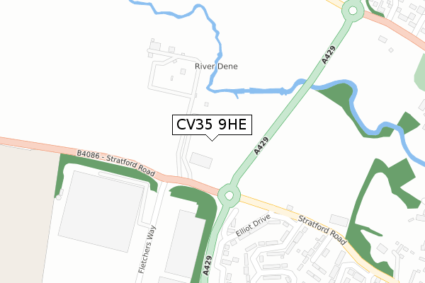
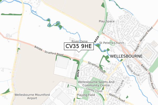
CV35 9HE is located in the Wellesbourne South electoral ward, within the local authority district of Stratford-on-Avon and the English Parliamentary constituency of Kenilworth and Southam. The Sub Integrated Care Board (ICB) Location is NHS Coventry and Warwickshire ICB - B2M3M and the police force is Warwickshire. This postcode has been in use since September 2018.


GetTheData
Source: OS Open Zoomstack (Ordnance Survey)
Licence: Open Government Licence (requires attribution)
Attribution: Contains OS data © Crown copyright and database right 2025
Source: Open Postcode Geo
Licence: Open Government Licence (requires attribution)
Attribution: Contains OS data © Crown copyright and database right 2025; Contains Royal Mail data © Royal Mail copyright and database right 2025; Source: Office for National Statistics licensed under the Open Government Licence v.3.0
| Easting | 427157 |
| Northing | 255432 |
| Latitude | 52.196473 |
| Longitude | -1.604092 |
GetTheData
Source: Open Postcode Geo
Licence: Open Government Licence
| Country | England |
| Postcode District | CV35 |
➜ See where CV35 is on a map | |
GetTheData
Source: Land Registry Price Paid Data
Licence: Open Government Licence
| Ward | Wellesbourne South |
| Constituency | Kenilworth And Southam |
GetTheData
Source: ONS Postcode Database
Licence: Open Government Licence
| Wellesbourne Market (Tiddington Road) | Wellesbourne | 53m |
| Wellesbourne Market (Tiddington Road) | Wellesbourne | 69m |
| Elliot Drive (Stratford Road) | Wellesbourne | 285m |
| Elliot Drive (Stratford Road) | Wellesbourne | 296m |
| Wellesbourne Depot (Loxley Road) | Wellesbourne | 607m |
GetTheData
Source: NaPTAN
Licence: Open Government Licence
GetTheData
Source: ONS Postcode Database
Licence: Open Government Licence


➜ Get more ratings from the Food Standards Agency
GetTheData
Source: Food Standards Agency
Licence: FSA terms & conditions
| Last Collection | |||
|---|---|---|---|
| Location | Mon-Fri | Sat | Distance |
| Elliott Drive | 16:45 | 09:00 | 386m |
| Chestnut Square | 17:00 | 09:00 | 643m |
| Warwick Road | 17:15 | 09:00 | 695m |
GetTheData
Source: Dracos
Licence: Creative Commons Attribution-ShareAlike
The below table lists the International Territorial Level (ITL) codes (formerly Nomenclature of Territorial Units for Statistics (NUTS) codes) and Local Administrative Units (LAU) codes for CV35 9HE:
| ITL 1 Code | Name |
|---|---|
| TLG | West Midlands (England) |
| ITL 2 Code | Name |
| TLG1 | Herefordshire, Worcestershire and Warwickshire |
| ITL 3 Code | Name |
| TLG13 | Warwickshire CC |
| LAU 1 Code | Name |
| E07000221 | Stratford-on-Avon |
GetTheData
Source: ONS Postcode Directory
Licence: Open Government Licence
The below table lists the Census Output Area (OA), Lower Layer Super Output Area (LSOA), and Middle Layer Super Output Area (MSOA) for CV35 9HE:
| Code | Name | |
|---|---|---|
| OA | E00159335 | |
| LSOA | E01031250 | Stratford-on-Avon 008D |
| MSOA | E02006511 | Stratford-on-Avon 008 |
GetTheData
Source: ONS Postcode Directory
Licence: Open Government Licence
| CV35 9HD | Fletchers Way | 202m |
| CV35 9RT | Elliott Drive | 260m |
| CV35 9SF | Stratford Road | 365m |
| CV35 9RR | Granville Road | 370m |
| CV35 9RS | Elliott Drive | 374m |
| CV35 9RU | Loxley Close | 450m |
| CV35 9RP | Westfield Crescent | 457m |
| CV35 9RN | Stratford Road | 476m |
| CV35 9PZ | Constance Harris Close | 578m |
| CV35 9PY | Ettington Road | 589m |
GetTheData
Source: Open Postcode Geo; Land Registry Price Paid Data
Licence: Open Government Licence