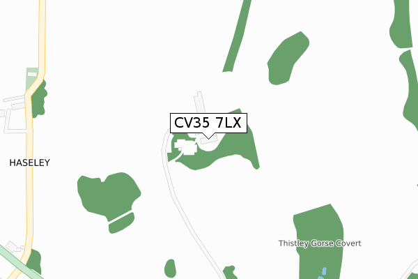
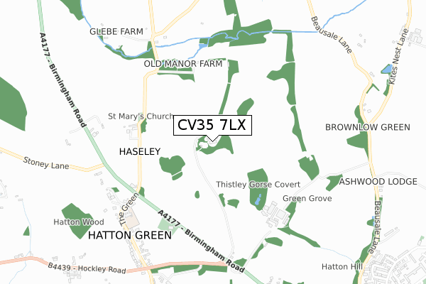
CV35 7LX is located in the Kenilworth Abbey & Arden electoral ward, within the local authority district of Warwick and the English Parliamentary constituency of Kenilworth and Southam. The Sub Integrated Care Board (ICB) Location is NHS Coventry and Warwickshire ICB - B2M3M and the police force is Warwickshire. This postcode has been in use since February 2018.


GetTheData
Source: OS Open Zoomstack (Ordnance Survey)
Licence: Open Government Licence (requires attribution)
Attribution: Contains OS data © Crown copyright and database right 2025
Source: Open Postcode Geo
Licence: Open Government Licence (requires attribution)
Attribution: Contains OS data © Crown copyright and database right 2025; Contains Royal Mail data © Royal Mail copyright and database right 2025; Source: Office for National Statistics licensed under the Open Government Licence v.3.0
| Easting | 423866 |
| Northing | 267895 |
| Latitude | 52.308670 |
| Longitude | -1.651363 |
GetTheData
Source: Open Postcode Geo
Licence: Open Government Licence
| Country | England |
| Postcode District | CV35 |
➜ See where CV35 is on a map ➜ Where is Haseley? | |
GetTheData
Source: Land Registry Price Paid Data
Licence: Open Government Licence
| Ward | Kenilworth Abbey & Arden |
| Constituency | Kenilworth And Southam |
GetTheData
Source: ONS Postcode Database
Licence: Open Government Licence
| Starmer Place (The Green) | Hatton | 803m |
| Starmer Place (The Green) | Hatton | 814m |
| The Green (Hockley Road) | Hatton | 898m |
| Mollington Grove (Barcheston Drive) | Hatton Park | 1,279m |
| Village Hall (Barcheston Drive) | Hatton Park | 1,342m |
| Hatton (Warks) Station | 2.1km |
| Warwick Parkway Station | 3.7km |
| Claverdon Station | 4.7km |
GetTheData
Source: NaPTAN
Licence: Open Government Licence
| Percentage of properties with Next Generation Access | 100.0% |
| Percentage of properties with Superfast Broadband | 100.0% |
| Percentage of properties with Ultrafast Broadband | 100.0% |
| Percentage of properties with Full Fibre Broadband | 100.0% |
Superfast Broadband is between 30Mbps and 300Mbps
Ultrafast Broadband is > 300Mbps
| Percentage of properties unable to receive 2Mbps | 0.0% |
| Percentage of properties unable to receive 5Mbps | 0.0% |
| Percentage of properties unable to receive 10Mbps | 0.0% |
| Percentage of properties unable to receive 30Mbps | 0.0% |
GetTheData
Source: Ofcom
Licence: Ofcom Terms of Use (requires attribution)
GetTheData
Source: ONS Postcode Database
Licence: Open Government Licence


➜ Get more ratings from the Food Standards Agency
GetTheData
Source: Food Standards Agency
Licence: FSA terms & conditions
| Last Collection | |||
|---|---|---|---|
| Location | Mon-Fri | Sat | Distance |
| Hatton | 17:15 | 07:30 | 724m |
| Little Shrewley | 15:10 | 07:30 | 1,451m |
| Hatton Park | 17:00 | 09:00 | 1,526m |
GetTheData
Source: Dracos
Licence: Creative Commons Attribution-ShareAlike
The below table lists the International Territorial Level (ITL) codes (formerly Nomenclature of Territorial Units for Statistics (NUTS) codes) and Local Administrative Units (LAU) codes for CV35 7LX:
| ITL 1 Code | Name |
|---|---|
| TLG | West Midlands (England) |
| ITL 2 Code | Name |
| TLG1 | Herefordshire, Worcestershire and Warwickshire |
| ITL 3 Code | Name |
| TLG13 | Warwickshire CC |
| LAU 1 Code | Name |
| E07000222 | Warwick |
GetTheData
Source: ONS Postcode Directory
Licence: Open Government Licence
The below table lists the Census Output Area (OA), Lower Layer Super Output Area (LSOA), and Middle Layer Super Output Area (MSOA) for CV35 7LX:
| Code | Name | |
|---|---|---|
| OA | E00159509 | |
| LSOA | E01031283 | Warwick 004C |
| MSOA | E02006522 | Warwick 004 |
GetTheData
Source: ONS Postcode Directory
Licence: Open Government Licence
| CV35 7LS | 477m | |
| CV35 7EX | The Green | 691m |
| CV35 7LU | 698m | |
| CV35 7HA | Birmingham Road | 715m |
| CV35 7LB | Starmer Place | 751m |
| CV35 7LA | Hatton Green | 801m |
| CV35 7JJ | Birmingham Road | 929m |
| CV35 7PE | Beausale Lane | 1014m |
| CV35 7JL | Canal Lane | 1034m |
| CV35 7HQ | Hockley Road | 1115m |
GetTheData
Source: Open Postcode Geo; Land Registry Price Paid Data
Licence: Open Government Licence