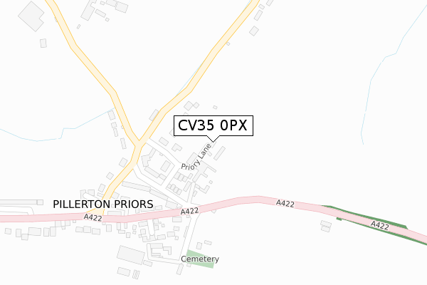
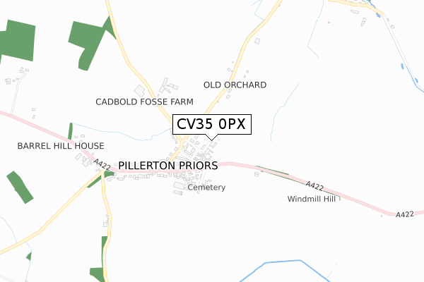
CV35 0PX maps, stats, and open data
CV35 0PX is located in the Gaydon, Kineton & Upper Lighthorne electoral ward, within the local authority district of Stratford-on-Avon and the English Parliamentary constituency of Kenilworth and Southam. The Sub Integrated Care Board (ICB) Location is NHS Coventry and Warwickshire ICB - B2M3M and the police force is Warwickshire. This postcode has been in use since April 2020.
CV35 0PX maps


Licence: Open Government Licence (requires attribution)
Attribution: Contains OS data © Crown copyright and database right 2025
Source: Open Postcode Geo
Licence: Open Government Licence (requires attribution)
Attribution: Contains OS data © Crown copyright and database right 2025; Contains Royal Mail data © Royal Mail copyright and database right 2025; Source: Office for National Statistics licensed under the Open Government Licence v.3.0
CV35 0PX geodata
| Easting | 433686 |
| Northing | 251038 |
| Latitude | 52.156612 |
| Longitude | -1.509010 |
Where is CV35 0PX?
| Country | England |
| Postcode District | CV35 |
Politics
| Ward | Gaydon, Kineton & Upper Lighthorne |
|---|---|
| Constituency | Kenilworth And Southam |
House Prices
Sales of detached houses in CV35 0PX
10, COURT CLOSE, KINETON, WARWICK, CV35 0PX 2022 30 SEP £433,000 |
10, COURT CLOSE, KINETON, WARWICK, CV35 0PX 2022 9 MAR £375,000 |
2, COURT CLOSE, KINETON, WARWICK, CV35 0PX 2021 31 MAR £372,500 |
10, COURT CLOSE, KINETON, WARWICK, CV35 0PX 2021 31 MAR £372,500 |
9, COURT CLOSE, KINETON, WARWICK, CV35 0PX 2021 15 MAR £381,500 |
3, COURT CLOSE, KINETON, WARWICK, CV35 0PX 2020 2 OCT £295,000 |
6, COURT CLOSE, KINETON, WARWICK, CV35 0PX 2020 30 JUN £395,000 |
1, COURT CLOSE, KINETON, WARWICK, CV35 0PX 2020 17 JUN £385,000 |
4, COURT CLOSE, KINETON, WARWICK, CV35 0PX 2020 27 MAR £315,000 |
5, COURT CLOSE, KINETON, WARWICK, CV35 0PX 2020 19 MAR £305,000 |
Licence: Contains HM Land Registry data © Crown copyright and database right 2025. This data is licensed under the Open Government Licence v3.0.
Transport
Nearest bus stops to CV35 0PX
| Warwick Road (Southam Street) | Kineton | 75m |
| Church (Warwick Road) | Kineton | 108m |
| Church (Warwick Road) | Kineton | 118m |
| Library (Bridge Street) | Kineton | 161m |
| Library (Bridge Street) | Kineton | 177m |
Deprivation
25.2% of English postcodes are less deprived than CV35 0PX:Food Standards Agency
Three nearest food hygiene ratings to CV35 0PX (metres)


➜ Get more ratings from the Food Standards Agency
Nearest post box to CV35 0PX
| Last Collection | |||
|---|---|---|---|
| Location | Mon-Fri | Sat | Distance |
| Kineton Post Office | 16:30 | 11:30 | 116m |
| Kineton Station | 16:00 | 08:00 | 497m |
| Chadshunt | 16:00 | 10:15 | 2,122m |
CV35 0PX ITL and CV35 0PX LAU
The below table lists the International Territorial Level (ITL) codes (formerly Nomenclature of Territorial Units for Statistics (NUTS) codes) and Local Administrative Units (LAU) codes for CV35 0PX:
| ITL 1 Code | Name |
|---|---|
| TLG | West Midlands (England) |
| ITL 2 Code | Name |
| TLG1 | Herefordshire, Worcestershire and Warwickshire |
| ITL 3 Code | Name |
| TLG13 | Warwickshire CC |
| LAU 1 Code | Name |
| E07000221 | Stratford-on-Avon |
CV35 0PX census areas
The below table lists the Census Output Area (OA), Lower Layer Super Output Area (LSOA), and Middle Layer Super Output Area (MSOA) for CV35 0PX:
| Code | Name | |
|---|---|---|
| OA | E00159087 | |
| LSOA | E01031205 | Stratford-on-Avon 013B |
| MSOA | E02006516 | Stratford-on-Avon 013 |
Nearest postcodes to CV35 0PX
| CV35 0LB | Mill Street | 42m |
| CV35 0JQ | The Old Stores Court | 57m |
| CV35 0JS | Banbury Street | 63m |
| CV35 0LL | Southam Street | 77m |
| CV35 0JT | Manor Lane | 120m |
| CV35 0LX | Battle Court | 121m |
| CV35 0JR | Bridge Street | 141m |
| CV35 0LA | Mill Lane | 156m |
| CV35 0LJ | Mill Crescent | 157m |
| CV35 0JU | Banbury Street | 168m |