CV32 7JW maps, stats, and open data
CV32 7JW is located in the Cubbington & Leek Wootton electoral ward, within the local authority district of Warwick and the English Parliamentary constituency of Kenilworth and Southam. The Sub Integrated Care Board (ICB) Location is NHS Coventry and Warwickshire ICB - B2M3M and the police force is Warwickshire. This postcode has been in use since April 2020.
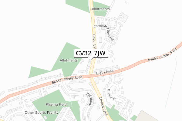
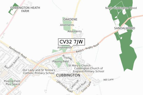
CV32 7JW maps


Licence: Open Government Licence (requires attribution)
Attribution: Contains OS data © Crown copyright and database right 2025
Source: Open Postcode Geo
Licence: Open Government Licence (requires attribution)
Attribution: Contains OS data © Crown copyright and database right 2025; Contains Royal Mail data © Royal Mail copyright and database right 2025; Source: Office for National Statistics licensed under the Open Government Licence v.3.0
CV32 7JW geodata
| Easting | 434086 |
| Northing | 268692 |
| Latitude | 52.315298 |
| Longitude | -1.501390 |
Where is CV32 7JW?
| Country | England |
| Postcode District | CV32 |
Politics
| Ward | Cubbington & Leek Wootton |
|---|---|
| Constituency | Kenilworth And Southam |
House Prices
Sales of detached houses in CV32 7JW
31, BLACKBERRY WAY, CUBBINGTON, LEAMINGTON SPA, CV32 7JW 2024 20 SEP £369,995 |
18, BLACKBERRY WAY, CUBBINGTON, LEAMINGTON SPA, CV32 7JW 2024 22 MAR £420,000 |
20, BLACKBERRY WAY, CUBBINGTON, LEAMINGTON SPA, CV32 7JW 2024 19 JAN £380,000 |
35, BLACKBERRY WAY, CUBBINGTON, LEAMINGTON SPA, CV32 7JW 2024 19 JAN £440,000 |
33, BLACKBERRY WAY, CUBBINGTON, LEAMINGTON SPA, CV32 7JW 2023 18 DEC £440,000 |
16, BLACKBERRY WAY, CUBBINGTON, LEAMINGTON SPA, CV32 7JW 2023 27 JUL £574,995 |
27, BLACKBERRY WAY, CUBBINGTON, LEAMINGTON SPA, CV32 7JW 2023 28 JUN £425,000 |
29, BLACKBERRY WAY, CUBBINGTON, LEAMINGTON SPA, CV32 7JW 2023 31 MAY £441,000 |
14, BLACKBERRY WAY, CUBBINGTON, LEAMINGTON SPA, CV32 7JW 2023 19 MAY £444,995 |
11, BLACKBERRY WAY, CUBBINGTON, LEAMINGTON SPA, CV32 7JW 2023 1 FEB £452,500 |
Licence: Contains HM Land Registry data © Crown copyright and database right 2025. This data is licensed under the Open Government Licence v3.0.
Transport
Nearest bus stops to CV32 7JW
| Broadway (Rugby Road) | Cubbington | 125m |
| Rugby Road | Cubbington | 205m |
| Rugby Road | Cubbington | 335m |
| Queens Head (Queen Street) | Cubbington | 490m |
| Stonehouse Close (Windmill Hill) | Cubbington | 502m |
Nearest railway stations to CV32 7JW
| Leamington Spa Station | 4.2km |
Deprivation
14.3% of English postcodes are less deprived than CV32 7JW:Food Standards Agency
Three nearest food hygiene ratings to CV32 7JW (metres)


➜ Get more ratings from the Food Standards Agency
Nearest post box to CV32 7JW
| Last Collection | |||
|---|---|---|---|
| Location | Mon-Fri | Sat | Distance |
| Broadway | 16:15 | 12:15 | 154m |
| Church Lane | 16:15 | 12:15 | 434m |
| Cubbington Post Office | 17:15 | 12:15 | 529m |
CV32 7JW ITL and CV32 7JW LAU
The below table lists the International Territorial Level (ITL) codes (formerly Nomenclature of Territorial Units for Statistics (NUTS) codes) and Local Administrative Units (LAU) codes for CV32 7JW:
| ITL 1 Code | Name |
|---|---|
| TLG | West Midlands (England) |
| ITL 2 Code | Name |
| TLG1 | Herefordshire, Worcestershire and Warwickshire |
| ITL 3 Code | Name |
| TLG13 | Warwickshire CC |
| LAU 1 Code | Name |
| E07000222 | Warwick |
CV32 7JW census areas
The below table lists the Census Output Area (OA), Lower Layer Super Output Area (LSOA), and Middle Layer Super Output Area (MSOA) for CV32 7JW:
| Code | Name | |
|---|---|---|
| OA | E00159493 | |
| LSOA | E01031278 | Warwick 005B |
| MSOA | E02006523 | Warwick 005 |
Nearest postcodes to CV32 7JW
| CV32 7JJ | Rugby Road | 118m |
| CV32 7JN | Coventry Road | 138m |
| CV32 7JL | Rugby Road | 181m |
| CV32 7JR | Broadway | 182m |
| CV32 7XL | Willow Sheets Meadow | 217m |
| CV32 7JT | Church Lane | 229m |
| CV32 7XJ | Three Cornered Close | 233m |
| CV32 7JQ | Rugby Road | 234m |
| CV32 7XH | Cotton Mill Spinney | 263m |
| CV32 7LT | Boddington Close | 318m |