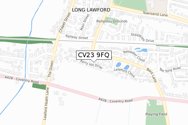
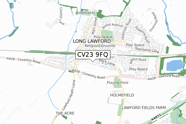
CV23 9FQ is located in the Wolston and the Lawfords electoral ward, within the local authority district of Rugby and the English Parliamentary constituency of Rugby. The Sub Integrated Care Board (ICB) Location is NHS Coventry and Warwickshire ICB - B2M3M and the police force is Warwickshire. This postcode has been in use since October 2017.


GetTheData
Source: OS Open Zoomstack (Ordnance Survey)
Licence: Open Government Licence (requires attribution)
Attribution: Contains OS data © Crown copyright and database right 2025
Source: Open Postcode Geo
Licence: Open Government Licence (requires attribution)
Attribution: Contains OS data © Crown copyright and database right 2025; Contains Royal Mail data © Royal Mail copyright and database right 2025; Source: Office for National Statistics licensed under the Open Government Licence v.3.0
| Easting | 447234 |
| Northing | 275732 |
| Latitude | 52.377614 |
| Longitude | -1.307540 |
GetTheData
Source: Open Postcode Geo
Licence: Open Government Licence
| Country | England |
| Postcode District | CV23 |
➜ See where CV23 is on a map ➜ Where is Long Lawford? | |
GetTheData
Source: Land Registry Price Paid Data
Licence: Open Government Licence
| Ward | Wolston And The Lawfords |
| Constituency | Rugby |
GetTheData
Source: ONS Postcode Database
Licence: Open Government Licence
2024 23 APR £325,000 |
2022 31 OCT £449,950 |
2022 22 JUL £415,000 |
2021 30 JUN £290,000 |
2021 27 JAN £272,500 |
2020 9 DEC £347,500 |
27, KERRY HILL DRIVE, LONG LAWFORD, RUGBY, CV23 9FQ 2019 28 JUN £385,000 |
19, KERRY HILL DRIVE, LONG LAWFORD, RUGBY, CV23 9FQ 2019 27 JUN £355,000 |
42, KERRY HILL DRIVE, LONG LAWFORD, RUGBY, CV23 9FQ 2019 14 JUN £390,000 |
36, KERRY HILL DRIVE, LONG LAWFORD, RUGBY, CV23 9FQ 2019 31 MAY £385,000 |
GetTheData
Source: HM Land Registry Price Paid Data
Licence: Contains HM Land Registry data © Crown copyright and database right 2025. This data is licensed under the Open Government Licence v3.0.
| Back Lane (Tee Tong Road) | Long Lawford | 64m |
| Back Lane (Tee Tong Lane) | Long Lawford | 65m |
| Livingstone Avenue (Chapel Street) | Long Lawford | 220m |
| Livingstone Avenue (Chapel Street) | Long Lawford | 234m |
| Green (A428) | Long Lawford | 278m |
| Rugby Station | 3.9km |
GetTheData
Source: NaPTAN
Licence: Open Government Licence
| Percentage of properties with Next Generation Access | 100.0% |
| Percentage of properties with Superfast Broadband | 100.0% |
| Percentage of properties with Ultrafast Broadband | 100.0% |
| Percentage of properties with Full Fibre Broadband | 100.0% |
Superfast Broadband is between 30Mbps and 300Mbps
Ultrafast Broadband is > 300Mbps
| Percentage of properties unable to receive 2Mbps | 0.0% |
| Percentage of properties unable to receive 5Mbps | 0.0% |
| Percentage of properties unable to receive 10Mbps | 0.0% |
| Percentage of properties unable to receive 30Mbps | 0.0% |
GetTheData
Source: Ofcom
Licence: Ofcom Terms of Use (requires attribution)
GetTheData
Source: ONS Postcode Database
Licence: Open Government Licence


➜ Get more ratings from the Food Standards Agency
GetTheData
Source: Food Standards Agency
Licence: FSA terms & conditions
| Last Collection | |||
|---|---|---|---|
| Location | Mon-Fri | Sat | Distance |
| Belgrave Road | 16:30 | 10:30 | 1,417m |
| Frobisher Road | 17:00 | 11:30 | 1,635m |
| Somers Road Business Box | 1,860m | ||
GetTheData
Source: Dracos
Licence: Creative Commons Attribution-ShareAlike
The below table lists the International Territorial Level (ITL) codes (formerly Nomenclature of Territorial Units for Statistics (NUTS) codes) and Local Administrative Units (LAU) codes for CV23 9FQ:
| ITL 1 Code | Name |
|---|---|
| TLG | West Midlands (England) |
| ITL 2 Code | Name |
| TLG1 | Herefordshire, Worcestershire and Warwickshire |
| ITL 3 Code | Name |
| TLG13 | Warwickshire CC |
| LAU 1 Code | Name |
| E07000220 | Rugby |
GetTheData
Source: ONS Postcode Directory
Licence: Open Government Licence
The below table lists the Census Output Area (OA), Lower Layer Super Output Area (LSOA), and Middle Layer Super Output Area (MSOA) for CV23 9FQ:
| Code | Name | |
|---|---|---|
| OA | E00158854 | |
| LSOA | E01031164 | Rugby 007D |
| MSOA | E02006498 | Rugby 007 |
GetTheData
Source: ONS Postcode Directory
Licence: Open Government Licence
| CV23 9BA | Railway Street | 157m |
| CV23 9AW | Grange Terrace | 176m |
| CV23 9GA | Teeswater Close | 179m |
| CV23 9AU | School Street | 181m |
| CV23 9BL | The Green | 204m |
| CV23 9BW | Coventry Road | 231m |
| CV23 9FH | Willowford Close | 234m |
| CV23 9GB | Teeswater Close | 239m |
| CV23 9AY | Main Street | 241m |
| CV23 9BF | Foxfield Place | 245m |
GetTheData
Source: Open Postcode Geo; Land Registry Price Paid Data
Licence: Open Government Licence