CV23 8YP maps, stats, and open data
CV23 8YP is located in the Braunston and Crick electoral ward, within the unitary authority of West Northamptonshire and the English Parliamentary constituency of Daventry. The Sub Integrated Care Board (ICB) Location is NHS Northamptonshire ICB - 78H and the police force is Northamptonshire. This postcode has been in use since April 2018.
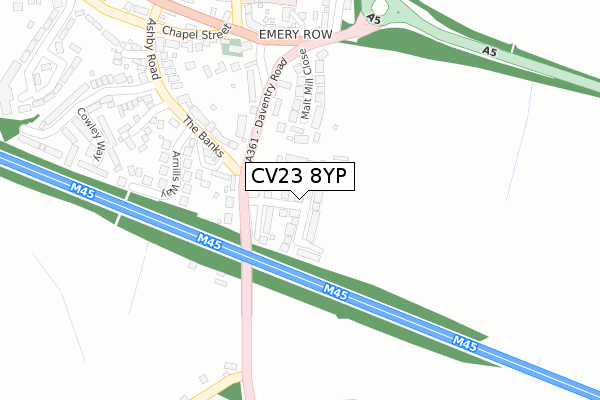
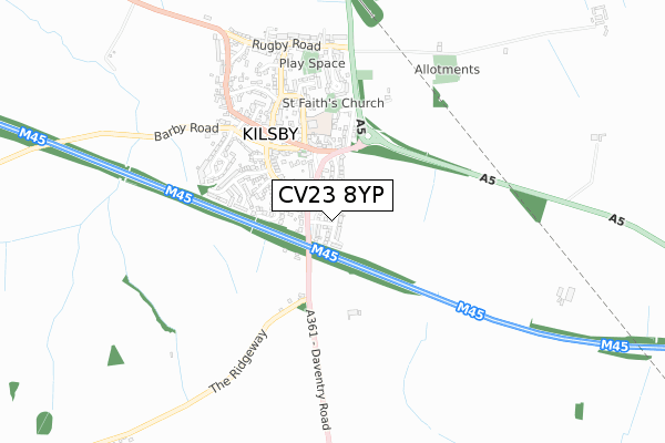
CV23 8YP maps


Licence: Open Government Licence (requires attribution)
Attribution: Contains OS data © Crown copyright and database right 2025
Source: Open Postcode Geo
Licence: Open Government Licence (requires attribution)
Attribution: Contains OS data © Crown copyright and database right 2025; Contains Royal Mail data © Royal Mail copyright and database right 2025; Source: Office for National Statistics licensed under the Open Government Licence v.3.0
CV23 8YP geodata
| Easting | 456324 |
| Northing | 270683 |
| Latitude | 52.331370 |
| Longitude | -1.174864 |
Where is CV23 8YP?
| Country | England |
| Postcode District | CV23 |
Politics
| Ward | Braunston And Crick |
|---|---|
| Constituency | Daventry |
House Prices
Sales of detached houses in CV23 8YP
2025 16 JUN £465,000 |
2024 15 FEB £465,000 |
2021 21 JUN £518,000 |
14, NORMANDY FIELDS WAY, KILSBY, RUGBY, CV23 8YP 2019 5 APR £559,995 |
31, NORMANDY FIELDS WAY, KILSBY, RUGBY, CV23 8YP 2019 22 FEB £443,000 |
27, NORMANDY FIELDS WAY, KILSBY, RUGBY, CV23 8YP 2019 18 FEB £553,000 |
2019 25 JAN £414,995 |
6, NORMANDY FIELDS WAY, KILSBY, RUGBY, CV23 8YP 2018 19 DEC £329,995 |
21, NORMANDY FIELDS WAY, KILSBY, RUGBY, CV23 8YP 2018 14 DEC £277,000 |
35, NORMANDY FIELDS WAY, KILSBY, RUGBY, CV23 8YP 2018 3 DEC £485,000 |
Licence: Contains HM Land Registry data © Crown copyright and database right 2025. This data is licensed under the Open Government Licence v3.0.
Transport
Nearest bus stops to CV23 8YP
| Malt Mill Green (Daventry Road) | Kilsby | 247m |
| Malt Mill Green (Daventry Road) | Kilsby | 250m |
| Lasalign Depot (Malt Hill Green) | Kilsby | 261m |
| Lasalign Depot (Malt Hill Green) | Kilsby | 271m |
| Devon Ox Road (Barby Road) | Kilsby | 417m |
Broadband
Broadband access in CV23 8YP (2020 data)
| Percentage of properties with Next Generation Access | 100.0% |
| Percentage of properties with Superfast Broadband | 100.0% |
| Percentage of properties with Ultrafast Broadband | 100.0% |
| Percentage of properties with Full Fibre Broadband | 100.0% |
Superfast Broadband is between 30Mbps and 300Mbps
Ultrafast Broadband is > 300Mbps
Broadband limitations in CV23 8YP (2020 data)
| Percentage of properties unable to receive 2Mbps | 0.0% |
| Percentage of properties unable to receive 5Mbps | 0.0% |
| Percentage of properties unable to receive 10Mbps | 0.0% |
| Percentage of properties unable to receive 30Mbps | 0.0% |
Deprivation
29.6% of English postcodes are less deprived than CV23 8YP:Food Standards Agency
Three nearest food hygiene ratings to CV23 8YP (metres)


➜ Get more ratings from the Food Standards Agency
Nearest post box to CV23 8YP
| Last Collection | |||
|---|---|---|---|
| Location | Mon-Fri | Sat | Distance |
| Ashby St Ledgers | 16:00 | 10:45 | 2,598m |
| Yelvertoft Road | 16:30 | 10:30 | 3,098m |
| Lennon Close | 16:45 | 11:30 | 3,306m |
CV23 8YP ITL and CV23 8YP LAU
The below table lists the International Territorial Level (ITL) codes (formerly Nomenclature of Territorial Units for Statistics (NUTS) codes) and Local Administrative Units (LAU) codes for CV23 8YP:
| ITL 1 Code | Name |
|---|---|
| TLF | East Midlands (England) |
| ITL 2 Code | Name |
| TLF2 | Leicestershire, Rutland and Northamptonshire |
| ITL 3 Code | Name |
| TLF24 | West Northamptonshire |
| LAU 1 Code | Name |
| E07000151 | Daventry |
CV23 8YP census areas
The below table lists the Census Output Area (OA), Lower Layer Super Output Area (LSOA), and Middle Layer Super Output Area (MSOA) for CV23 8YP:
| Code | Name | |
|---|---|---|
| OA | E00137297 | |
| LSOA | E01026994 | Daventry 003A |
| MSOA | E02005621 | Daventry 003 |
Nearest postcodes to CV23 8YP
| CV23 8XF | Daventry Road | 167m |
| CV23 8XA | The Banks | 181m |
| CV23 8XN | Malt Mill Close | 185m |
| CV23 8UY | Arnills Way | 231m |
| CV23 8YZ | Spring Close | 278m |
| CV23 8YY | Emery Row | 279m |
| CV23 8BF | Llamas Farm Court | 289m |
| CV23 8YW | Malt Mill Green | 290m |
| CV23 8UZ | Ashby Road | 304m |
| CV23 8ZA | Emery Close | 304m |