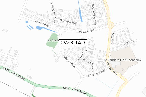
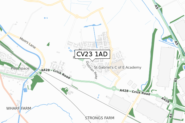
CV23 1AD is located in the Hillmorton electoral ward, within the local authority district of Rugby and the English Parliamentary constituency of Rugby. The Sub Integrated Care Board (ICB) Location is NHS Coventry and Warwickshire ICB - B2M3M and the police force is Warwickshire. This postcode has been in use since March 2018.


GetTheData
Source: OS Open Zoomstack (Ordnance Survey)
Licence: Open Government Licence (requires attribution)
Attribution: Contains OS data © Crown copyright and database right 2025
Source: Open Postcode Geo
Licence: Open Government Licence (requires attribution)
Attribution: Contains OS data © Crown copyright and database right 2025; Contains Royal Mail data © Royal Mail copyright and database right 2025; Source: Office for National Statistics licensed under the Open Government Licence v.3.0
| Easting | 455385 |
| Northing | 273661 |
| Latitude | 52.358236 |
| Longitude | -1.188152 |
GetTheData
Source: Open Postcode Geo
Licence: Open Government Licence
| Country | England |
| Postcode District | CV23 |
➜ See where CV23 is on a map ➜ Where is Rugby? | |
GetTheData
Source: Land Registry Price Paid Data
Licence: Open Government Licence
| Ward | Hillmorton |
| Constituency | Rugby |
GetTheData
Source: ONS Postcode Database
Licence: Open Government Licence
2025 31 JAN £476,000 |
2023 10 JAN £490,000 |
2021 28 JUN £577,700 |
2021 26 FEB £419,995 |
17, FAULKNER ROAD, HOULTON, RUGBY, CV23 1AD 2021 15 JAN £564,995 |
33, FAULKNER ROAD, HOULTON, RUGBY, CV23 1AD 2020 18 DEC £549,995 |
27, FAULKNER ROAD, HOULTON, RUGBY, CV23 1AD 2020 11 DEC £559,995 |
19, FAULKNER ROAD, HOULTON, RUGBY, CV23 1AD 2020 11 DEC £399,995 |
21, FAULKNER ROAD, HOULTON, RUGBY, CV23 1AD 2020 11 DEC £329,995 |
23, FAULKNER ROAD, HOULTON, RUGBY, CV23 1AD 2020 11 DEC £284,995 |
GetTheData
Source: HM Land Registry Price Paid Data
Licence: Contains HM Land Registry data © Crown copyright and database right 2025. This data is licensed under the Open Government Licence v3.0.
| Lennon Close (Crick Road) | Hillmorton | 943m |
| Lennon Close (Crick Road) | Hillmorton | 954m |
| Danes Way Roundabout (Private Road Off A5) | Dirft | 1,099m |
| Halfway House Ph (Watling Street) | Dirft | 1,235m |
| Halfway House Ph (Watling Street) | Dirft | 1,247m |
| Rugby Station | 4.8km |
GetTheData
Source: NaPTAN
Licence: Open Government Licence
| Percentage of properties with Next Generation Access | 100.0% |
| Percentage of properties with Superfast Broadband | 100.0% |
| Percentage of properties with Ultrafast Broadband | 100.0% |
| Percentage of properties with Full Fibre Broadband | 100.0% |
Superfast Broadband is between 30Mbps and 300Mbps
Ultrafast Broadband is > 300Mbps
| Percentage of properties unable to receive 2Mbps | 0.0% |
| Percentage of properties unable to receive 5Mbps | 0.0% |
| Percentage of properties unable to receive 10Mbps | 0.0% |
| Percentage of properties unable to receive 30Mbps | 0.0% |
GetTheData
Source: Ofcom
Licence: Ofcom Terms of Use (requires attribution)
GetTheData
Source: ONS Postcode Database
Licence: Open Government Licence


➜ Get more ratings from the Food Standards Agency
GetTheData
Source: Food Standards Agency
Licence: FSA terms & conditions
| Last Collection | |||
|---|---|---|---|
| Location | Mon-Fri | Sat | Distance |
| Lennon Close | 16:45 | 11:30 | 928m |
| Lower Street | 16:30 | 11:30 | 1,664m |
| Watts Lane | 16:30 | 11:45 | 1,718m |
GetTheData
Source: Dracos
Licence: Creative Commons Attribution-ShareAlike
The below table lists the International Territorial Level (ITL) codes (formerly Nomenclature of Territorial Units for Statistics (NUTS) codes) and Local Administrative Units (LAU) codes for CV23 1AD:
| ITL 1 Code | Name |
|---|---|
| TLG | West Midlands (England) |
| ITL 2 Code | Name |
| TLG1 | Herefordshire, Worcestershire and Warwickshire |
| ITL 3 Code | Name |
| TLG13 | Warwickshire CC |
| LAU 1 Code | Name |
| E07000220 | Rugby |
GetTheData
Source: ONS Postcode Directory
Licence: Open Government Licence
The below table lists the Census Output Area (OA), Lower Layer Super Output Area (LSOA), and Middle Layer Super Output Area (MSOA) for CV23 1AD:
| Code | Name | |
|---|---|---|
| OA | E00158669 | |
| LSOA | E01032892 | Rugby 001G |
| MSOA | E02006492 | Rugby 001 |
GetTheData
Source: ONS Postcode Directory
Licence: Open Government Licence
| CV23 0AB | Crick Road | 545m |
| CV23 0AF | Moors Lane | 676m |
| CV21 4DT | Lennon Close | 878m |
| CV21 4DS | Lennon Close | 947m |
| CV21 4DR | Leys Road | 1017m |
| CV21 4DZ | Crick Road | 1056m |
| CV21 4DY | Crick Road | 1081m |
| CV21 4DP | Eastwood Grove | 1123m |
| CV21 4PN | Kilsby Lane | 1178m |
| CV21 4BY | Myers Road | 1319m |
GetTheData
Source: Open Postcode Geo; Land Registry Price Paid Data
Licence: Open Government Licence