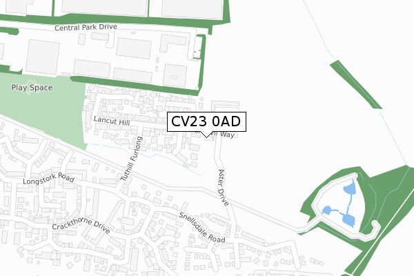
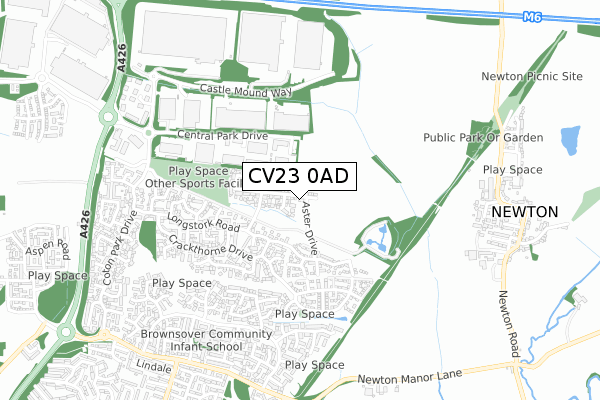
CV23 0AD is located in the Clifton, Newton and Churchover electoral ward, within the local authority district of Rugby and the English Parliamentary constituency of Rugby. The Sub Integrated Care Board (ICB) Location is NHS Coventry and Warwickshire ICB - B2M3M and the police force is Warwickshire. This postcode has been in use since April 2020.


GetTheData
Source: OS Open Zoomstack (Ordnance Survey)
Licence: Open Government Licence (requires attribution)
Attribution: Contains OS data © Crown copyright and database right 2025
Source: Open Postcode Geo
Licence: Open Government Licence (requires attribution)
Attribution: Contains OS data © Crown copyright and database right 2025; Contains Royal Mail data © Royal Mail copyright and database right 2025; Source: Office for National Statistics licensed under the Open Government Licence v.3.0
| Easting | 452281 |
| Northing | 278261 |
| Latitude | 52.399891 |
| Longitude | -1.233011 |
GetTheData
Source: Open Postcode Geo
Licence: Open Government Licence
| Country | England |
| Postcode District | CV23 |
➜ See where CV23 is on a map ➜ Where is Rugby? | |
GetTheData
Source: Land Registry Price Paid Data
Licence: Open Government Licence
| Ward | Clifton, Newton And Churchover |
| Constituency | Rugby |
GetTheData
Source: ONS Postcode Database
Licence: Open Government Licence
46, CHERVIL WAY, RUGBY, CV23 0AD 2023 22 NOV £340,000 |
27, CHERVIL WAY, RUGBY, CV23 0AD 2022 21 DEC £370,000 |
28, CHERVIL WAY, RUGBY, CV23 0AD 2022 21 DEC £360,000 |
17, CHERVIL WAY, RUGBY, CV23 0AD 2022 20 DEC £330,000 |
44, CHERVIL WAY, RUGBY, CV23 0AD 2022 19 DEC £345,000 |
29, CHERVIL WAY, RUGBY, CV23 0AD 2022 16 DEC £360,000 |
15, CHERVIL WAY, RUGBY, CV23 0AD 2022 30 NOV £330,000 |
26, CHERVIL WAY, RUGBY, CV23 0AD 2022 30 SEP £363,500 |
7, CHERVIL WAY, RUGBY, CV23 0AD 2020 29 OCT £290,000 |
16, CHERVIL WAY, RUGBY, CV23 0AD 2020 23 OCT £295,000 |
GetTheData
Source: HM Land Registry Price Paid Data
Licence: Contains HM Land Registry data © Crown copyright and database right 2025. This data is licensed under the Open Government Licence v3.0.
| Harebell Way (Campion Way) | Brownsover | 650m |
| Gentian Way (Campion Way) | Brownsover | 652m |
| Sorrel Drive (Campion Way) | Brownsover | 730m |
| Newton Lane (The Leys) | Newton | 749m |
| Avocet Close (Coton Park Drive) | Rugby | 810m |
| Rugby Station | 2.6km |
GetTheData
Source: NaPTAN
Licence: Open Government Licence
GetTheData
Source: ONS Postcode Database
Licence: Open Government Licence

➜ Get more ratings from the Food Standards Agency
GetTheData
Source: Food Standards Agency
Licence: FSA terms & conditions
| Last Collection | |||
|---|---|---|---|
| Location | Mon-Fri | Sat | Distance |
| Campion Way | 16:45 | 12:30 | 828m |
| The Local Centre | 16:00 | 11:00 | 842m |
| Hollowell Way | 17:00 | 12:00 | 1,474m |
GetTheData
Source: Dracos
Licence: Creative Commons Attribution-ShareAlike
The below table lists the International Territorial Level (ITL) codes (formerly Nomenclature of Territorial Units for Statistics (NUTS) codes) and Local Administrative Units (LAU) codes for CV23 0AD:
| ITL 1 Code | Name |
|---|---|
| TLG | West Midlands (England) |
| ITL 2 Code | Name |
| TLG1 | Herefordshire, Worcestershire and Warwickshire |
| ITL 3 Code | Name |
| TLG13 | Warwickshire CC |
| LAU 1 Code | Name |
| E07000220 | Rugby |
GetTheData
Source: ONS Postcode Directory
Licence: Open Government Licence
The below table lists the Census Output Area (OA), Lower Layer Super Output Area (LSOA), and Middle Layer Super Output Area (MSOA) for CV23 0AD:
| Code | Name | |
|---|---|---|
| OA | E00168309 | |
| LSOA | E01032892 | Rugby 001G |
| MSOA | E02006492 | Rugby 001 |
GetTheData
Source: ONS Postcode Directory
Licence: Open Government Licence
| CV23 0JS | Long Hassocks | 179m |
| CV23 0GN | Snellsdale Road | 255m |
| CV23 0GH | Tuthill Furlong | 316m |
| CV23 0JR | Lancut Hill | 340m |
| CV23 0FA | Avens Close | 350m |
| CV23 0JG | Langlands Place | 363m |
| CV23 0JF | Smithhill Place | 371m |
| CV23 0FL | Vetch Walk | 373m |
| CV23 0FH | Fennel Close | 374m |
| CV23 0FD | Bugle Close | 378m |
GetTheData
Source: Open Postcode Geo; Land Registry Price Paid Data
Licence: Open Government Licence