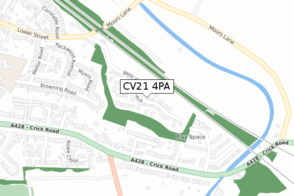
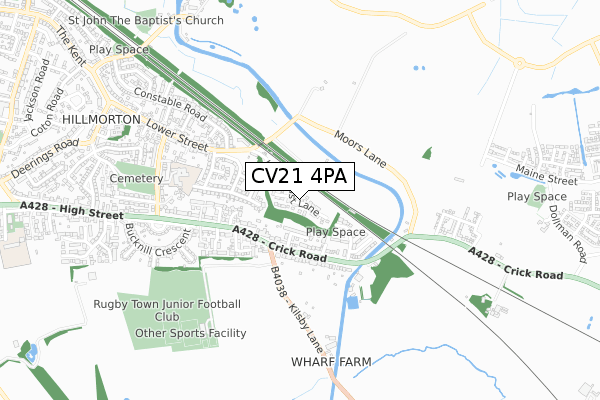
CV21 4PA is located in the Hillmorton electoral ward, within the local authority district of Rugby and the English Parliamentary constituency of Rugby. The Sub Integrated Care Board (ICB) Location is NHS Coventry and Warwickshire ICB - B2M3M and the police force is Warwickshire. This postcode has been in use since April 2018.


GetTheData
Source: OS Open Zoomstack (Ordnance Survey)
Licence: Open Government Licence (requires attribution)
Attribution: Contains OS data © Crown copyright and database right 2025
Source: Open Postcode Geo
Licence: Open Government Licence (requires attribution)
Attribution: Contains OS data © Crown copyright and database right 2025; Contains Royal Mail data © Royal Mail copyright and database right 2025; Source: Office for National Statistics licensed under the Open Government Licence v.3.0
| Easting | 454283 |
| Northing | 273680 |
| Latitude | 52.358517 |
| Longitude | -1.204329 |
GetTheData
Source: Open Postcode Geo
Licence: Open Government Licence
| Country | England |
| Postcode District | CV21 |
➜ See where CV21 is on a map ➜ Where is Rugby? | |
GetTheData
Source: Land Registry Price Paid Data
Licence: Open Government Licence
| Ward | Hillmorton |
| Constituency | Rugby |
GetTheData
Source: ONS Postcode Database
Licence: Open Government Licence
2024 19 DEC £314,000 |
2022 30 NOV £415,000 |
10, WEST COAST LANE, RUGBY, CV21 4PA 2020 25 SEP £400,000 |
6, WEST COAST LANE, RUGBY, CV21 4PA 2020 16 SEP £355,000 |
8, WEST COAST LANE, RUGBY, CV21 4PA 2020 20 AUG £363,000 |
2020 31 JUL £355,000 |
33, WEST COAST LANE, RUGBY, CV21 4PA 2020 27 JUL £353,000 |
50, WEST COAST LANE, RUGBY, CV21 4PA 2020 16 JUL £353,000 |
19, WEST COAST LANE, RUGBY, CV21 4PA 2020 6 JUL £340,000 |
37, WEST COAST LANE, RUGBY, CV21 4PA 2020 18 JUN £347,500 |
GetTheData
Source: HM Land Registry Price Paid Data
Licence: Contains HM Land Registry data © Crown copyright and database right 2025. This data is licensed under the Open Government Licence v3.0.
| Kilsby Lane (High Street) | Hillmorton | 240m |
| Kilsby Lane (High Street) | Hillmorton | 257m |
| Lennon Close (Crick Road) | Hillmorton | 306m |
| Lennon Close (Crick Road) | Hillmorton | 333m |
| Landseer Close (Constable Road) | Hillmorton | 432m |
| Rugby Station | 3.9km |
GetTheData
Source: NaPTAN
Licence: Open Government Licence
| Percentage of properties with Next Generation Access | 100.0% |
| Percentage of properties with Superfast Broadband | 100.0% |
| Percentage of properties with Ultrafast Broadband | 97.6% |
| Percentage of properties with Full Fibre Broadband | 97.6% |
Superfast Broadband is between 30Mbps and 300Mbps
Ultrafast Broadband is > 300Mbps
| Median download speed | 360.0Mbps |
| Average download speed | 360.0Mbps |
| Maximum download speed | 360.00Mbps |
| Median upload speed | 360.0Mbps |
| Average upload speed | 360.0Mbps |
| Maximum upload speed | 360.00Mbps |
| Percentage of properties unable to receive 2Mbps | 0.0% |
| Percentage of properties unable to receive 5Mbps | 0.0% |
| Percentage of properties unable to receive 10Mbps | 0.0% |
| Percentage of properties unable to receive 30Mbps | 0.0% |
GetTheData
Source: Ofcom
Licence: Ofcom Terms of Use (requires attribution)
GetTheData
Source: ONS Postcode Database
Licence: Open Government Licence


➜ Get more ratings from the Food Standards Agency
GetTheData
Source: Food Standards Agency
Licence: FSA terms & conditions
| Last Collection | |||
|---|---|---|---|
| Location | Mon-Fri | Sat | Distance |
| Lennon Close | 16:45 | 11:30 | 321m |
| Lower Street | 16:30 | 11:30 | 602m |
| Watts Lane | 16:30 | 11:45 | 618m |
GetTheData
Source: Dracos
Licence: Creative Commons Attribution-ShareAlike
The below table lists the International Territorial Level (ITL) codes (formerly Nomenclature of Territorial Units for Statistics (NUTS) codes) and Local Administrative Units (LAU) codes for CV21 4PA:
| ITL 1 Code | Name |
|---|---|
| TLG | West Midlands (England) |
| ITL 2 Code | Name |
| TLG1 | Herefordshire, Worcestershire and Warwickshire |
| ITL 3 Code | Name |
| TLG13 | Warwickshire CC |
| LAU 1 Code | Name |
| E07000220 | Rugby |
GetTheData
Source: ONS Postcode Directory
Licence: Open Government Licence
The below table lists the Census Output Area (OA), Lower Layer Super Output Area (LSOA), and Middle Layer Super Output Area (MSOA) for CV21 4PA:
| Code | Name | |
|---|---|---|
| OA | E00158842 | |
| LSOA | E01031162 | Rugby 010B |
| MSOA | E02006501 | Rugby 010 |
GetTheData
Source: ONS Postcode Directory
Licence: Open Government Licence
| CV21 4DP | Eastwood Grove | 131m |
| CV21 4DR | Leys Road | 189m |
| CV21 4DZ | Crick Road | 208m |
| CV21 4BU | Browning Road | 222m |
| CV21 4BY | Myers Road | 225m |
| CV21 4DS | Lennon Close | 235m |
| CV21 4DY | Crick Road | 267m |
| CV21 4DW | Farthing Court | 278m |
| CV21 4DT | Lennon Close | 291m |
| CV21 4BZ | Packwood Avenue | 299m |
GetTheData
Source: Open Postcode Geo; Land Registry Price Paid Data
Licence: Open Government Licence