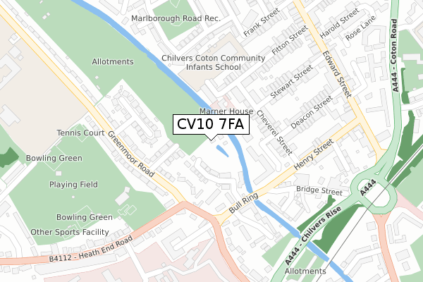
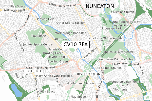
CV10 7FA is located in the Bar Pool electoral ward, within the local authority district of Nuneaton and Bedworth and the English Parliamentary constituency of Nuneaton. The Sub Integrated Care Board (ICB) Location is NHS Coventry and Warwickshire ICB - B2M3M and the police force is Warwickshire. This postcode has been in use since September 2018.


GetTheData
Source: OS Open Zoomstack (Ordnance Survey)
Licence: Open Government Licence (requires attribution)
Attribution: Contains OS data © Crown copyright and database right 2025
Source: Open Postcode Geo
Licence: Open Government Licence (requires attribution)
Attribution: Contains OS data © Crown copyright and database right 2025; Contains Royal Mail data © Royal Mail copyright and database right 2025; Source: Office for National Statistics licensed under the Open Government Licence v.3.0
| Easting | 435836 |
| Northing | 290935 |
| Latitude | 52.515146 |
| Longitude | -1.473346 |
GetTheData
Source: Open Postcode Geo
Licence: Open Government Licence
| Country | England |
| Postcode District | CV10 |
➜ See where CV10 is on a map ➜ Where is Nuneaton? | |
GetTheData
Source: Land Registry Price Paid Data
Licence: Open Government Licence
| Ward | Bar Pool |
| Constituency | Nuneaton |
GetTheData
Source: ONS Postcode Database
Licence: Open Government Licence
3, THE WATERWAY, NUNEATON, CV10 7FA 2020 25 SEP £230,000 |
5, THE WATERWAY, NUNEATON, CV10 7FA 2020 25 SEP £240,000 |
7, THE WATERWAY, NUNEATON, CV10 7FA 2020 17 JUL £245,000 |
9, THE WATERWAY, NUNEATON, CV10 7FA 2020 21 FEB £229,950 |
4, THE WATERWAY, NUNEATON, CV10 7FA 2018 23 OCT £249,950 |
2, THE WATERWAY, NUNEATON, CV10 7FA 2018 31 AUG £265,000 |
GetTheData
Source: HM Land Registry Price Paid Data
Licence: Contains HM Land Registry data © Crown copyright and database right 2025. This data is licensed under the Open Government Licence v3.0.
| Boot Inn (Bull Ring) | Nuneaton | 107m |
| Bull Ring (Greenmoor Road) | Nuneaton | 124m |
| Boot Inn (Bull Ring) | Nuneaton | 125m |
| Bull Ring (Greenmoor Road) | Nuneaton | 138m |
| Chevrel Street (Henry Street) | Nuneaton | 153m |
| Nuneaton Station | 1.4km |
| Bermuda Park Station | 1.5km |
| Bedworth Station | 4km |
GetTheData
Source: NaPTAN
Licence: Open Government Licence
| Percentage of properties with Next Generation Access | 100.0% |
| Percentage of properties with Superfast Broadband | 100.0% |
| Percentage of properties with Ultrafast Broadband | 75.0% |
| Percentage of properties with Full Fibre Broadband | 75.0% |
Superfast Broadband is between 30Mbps and 300Mbps
Ultrafast Broadband is > 300Mbps
| Percentage of properties unable to receive 2Mbps | 0.0% |
| Percentage of properties unable to receive 5Mbps | 0.0% |
| Percentage of properties unable to receive 10Mbps | 0.0% |
| Percentage of properties unable to receive 30Mbps | 0.0% |
GetTheData
Source: Ofcom
Licence: Ofcom Terms of Use (requires attribution)
GetTheData
Source: ONS Postcode Database
Licence: Open Government Licence


➜ Get more ratings from the Food Standards Agency
GetTheData
Source: Food Standards Agency
Licence: FSA terms & conditions
| Last Collection | |||
|---|---|---|---|
| Location | Mon-Fri | Sat | Distance |
| Greenmoor Road | 16:30 | 11:15 | 813m |
| Coventry Street | 17:30 | 11:45 | 874m |
| St Pauls Road | 17:15 | 11:35 | 953m |
GetTheData
Source: Dracos
Licence: Creative Commons Attribution-ShareAlike
The below table lists the International Territorial Level (ITL) codes (formerly Nomenclature of Territorial Units for Statistics (NUTS) codes) and Local Administrative Units (LAU) codes for CV10 7FA:
| ITL 1 Code | Name |
|---|---|
| TLG | West Midlands (England) |
| ITL 2 Code | Name |
| TLG1 | Herefordshire, Worcestershire and Warwickshire |
| ITL 3 Code | Name |
| TLG13 | Warwickshire CC |
| LAU 1 Code | Name |
| E07000219 | Nuneaton and Bedworth |
GetTheData
Source: ONS Postcode Directory
Licence: Open Government Licence
The below table lists the Census Output Area (OA), Lower Layer Super Output Area (LSOA), and Middle Layer Super Output Area (MSOA) for CV10 7FA:
| Code | Name | |
|---|---|---|
| OA | E00158353 | |
| LSOA | E01031059 | Nuneaton and Bedworth 006C |
| MSOA | E02006480 | Nuneaton and Bedworth 006 |
GetTheData
Source: ONS Postcode Directory
Licence: Open Government Licence
| CV10 7BE | Bull Ring | 88m |
| CV10 7EU | Milford Street | 135m |
| CV10 7BB | Bull Ring | 147m |
| CV11 5SE | Cheverel Street | 150m |
| CV10 7BH | Bull Ring | 155m |
| CV11 5SB | Cheverel Street | 158m |
| CV11 5SD | Cheverel Street | 159m |
| CV11 5RZ | Fitton Street | 189m |
| CV10 7EW | Greenmoor Road | 192m |
| CV10 7BY | Bull Ring | 209m |
GetTheData
Source: Open Postcode Geo; Land Registry Price Paid Data
Licence: Open Government Licence