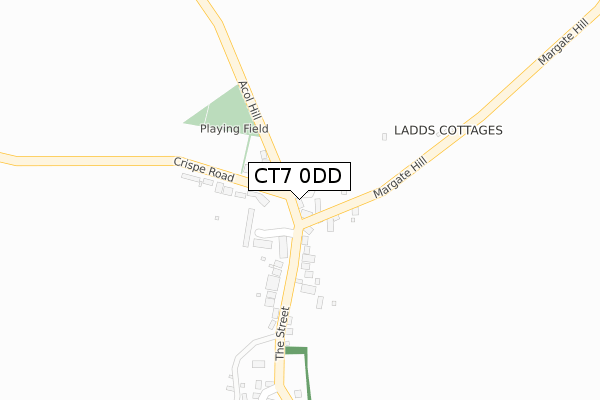
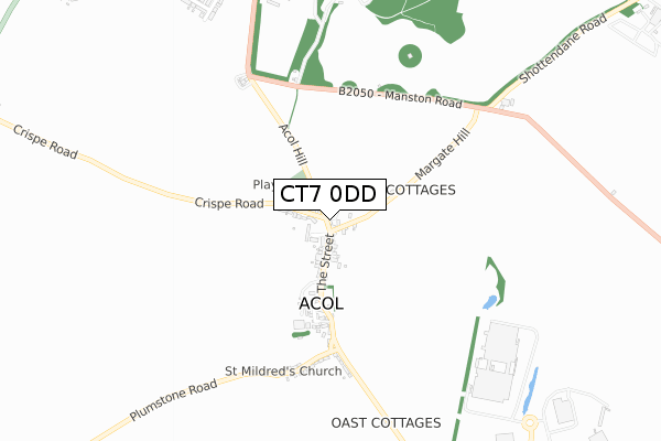
CT7 0DD is located in the Thanet Villages electoral ward, within the local authority district of Thanet and the English Parliamentary constituency of North Thanet. The Sub Integrated Care Board (ICB) Location is NHS Kent and Medway ICB - 91Q and the police force is Kent. This postcode has been in use since August 2019.


GetTheData
Source: OS Open Zoomstack (Ordnance Survey)
Licence: Open Government Licence (requires attribution)
Attribution: Contains OS data © Crown copyright and database right 2025
Source: Open Postcode Geo
Licence: Open Government Licence (requires attribution)
Attribution: Contains OS data © Crown copyright and database right 2025; Contains Royal Mail data © Royal Mail copyright and database right 2025; Source: Office for National Statistics licensed under the Open Government Licence v.3.0
| Easting | 630784 |
| Northing | 167413 |
| Latitude | 51.358887 |
| Longitude | 1.313530 |
GetTheData
Source: Open Postcode Geo
Licence: Open Government Licence
| Country | England |
| Postcode District | CT7 |
➜ See where CT7 is on a map ➜ Where is Acol? | |
GetTheData
Source: Land Registry Price Paid Data
Licence: Open Government Licence
| Ward | Thanet Villages |
| Constituency | North Thanet |
GetTheData
Source: ONS Postcode Database
Licence: Open Government Licence
| Nursery Fields (The Street) | Acol | 107m |
| Nursery Fields (The Street) | Acol | 111m |
| King Edward Road (Brunswick Road) | Birchington-on-sea | 927m |
| King Edward Road | Birchington-on-sea | 946m |
| Quex Park (Park Lane) | Birchington-on-sea | 947m |
| Birchington-on-Sea Station | 2.2km |
| Westgate-on-Sea Station | 3.1km |
| Minster Station | 3.3km |
GetTheData
Source: NaPTAN
Licence: Open Government Licence
GetTheData
Source: ONS Postcode Database
Licence: Open Government Licence


➜ Get more ratings from the Food Standards Agency
GetTheData
Source: Food Standards Agency
Licence: FSA terms & conditions
| Last Collection | |||
|---|---|---|---|
| Location | Mon-Fri | Sat | Distance |
| Acol Old Post Office | 16:15 | 10:45 | 179m |
| Brunswick Road | 16:00 | 11:15 | 947m |
| Linington Road | 16:00 | 11:15 | 1,473m |
GetTheData
Source: Dracos
Licence: Creative Commons Attribution-ShareAlike
The below table lists the International Territorial Level (ITL) codes (formerly Nomenclature of Territorial Units for Statistics (NUTS) codes) and Local Administrative Units (LAU) codes for CT7 0DD:
| ITL 1 Code | Name |
|---|---|
| TLJ | South East (England) |
| ITL 2 Code | Name |
| TLJ4 | Kent |
| ITL 3 Code | Name |
| TLJ44 | East Kent |
| LAU 1 Code | Name |
| E07000114 | Thanet |
GetTheData
Source: ONS Postcode Directory
Licence: Open Government Licence
The below table lists the Census Output Area (OA), Lower Layer Super Output Area (LSOA), and Middle Layer Super Output Area (MSOA) for CT7 0DD:
| Code | Name | |
|---|---|---|
| OA | E00125381 | |
| LSOA | E01024701 | Thanet 014A |
| MSOA | E02005145 | Thanet 014 |
GetTheData
Source: ONS Postcode Directory
Licence: Open Government Licence
| CT7 0HX | Margate Hill | 25m |
| CT7 0JG | Crispe Road | 81m |
| CT7 0HT | Park View | 93m |
| CT7 0JF | Nursery Fields | 97m |
| CT7 0JE | Acol Hill | 103m |
| CT7 0JQ | Summerfold Villas | 158m |
| CT7 0JA | The Street | 196m |
| CT7 0HW | Dilnot Lane | 368m |
| CT7 0JD | Plumstone Road | 565m |
| CT12 4BB | Minster Road | 782m |
GetTheData
Source: Open Postcode Geo; Land Registry Price Paid Data
Licence: Open Government Licence