Property/Postcode Data Search:
CT1 3ZD maps, stats, and open data
CT1 3ZD is located in the Wincheap electoral ward, within the local authority district of Canterbury and the English Parliamentary constituency of Canterbury. The Sub Integrated Care Board (ICB) Location is NHS Kent and Medway ICB - 91Q and the police force is Kent. This postcode has been in use since September 2017.
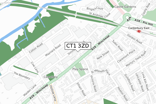
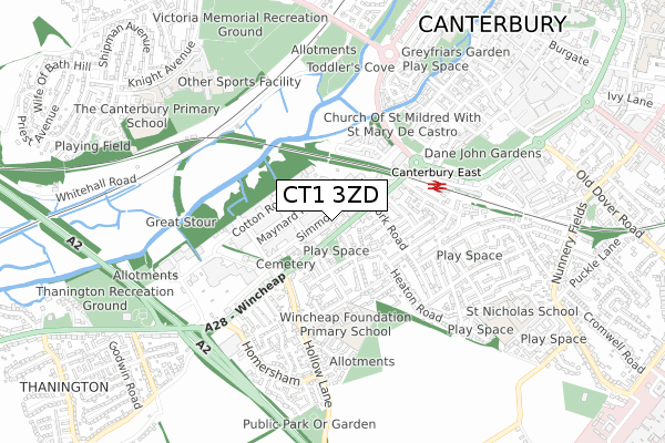
CT1 3ZD maps


Source: OS Open Zoomstack (Ordnance Survey)
Licence: Open Government Licence (requires attribution)
Attribution: Contains OS data © Crown copyright and database right 2025
Source: Open Postcode Geo
Licence: Open Government Licence (requires attribution)
Attribution: Contains OS data © Crown copyright and database right 2025; Contains Royal Mail data © Royal Mail copyright and database right 2025; Source: Office for National Statistics licensed under the Open Government Licence v.3.0
Licence: Open Government Licence (requires attribution)
Attribution: Contains OS data © Crown copyright and database right 2025
Source: Open Postcode Geo
Licence: Open Government Licence (requires attribution)
Attribution: Contains OS data © Crown copyright and database right 2025; Contains Royal Mail data © Royal Mail copyright and database right 2025; Source: Office for National Statistics licensed under the Open Government Licence v.3.0
CT1 3ZD geodata
| Easting | 614221 |
| Northing | 157150 |
| Latitude | 51.273218 |
| Longitude | 1.069848 |
Where is CT1 3ZD?
| Country | England |
| Postcode District | CT1 |
Politics
| Ward | Wincheap |
|---|---|
| Constituency | Canterbury |
Transport
Nearest bus stops to CT1 3ZD
| York Road (Wincheap) | Wincheap | 125m |
| Hollow Lane (Wincheap) | Wincheap | 133m |
| York Road (Wincheap) | Wincheap | 155m |
| Hollowmede (Elham Road) | Wincheap | 278m |
| Hollow Lane (Wincheap) | Wincheap | 327m |
Nearest railway stations to CT1 3ZD
| Canterbury East Station | 0.4km |
| Canterbury West Station | 1.3km |
| Chartham Station | 4km |
Deprivation
38% of English postcodes are less deprived than CT1 3ZD:Food Standards Agency
Three nearest food hygiene ratings to CT1 3ZD (metres)
Canterbury Hotel

140 Wincheap
55m
The Wincheap B&B

94 Wincheap
68m
Big Boys Pizza

79 Wincheap
75m
➜ Get more ratings from the Food Standards Agency
Nearest post box to CT1 3ZD
| Last Collection | |||
|---|---|---|---|
| Location | Mon-Fri | Sat | Distance |
| Wincheap Post Office | 18:00 | 12:00 | 92m |
| Maynard Road | 18:30 | 12:00 | 143m |
| Wincheap Ind Estate Meter Box | 18:30 | 12:00 | 144m |
CT1 3ZD ITL and CT1 3ZD LAU
The below table lists the International Territorial Level (ITL) codes (formerly Nomenclature of Territorial Units for Statistics (NUTS) codes) and Local Administrative Units (LAU) codes for CT1 3ZD:
| ITL 1 Code | Name |
|---|---|
| TLJ | South East (England) |
| ITL 2 Code | Name |
| TLJ4 | Kent |
| ITL 3 Code | Name |
| TLJ44 | East Kent |
| LAU 1 Code | Name |
| E07000106 | Canterbury |
CT1 3ZD census areas
The below table lists the Census Output Area (OA), Lower Layer Super Output Area (LSOA), and Middle Layer Super Output Area (MSOA) for CT1 3ZD:
| Code | Name | |
|---|---|---|
| OA | E00122499 | |
| LSOA | E01024129 | Canterbury 019B |
| MSOA | E02006855 | Canterbury 019 |
Nearest postcodes to CT1 3ZD
| CT1 3RY | Wincheap | 104m |
| CT1 3RS | Wincheap | 107m |
| CT1 3RH | Maynard Road | 111m |
| CT1 3SG | Victoria Road | 119m |
| CT1 3RX | Wincheap | 119m |
| CT1 3SF | Seymour Place | 150m |
| CT1 3SS | New Street | 153m |
| CT1 3SE | Wincheap | 162m |
| CT1 3SJ | Cogans Terrace | 177m |
| CT1 3TA | York Road | 187m |