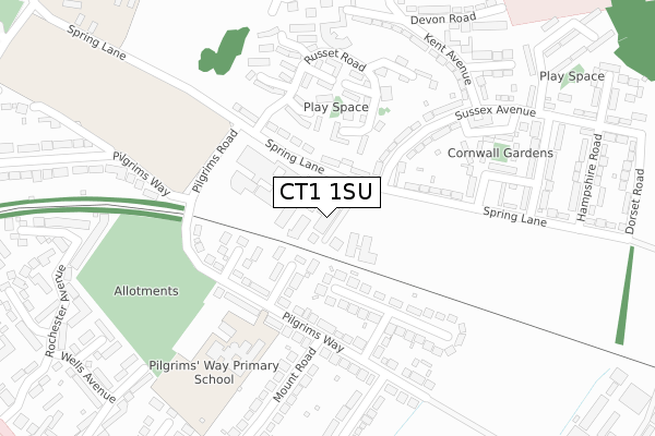
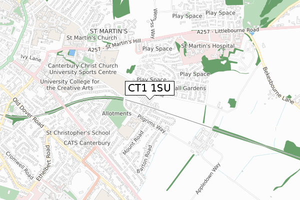
CT1 1SU is located in the Barton electoral ward, within the local authority district of Canterbury and the English Parliamentary constituency of Canterbury. The Sub Integrated Care Board (ICB) Location is NHS Kent and Medway ICB - 91Q and the police force is Kent. This postcode has been in use since May 2018.


GetTheData
Source: OS Open Zoomstack (Ordnance Survey)
Licence: Open Government Licence (requires attribution)
Attribution: Contains OS data © Crown copyright and database right 2025
Source: Open Postcode Geo
Licence: Open Government Licence (requires attribution)
Attribution: Contains OS data © Crown copyright and database right 2025; Contains Royal Mail data © Royal Mail copyright and database right 2025; Source: Office for National Statistics licensed under the Open Government Licence v.3.0
| Easting | 616290 |
| Northing | 157296 |
| Latitude | 51.273748 |
| Longitude | 1.099552 |
GetTheData
Source: Open Postcode Geo
Licence: Open Government Licence
| Country | England |
| Postcode District | CT1 |
➜ See where CT1 is on a map ➜ Where is Canterbury? | |
GetTheData
Source: Land Registry Price Paid Data
Licence: Open Government Licence
| Ward | Barton |
| Constituency | Canterbury |
GetTheData
Source: ONS Postcode Database
Licence: Open Government Licence
| Russet Road (Spring Lane) | Spring Lane Estate | 41m |
| Russet Road (Spring Lane) | Spring Lane Estate | 70m |
| Sussex Avenue | Spring Lane Estate | 146m |
| Pilgrim's Way School (Pilgrim's Way) | Barton Estate | 193m |
| Surrey Road (Spring Lane) | Spring Lane Estate | 300m |
| Canterbury East Station | 1.6km |
| Canterbury West Station | 2.1km |
| Bekesbourne Station | 2.9km |
GetTheData
Source: NaPTAN
Licence: Open Government Licence
GetTheData
Source: ONS Postcode Database
Licence: Open Government Licence


➜ Get more ratings from the Food Standards Agency
GetTheData
Source: Food Standards Agency
Licence: FSA terms & conditions
| Last Collection | |||
|---|---|---|---|
| Location | Mon-Fri | Sat | Distance |
| Collard House | 18:00 | 12:00 | 233m |
| Pilgrims Way | 17:45 | 12:00 | 297m |
| Kent Avenue | 18:00 | 12:00 | 313m |
GetTheData
Source: Dracos
Licence: Creative Commons Attribution-ShareAlike
The below table lists the International Territorial Level (ITL) codes (formerly Nomenclature of Territorial Units for Statistics (NUTS) codes) and Local Administrative Units (LAU) codes for CT1 1SU:
| ITL 1 Code | Name |
|---|---|
| TLJ | South East (England) |
| ITL 2 Code | Name |
| TLJ4 | Kent |
| ITL 3 Code | Name |
| TLJ44 | East Kent |
| LAU 1 Code | Name |
| E07000106 | Canterbury |
GetTheData
Source: ONS Postcode Directory
Licence: Open Government Licence
The below table lists the Census Output Area (OA), Lower Layer Super Output Area (LSOA), and Middle Layer Super Output Area (MSOA) for CT1 1SU:
| Code | Name | |
|---|---|---|
| OA | E00122078 | |
| LSOA | E01024045 | Canterbury 016B |
| MSOA | E02005025 | Canterbury 016 |
GetTheData
Source: ONS Postcode Directory
Licence: Open Government Licence
| CT1 1SW | Spring Lane | 71m |
| CT1 1XN | Byron Close | 103m |
| CT1 1FA | Winston Close | 109m |
| CT1 1XW | Dryden Close | 132m |
| CT1 1SP | Spring Lane | 146m |
| CT1 1FB | Sturmer Close | 166m |
| CT1 1XU | Pilgrims Way | 176m |
| CT1 1FD | Lambourne Walk | 201m |
| CT1 1SN | Spring Lane | 223m |
| CT1 1RT | Sussex Avenue | 228m |
GetTheData
Source: Open Postcode Geo; Land Registry Price Paid Data
Licence: Open Government Licence