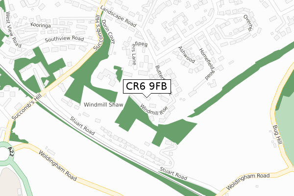
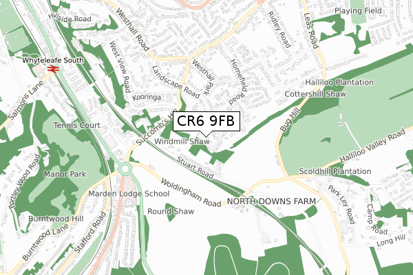
CR6 9FB is located in the Warlingham West electoral ward, within the local authority district of Tandridge and the English Parliamentary constituency of East Surrey. The Sub Integrated Care Board (ICB) Location is NHS Surrey Heartlands ICB - 92A and the police force is Surrey. This postcode has been in use since October 2017.


GetTheData
Source: OS Open Zoomstack (Ordnance Survey)
Licence: Open Government Licence (requires attribution)
Attribution: Contains OS data © Crown copyright and database right 2025
Source: Open Postcode Geo
Licence: Open Government Licence (requires attribution)
Attribution: Contains OS data © Crown copyright and database right 2025; Contains Royal Mail data © Royal Mail copyright and database right 2025; Source: Office for National Statistics licensed under the Open Government Licence v.3.0
| Easting | 535115 |
| Northing | 157324 |
| Latitude | 51.299014 |
| Longitude | -0.063302 |
GetTheData
Source: Open Postcode Geo
Licence: Open Government Licence
| Country | England |
| Postcode District | CR6 |
➜ See where CR6 is on a map ➜ Where is Warlingham? | |
GetTheData
Source: Land Registry Price Paid Data
Licence: Open Government Licence
| Ward | Warlingham West |
| Constituency | East Surrey |
GetTheData
Source: ONS Postcode Database
Licence: Open Government Licence
4, WINDMILL RISE, WARLINGHAM, CR6 9FB 2020 19 AUG £1,700,000 |
8, WINDMILL RISE, WARLINGHAM, CR6 9FB 2020 24 JUL £1,715,000 |
5, WINDMILL RISE, WARLINGHAM, CR6 9FB 2019 22 NOV £1,470,000 |
3, WINDMILL RISE, WARLINGHAM, CR6 9FB 2019 26 SEP £1,620,000 |
7, WINDMILL RISE, WARLINGHAM, CR6 9FB 2019 31 JUL £1,800,000 |
6, WINDMILL RISE, WARLINGHAM, CR6 9FB 2019 30 JUL £1,800,000 |
2, WINDMILL RISE, WARLINGHAM, CR6 9FB 2019 4 MAR £1,600,000 |
1, WINDMILL RISE, WARLINGHAM, CR6 9FB 2018 14 DEC £1,590,000 |
GetTheData
Source: HM Land Registry Price Paid Data
Licence: Contains HM Land Registry data © Crown copyright and database right 2025. This data is licensed under the Open Government Licence v3.0.
| Stuart Road (Woldingham Road) | Woldingham Garden Village | 376m |
| Stuart Road (Woldingham Road) | Woldingham Garden Village | 381m |
| Clovelly Avenue (Westhall Road) | Warlingham | 550m |
| Clovelly Avenue (Westhall Road) | Warlingham | 556m |
| Bug Hill (Woldingham Road) | Woldingham Garden Village | 569m |
| Whyteleafe South Station | 1.1km |
| Woldingham Station | 1.3km |
| Upper Warlingham Station | 1.5km |
GetTheData
Source: NaPTAN
Licence: Open Government Licence
| Percentage of properties with Next Generation Access | 100.0% |
| Percentage of properties with Superfast Broadband | 100.0% |
| Percentage of properties with Ultrafast Broadband | 0.0% |
| Percentage of properties with Full Fibre Broadband | 0.0% |
Superfast Broadband is between 30Mbps and 300Mbps
Ultrafast Broadband is > 300Mbps
| Percentage of properties unable to receive 2Mbps | 0.0% |
| Percentage of properties unable to receive 5Mbps | 0.0% |
| Percentage of properties unable to receive 10Mbps | 0.0% |
| Percentage of properties unable to receive 30Mbps | 0.0% |
GetTheData
Source: Ofcom
Licence: Ofcom Terms of Use (requires attribution)
GetTheData
Source: ONS Postcode Database
Licence: Open Government Licence


➜ Get more ratings from the Food Standards Agency
GetTheData
Source: Food Standards Agency
Licence: FSA terms & conditions
| Last Collection | |||
|---|---|---|---|
| Location | Mon-Fri | Sat | Distance |
| Succombes Hill(Tall Timbers) | 16:00 | 12:00 | 351m |
| 359 Croydon Road | 19:15 | 12:00 | 778m |
| Whyteleafe South Station | 17:30 | 12:00 | 1,034m |
GetTheData
Source: Dracos
Licence: Creative Commons Attribution-ShareAlike
The below table lists the International Territorial Level (ITL) codes (formerly Nomenclature of Territorial Units for Statistics (NUTS) codes) and Local Administrative Units (LAU) codes for CR6 9FB:
| ITL 1 Code | Name |
|---|---|
| TLJ | South East (England) |
| ITL 2 Code | Name |
| TLJ2 | Surrey, East and West Sussex |
| ITL 3 Code | Name |
| TLJ26 | East Surrey |
| LAU 1 Code | Name |
| E07000215 | Tandridge |
GetTheData
Source: ONS Postcode Directory
Licence: Open Government Licence
The below table lists the Census Output Area (OA), Lower Layer Super Output Area (LSOA), and Middle Layer Super Output Area (MSOA) for CR6 9FB:
| Code | Name | |
|---|---|---|
| OA | E00157324 | |
| LSOA | E01030855 | Tandridge 002A |
| MSOA | E02006429 | Tandridge 002 |
GetTheData
Source: ONS Postcode Directory
Licence: Open Government Licence
| CR6 9JA | Butterfly Walk | 71m |
| CR6 9JH | Stuart Road | 157m |
| CR6 9JX | Badgers Lane | 168m |
| CR6 9JT | Dorin Court | 183m |
| CR6 9HT | Ashwood | 220m |
| CR6 9JS | Burfield Drive | 271m |
| CR6 9HQ | Homefield Road | 287m |
| CR6 9HX | Broadlands Drive | 361m |
| CR6 9JQ | Succombs Place | 362m |
| CR6 9JR | Overhill | 385m |
GetTheData
Source: Open Postcode Geo; Land Registry Price Paid Data
Licence: Open Government Licence