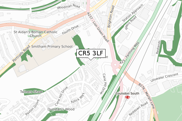
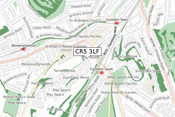
CR5 3LF is located in the Coulsdon Town electoral ward, within the London borough of Croydon and the English Parliamentary constituency of Croydon South. The Sub Integrated Care Board (ICB) Location is NHS South West London ICB - 36L and the police force is Metropolitan Police. This postcode has been in use since December 2018.


GetTheData
Source: OS Open Zoomstack (Ordnance Survey)
Licence: Open Government Licence (requires attribution)
Attribution: Contains OS data © Crown copyright and database right 2025
Source: Open Postcode Geo
Licence: Open Government Licence (requires attribution)
Attribution: Contains OS data © Crown copyright and database right 2025; Contains Royal Mail data © Royal Mail copyright and database right 2025; Source: Office for National Statistics licensed under the Open Government Licence v.3.0
| Easting | 529673 |
| Northing | 159254 |
| Latitude | 51.317623 |
| Longitude | -0.140616 |
GetTheData
Source: Open Postcode Geo
Licence: Open Government Licence
| Country | England |
| Postcode District | CR5 |
➜ See where CR5 is on a map ➜ Where is Coulsdon? | |
GetTheData
Source: Land Registry Price Paid Data
Licence: Open Government Licence
| Ward | Coulsdon Town |
| Constituency | Croydon South |
GetTheData
Source: ONS Postcode Database
Licence: Open Government Licence
| Lion Green Road (Brighton Road) | Coulsdon | 140m |
| Coulsdon Library (Brighton Road) | Coulsdon | 166m |
| Coulsdon Library (Brighton Road) | Coulsdon | 248m |
| Coulsdon South | Coulsdon South | 250m |
| Portnalls Road | Coulsdon | 256m |
| Coulsdon South Station | 0.3km |
| Coulsdon Town Station | 0.7km |
| Woodmansterne Station | 1km |
GetTheData
Source: NaPTAN
Licence: Open Government Licence
| Percentage of properties with Next Generation Access | 100.0% |
| Percentage of properties with Superfast Broadband | 100.0% |
| Percentage of properties with Ultrafast Broadband | 100.0% |
| Percentage of properties with Full Fibre Broadband | 100.0% |
Superfast Broadband is between 30Mbps and 300Mbps
Ultrafast Broadband is > 300Mbps
| Percentage of properties unable to receive 2Mbps | 0.0% |
| Percentage of properties unable to receive 5Mbps | 0.0% |
| Percentage of properties unable to receive 10Mbps | 0.0% |
| Percentage of properties unable to receive 30Mbps | 0.0% |
GetTheData
Source: Ofcom
Licence: Ofcom Terms of Use (requires attribution)
GetTheData
Source: ONS Postcode Database
Licence: Open Government Licence


➜ Get more ratings from the Food Standards Agency
GetTheData
Source: Food Standards Agency
Licence: FSA terms & conditions
| Last Collection | |||
|---|---|---|---|
| Location | Mon-Fri | Sat | Distance |
| Portnalls Road(50) | 17:00 | 12:00 | 253m |
| Coulsdon Mspo | 18:45 | 12:00 | 256m |
| Brighton Road | 17:15 | 12:00 | 287m |
GetTheData
Source: Dracos
Licence: Creative Commons Attribution-ShareAlike
The below table lists the International Territorial Level (ITL) codes (formerly Nomenclature of Territorial Units for Statistics (NUTS) codes) and Local Administrative Units (LAU) codes for CR5 3LF:
| ITL 1 Code | Name |
|---|---|
| TLI | London |
| ITL 2 Code | Name |
| TLI6 | Outer London - South |
| ITL 3 Code | Name |
| TLI62 | Croydon |
| LAU 1 Code | Name |
| E09000008 | Croydon |
GetTheData
Source: ONS Postcode Directory
Licence: Open Government Licence
The below table lists the Census Output Area (OA), Lower Layer Super Output Area (LSOA), and Middle Layer Super Output Area (MSOA) for CR5 3LF:
| Code | Name | |
|---|---|---|
| OA | E00005102 | |
| LSOA | E01001023 | Croydon 041C |
| MSOA | E02000234 | Croydon 041 |
GetTheData
Source: ONS Postcode Directory
Licence: Open Government Licence
| CR5 2BS | Lion Green Road | 162m |
| CR5 2NL | Lion Green Road | 178m |
| CR5 2NF | Brighton Road | 229m |
| CR5 3BP | Chipstead Valley Road | 234m |
| CR5 3BA | Chipstead Valley Road | 267m |
| CR5 2NR | Station Approach | 278m |
| CR5 2NH | Brighton Road | 297m |
| CR5 2RB | Chipstead Valley Road | 305m |
| CR5 2NT | Station Approach | 314m |
| CR5 3HQ | Woodman Road | 333m |
GetTheData
Source: Open Postcode Geo; Land Registry Price Paid Data
Licence: Open Government Licence