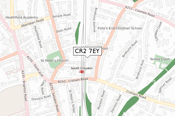
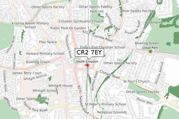
CR2 7EY is located in the South Croydon electoral ward, within the London borough of Croydon and the English Parliamentary constituency of Croydon South. The Sub Integrated Care Board (ICB) Location is NHS South West London ICB - 36L and the police force is Metropolitan Police. This postcode has been in use since June 2019.


GetTheData
Source: OS Open Zoomstack (Ordnance Survey)
Licence: Open Government Licence (requires attribution)
Attribution: Contains OS data © Crown copyright and database right 2025
Source: Open Postcode Geo
Licence: Open Government Licence (requires attribution)
Attribution: Contains OS data © Crown copyright and database right 2025; Contains Royal Mail data © Royal Mail copyright and database right 2025; Source: Office for National Statistics licensed under the Open Government Licence v.3.0
| Easting | 532864 |
| Northing | 164428 |
| Latitude | 51.363386 |
| Longitude | -0.092925 |
GetTheData
Source: Open Postcode Geo
Licence: Open Government Licence
| Country | England |
| Postcode District | CR2 |
➜ See where CR2 is on a map ➜ Where is Croydon? | |
GetTheData
Source: Land Registry Price Paid Data
Licence: Open Government Licence
| Ward | South Croydon |
| Constituency | Croydon South |
GetTheData
Source: ONS Postcode Database
Licence: Open Government Licence
| Elmhurst School (South Park Hill Road) | South Croydon | 115m |
| Elmhurst School (South Park Hill Road) | South Croydon | 145m |
| Birdhurst Road South Croydon Station (Croham Road) | South Croydon | 162m |
| South Croydon (St Peter's Road) | South Croydon | 187m |
| South Croydon (St Peter's Road) | South Croydon | 209m |
| Lloyd Park Tram Stop (Coombe Road) | South Croydon | 854m |
| George Street Tram Stop (George Street) | Croydon | 1,245m |
| East Croydon Tram Stop (George Street) | Croydon | 1,277m |
| Wellesley Road Tram Stop (Wellesley Road) | Croydon | 1,371m |
| Church Street Tram Stop (Church Street) | Croydon | 1,396m |
| South Croydon Station | 0.1km |
| East Croydon Station | 1.3km |
| Sanderstead Station | 1.7km |
GetTheData
Source: NaPTAN
Licence: Open Government Licence
| Percentage of properties with Next Generation Access | 100.0% |
| Percentage of properties with Superfast Broadband | 100.0% |
| Percentage of properties with Ultrafast Broadband | 100.0% |
| Percentage of properties with Full Fibre Broadband | 0.0% |
Superfast Broadband is between 30Mbps and 300Mbps
Ultrafast Broadband is > 300Mbps
| Percentage of properties unable to receive 2Mbps | 0.0% |
| Percentage of properties unable to receive 5Mbps | 0.0% |
| Percentage of properties unable to receive 10Mbps | 0.0% |
| Percentage of properties unable to receive 30Mbps | 0.0% |
GetTheData
Source: Ofcom
Licence: Ofcom Terms of Use (requires attribution)
GetTheData
Source: ONS Postcode Database
Licence: Open Government Licence


➜ Get more ratings from the Food Standards Agency
GetTheData
Source: Food Standards Agency
Licence: FSA terms & conditions
| Last Collection | |||
|---|---|---|---|
| Location | Mon-Fri | Sat | Distance |
| Birdhurst Road (23) | 16:45 | 12:00 | 223m |
| Croham Road (70) | 16:45 | 12:00 | 280m |
| South End (129) Tso | 19:15 | 12:00 | 347m |
GetTheData
Source: Dracos
Licence: Creative Commons Attribution-ShareAlike
The below table lists the International Territorial Level (ITL) codes (formerly Nomenclature of Territorial Units for Statistics (NUTS) codes) and Local Administrative Units (LAU) codes for CR2 7EY:
| ITL 1 Code | Name |
|---|---|
| TLI | London |
| ITL 2 Code | Name |
| TLI6 | Outer London - South |
| ITL 3 Code | Name |
| TLI62 | Croydon |
| LAU 1 Code | Name |
| E09000008 | Croydon |
GetTheData
Source: ONS Postcode Directory
Licence: Open Government Licence
The below table lists the Census Output Area (OA), Lower Layer Super Output Area (LSOA), and Middle Layer Super Output Area (MSOA) for CR2 7EY:
| Code | Name | |
|---|---|---|
| OA | E00005146 | |
| LSOA | E01001035 | Croydon 027A |
| MSOA | E02000220 | Croydon 027 |
GetTheData
Source: ONS Postcode Directory
Licence: Open Government Licence
| CR2 7DW | South Park Hill Road | 52m |
| CR0 1JT | Hurst Road | 91m |
| CR2 7DZ | South Park Hill Road | 91m |
| CR2 7PA | Blunt Road | 96m |
| CR0 1JU | Deanfield Gardens | 129m |
| CR0 1HS | St Peters Road | 152m |
| CR2 7EB | Birdhurst Road | 157m |
| CR2 7BA | Croham Road | 163m |
| CR2 7LB | Muggeridge Close | 175m |
| CR2 7PB | Croham Road | 178m |
GetTheData
Source: Open Postcode Geo; Land Registry Price Paid Data
Licence: Open Government Licence