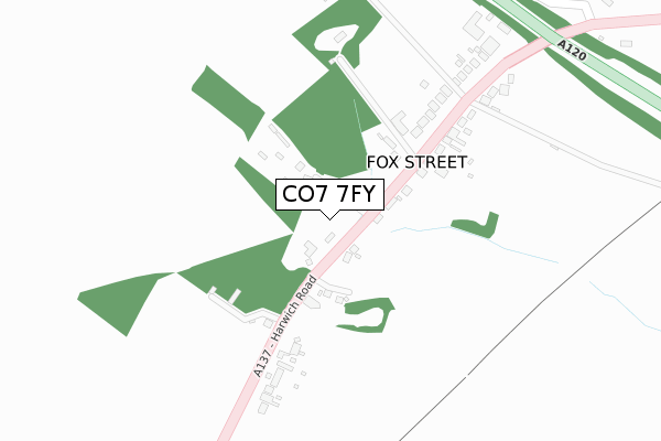
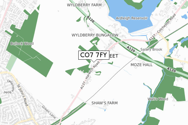
CO7 7FY is located in the Ardleigh & Little Bromley electoral ward, within the local authority district of Tendring and the English Parliamentary constituency of Harwich and North Essex. The Sub Integrated Care Board (ICB) Location is NHS Suffolk and North East Essex ICB - 06T and the police force is Essex. This postcode has been in use since April 2020.


GetTheData
Source: OS Open Zoomstack (Ordnance Survey)
Licence: Open Government Licence (requires attribution)
Attribution: Contains OS data © Crown copyright and database right 2025
Source: Open Postcode Geo
Licence: Open Government Licence (requires attribution)
Attribution: Contains OS data © Crown copyright and database right 2025; Contains Royal Mail data © Royal Mail copyright and database right 2025; Source: Office for National Statistics licensed under the Open Government Licence v.3.0
| Easting | 602833 |
| Northing | 227603 |
| Latitude | 51.910027 |
| Longitude | 0.947510 |
GetTheData
Source: Open Postcode Geo
Licence: Open Government Licence
| Country | England |
| Postcode District | CO7 |
➜ See where CO7 is on a map ➜ Where is Fox Street? | |
GetTheData
Source: Land Registry Price Paid Data
Licence: Open Government Licence
| Ward | Ardleigh & Little Bromley |
| Constituency | Harwich And North Essex |
GetTheData
Source: ONS Postcode Database
Licence: Open Government Licence
| Hyundai Garage (Fox Street (A137)) | Colchester | 270m |
| Hyundai Garage (Fox Street (A137)) | Colchester | 376m |
| Welshwood Park (Parson's Heath) | Colchester | 1,018m |
| Broad Oaks Park (St. John's Road) | Colchester | 1,029m |
| Clover Way (John De Bois Hill (A137)) | Colchester | 1,038m |
| Hythe (Essex) Station | 3km |
| Colchester Station | 3.9km |
| Colchester Town Station | 3.9km |
GetTheData
Source: NaPTAN
Licence: Open Government Licence
GetTheData
Source: ONS Postcode Database
Licence: Open Government Licence


➜ Get more ratings from the Food Standards Agency
GetTheData
Source: Food Standards Agency
Licence: FSA terms & conditions
| Last Collection | |||
|---|---|---|---|
| Location | Mon-Fri | Sat | Distance |
| Fox Street Ardleigh | 17:30 | 10:30 | 48m |
| Welshwood Park Road | 17:30 | 11:40 | 1,015m |
| St Johns Road | 17:30 | 11:30 | 1,127m |
GetTheData
Source: Dracos
Licence: Creative Commons Attribution-ShareAlike
The below table lists the International Territorial Level (ITL) codes (formerly Nomenclature of Territorial Units for Statistics (NUTS) codes) and Local Administrative Units (LAU) codes for CO7 7FY:
| ITL 1 Code | Name |
|---|---|
| TLH | East |
| ITL 2 Code | Name |
| TLH3 | Essex |
| ITL 3 Code | Name |
| TLH34 | Essex Haven Gateway |
| LAU 1 Code | Name |
| E07000076 | Tendring |
GetTheData
Source: ONS Postcode Directory
Licence: Open Government Licence
The below table lists the Census Output Area (OA), Lower Layer Super Output Area (LSOA), and Middle Layer Super Output Area (MSOA) for CO7 7FY:
| Code | Name | |
|---|---|---|
| OA | E00111603 | |
| LSOA | E01021971 | Tendring 005A |
| MSOA | E02004577 | Tendring 005 |
GetTheData
Source: ONS Postcode Directory
Licence: Open Government Licence
| CO7 7PS | Fox Street | 66m |
| CO7 7PP | Fox Street | 70m |
| CO7 7PW | Fox Street | 269m |
| CO7 7PN | Fox Street | 358m |
| CO7 7PL | Crown Lane South | 494m |
| CO4 3ER | Parsons Heath | 598m |
| CO4 3EP | Parsons Heath | 703m |
| CO4 3HZ | Welshwood Park Road | 791m |
| CO4 3JJ | Welshwood Park Road | 874m |
| CO4 0JA | Green Lane | 879m |
GetTheData
Source: Open Postcode Geo; Land Registry Price Paid Data
Licence: Open Government Licence