CO7 7FG maps, stats, and open data
- Home
- Postcode
- CO
- CO7
- CO7 7
CO7 7FG is located in the Alresford & Elmstead electoral ward, within the local authority district of Tendring and the English Parliamentary constituency of Harwich and North Essex. The Sub Integrated Care Board (ICB) Location is NHS Suffolk and North East Essex ICB - 06T and the police force is Essex. This postcode has been in use since December 2017.
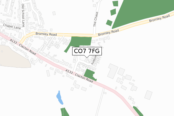
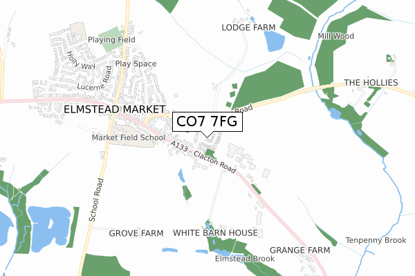
CO7 7FG maps


Source: OS Open Zoomstack (Ordnance Survey)
Licence: Open Government Licence (requires attribution)
Attribution: Contains OS data © Crown copyright and database right 2025
Source: Open Postcode GeoLicence: Open Government Licence (requires attribution)
Attribution: Contains OS data © Crown copyright and database right 2025; Contains Royal Mail data © Royal Mail copyright and database right 2025; Source: Office for National Statistics licensed under the Open Government Licence v.3.0
CO7 7FG geodata
| Easting | 606786 |
| Northing | 224344 |
| Latitude | 51.879314 |
| Longitude | 1.002943 |
Where is CO7 7FG?
| Country | England |
| Postcode District | CO7 |
Politics
| Ward | Alresford & Elmstead |
|---|
| Constituency | Harwich And North Essex |
|---|
Transport
Nearest bus stops to CO7 7FG
| Elmstead Market (Clacton Road) | Elmstead Market | 164m |
| Elmstead Market (Clacton Road) | Elmstead Market | 229m |
| Nursery (Clacton Road) | Frating Hill | 365m |
| Nursery (Clacton Road) | Frating Hill | 393m |
| The Kings Arms (Clacton Road) | Elmstead Market | 545m |
Nearest railway stations to CO7 7FG
| Alresford (Essex) Station | 2.8km |
| Wivenhoe Station | 4.1km |
| Great Bentley Station | 5.3km |
Broadband
Broadband access in CO7 7FG (2020 data)
| Percentage of properties with Next Generation Access | 100.0% |
| Percentage of properties with Superfast Broadband | 100.0% |
| Percentage of properties with Ultrafast Broadband | 100.0% |
| Percentage of properties with Full Fibre Broadband | 100.0% |
Superfast Broadband is between 30Mbps and 300Mbps
Ultrafast Broadband is > 300Mbps
Broadband limitations in CO7 7FG (2020 data)
| Percentage of properties unable to receive 2Mbps | 0.0% |
| Percentage of properties unable to receive 5Mbps | 0.0% |
| Percentage of properties unable to receive 10Mbps | 0.0% |
| Percentage of properties unable to receive 30Mbps | 0.0% |
Deprivation
39.9% of English postcodes are less deprived than
CO7 7FG:
Food Standards Agency
Three nearest food hygiene ratings to CO7 7FG (metres)
Beth Chatto Gardens Ltd
Saresta And Serenade
Mike's Golden Fish Dish
➜ Get more ratings from the Food Standards Agency
Nearest post box to CO7 7FG
| | Last Collection | |
|---|
| Location | Mon-Fri | Sat | Distance |
|---|
| Post Office | 17:30 | 11:30 | 649m |
| Holly Way Elmstead | 17:30 | 10:30 | 717m |
| Alfells Road Elmstead | 16:30 | 10:30 | 946m |
CO7 7FG ITL and CO7 7FG LAU
The below table lists the International Territorial Level (ITL) codes (formerly Nomenclature of Territorial Units for Statistics (NUTS) codes) and Local Administrative Units (LAU) codes for CO7 7FG:
| ITL 1 Code | Name |
|---|
| TLH | East |
| ITL 2 Code | Name |
|---|
| TLH3 | Essex |
| ITL 3 Code | Name |
|---|
| TLH34 | Essex Haven Gateway |
| LAU 1 Code | Name |
|---|
| E07000076 | Tendring |
CO7 7FG census areas
The below table lists the Census Output Area (OA), Lower Layer Super Output Area (LSOA), and Middle Layer Super Output Area (MSOA) for CO7 7FG:
| Code | Name |
|---|
| OA | E00112037 | |
|---|
| LSOA | E01022052 | Tendring 005D |
|---|
| MSOA | E02004577 | Tendring 005 |
|---|
Nearest postcodes to CO7 7FG


