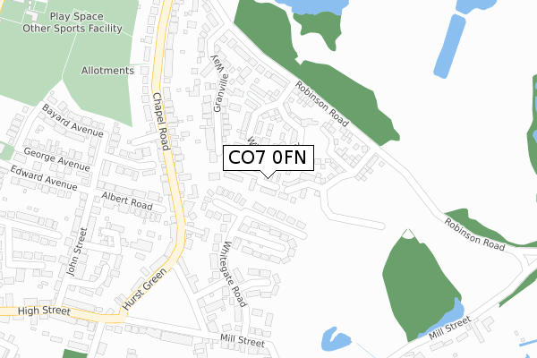
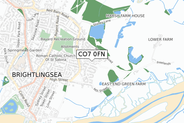
CO7 0FN is located in the Brightlingsea electoral ward, within the local authority district of Tendring and the English Parliamentary constituency of Harwich and North Essex. The Sub Integrated Care Board (ICB) Location is NHS Suffolk and North East Essex ICB - 06T and the police force is Essex. This postcode has been in use since August 2017.


GetTheData
Source: OS Open Zoomstack (Ordnance Survey)
Licence: Open Government Licence (requires attribution)
Attribution: Contains OS data © Crown copyright and database right 2025
Source: Open Postcode Geo
Licence: Open Government Licence (requires attribution)
Attribution: Contains OS data © Crown copyright and database right 2025; Contains Royal Mail data © Royal Mail copyright and database right 2025; Source: Office for National Statistics licensed under the Open Government Licence v.3.0
| Easting | 609338 |
| Northing | 217004 |
| Latitude | 51.812461 |
| Longitude | 1.035525 |
GetTheData
Source: Open Postcode Geo
Licence: Open Government Licence
| Country | England |
| Postcode District | CO7 |
➜ See where CO7 is on a map ➜ Where is Brightlingsea? | |
GetTheData
Source: Land Registry Price Paid Data
Licence: Open Government Licence
| Ward | Brightlingsea |
| Constituency | Harwich And North Essex |
GetTheData
Source: ONS Postcode Database
Licence: Open Government Licence
15, STEPHENS DRIVE, BRIGHTLINGSEA, COLCHESTER, CO7 0FN 2017 10 NOV £289,995 |
17, STEPHENS DRIVE, BRIGHTLINGSEA, COLCHESTER, CO7 0FN 2017 27 OCT £269,995 |
GetTheData
Source: HM Land Registry Price Paid Data
Licence: Contains HM Land Registry data © Crown copyright and database right 2025. This data is licensed under the Open Government Licence v3.0.
| Chapel Road | Brightlingsea | 245m |
| Chapel Road | Brightlingsea | 276m |
| Hurst Green (Chapel Road) | Brightlingsea | 284m |
| Hurst Green (Chapel Road) | Brightlingsea | 294m |
| Bellfield Avenue (Chapel Road) | Brightlingsea | 402m |
| Great Bentley Station | 4.8km |
| Alresford (Essex) Station | 5.3km |
GetTheData
Source: NaPTAN
Licence: Open Government Licence
| Percentage of properties with Next Generation Access | 100.0% |
| Percentage of properties with Superfast Broadband | 100.0% |
| Percentage of properties with Ultrafast Broadband | 0.0% |
| Percentage of properties with Full Fibre Broadband | 0.0% |
Superfast Broadband is between 30Mbps and 300Mbps
Ultrafast Broadband is > 300Mbps
| Median download speed | 34.6Mbps |
| Average download speed | 37.2Mbps |
| Maximum download speed | 70.95Mbps |
| Median upload speed | 10.0Mbps |
| Average upload speed | 8.6Mbps |
| Maximum upload speed | 19.97Mbps |
| Percentage of properties unable to receive 2Mbps | 0.0% |
| Percentage of properties unable to receive 5Mbps | 0.0% |
| Percentage of properties unable to receive 10Mbps | 0.0% |
| Percentage of properties unable to receive 30Mbps | 0.0% |
GetTheData
Source: Ofcom
Licence: Ofcom Terms of Use (requires attribution)
GetTheData
Source: ONS Postcode Database
Licence: Open Government Licence


➜ Get more ratings from the Food Standards Agency
GetTheData
Source: Food Standards Agency
Licence: FSA terms & conditions
| Last Collection | |||
|---|---|---|---|
| Location | Mon-Fri | Sat | Distance |
| Hurst Green Brightlingsea | 17:15 | 11:00 | 241m |
| Bayard Avenue Brightlingsea | 17:15 | 11:00 | 319m |
| Chapel Road Brightlingsea | 17:15 | 10:45 | 428m |
GetTheData
Source: Dracos
Licence: Creative Commons Attribution-ShareAlike
The below table lists the International Territorial Level (ITL) codes (formerly Nomenclature of Territorial Units for Statistics (NUTS) codes) and Local Administrative Units (LAU) codes for CO7 0FN:
| ITL 1 Code | Name |
|---|---|
| TLH | East |
| ITL 2 Code | Name |
| TLH3 | Essex |
| ITL 3 Code | Name |
| TLH34 | Essex Haven Gateway |
| LAU 1 Code | Name |
| E07000076 | Tendring |
GetTheData
Source: ONS Postcode Directory
Licence: Open Government Licence
The below table lists the Census Output Area (OA), Lower Layer Super Output Area (LSOA), and Middle Layer Super Output Area (MSOA) for CO7 0FN:
| Code | Name | |
|---|---|---|
| OA | E00111639 | |
| LSOA | E01021981 | Tendring 011C |
| MSOA | E02004583 | Tendring 011 |
GetTheData
Source: ONS Postcode Directory
Licence: Open Government Licence
| CO7 0EY | Kirkhurst Close | 83m |
| CO7 0EX | Greenhurst Road | 98m |
| CO7 0EU | Whitegate Road | 147m |
| CO7 0ET | Creekhurst Close | 148m |
| CO7 0SY | Granville Way | 156m |
| CO7 0FJ | Chapel Mews | 167m |
| CO7 0ER | Hurst Close | 174m |
| CO7 0HB | Chapel Road | 186m |
| CO7 0ES | Whitegate Road | 186m |
| CO7 0ST | Robinson Road | 190m |
GetTheData
Source: Open Postcode Geo; Land Registry Price Paid Data
Licence: Open Government Licence