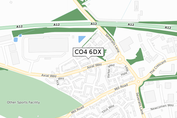
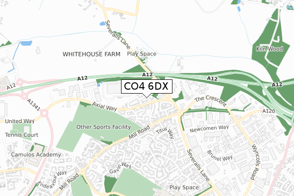
CO4 6DX maps, stats, and open data
CO4 6DX is located in the Mile End electoral ward, within the local authority district of Colchester and the English Parliamentary constituency of Colchester. The Sub Integrated Care Board (ICB) Location is NHS Suffolk and North East Essex ICB - 06T and the police force is Essex. This postcode has been in use since January 2018.
CO4 6DX maps


Licence: Open Government Licence (requires attribution)
Attribution: Contains OS data © Crown copyright and database right 2025
Source: Open Postcode Geo
Licence: Open Government Licence (requires attribution)
Attribution: Contains OS data © Crown copyright and database right 2025; Contains Royal Mail data © Royal Mail copyright and database right 2025; Source: Office for National Statistics licensed under the Open Government Licence v.3.0
CO4 6DX geodata
| Easting | 600606 |
| Northing | 229044 |
| Latitude | 51.923772 |
| Longitude | 0.916018 |
Where is CO4 6DX?
| Country | England |
| Postcode District | CO4 |
Politics
| Ward | Mile End |
|---|---|
| Constituency | Colchester |
House Prices
Sales of detached houses in CO4 6DX
2024 10 MAY £378,000 |
2018 31 OCT £284,995 |
15, CULTURE CLOSE, COLCHESTER, CO4 6DX 2018 27 JUN £337,995 |
16, CULTURE CLOSE, COLCHESTER, CO4 6DX 2018 25 JUN £285,000 |
1, CULTURE CLOSE, COLCHESTER, CO4 6DX 2018 26 FEB £304,995 |
2, CULTURE CLOSE, COLCHESTER, CO4 6DX 2017 21 DEC £304,995 |
12, CULTURE CLOSE, COLCHESTER, CO4 6DX 2017 21 DEC £304,995 |
Licence: Contains HM Land Registry data © Crown copyright and database right 2025. This data is licensed under the Open Government Licence v3.0.
Transport
Nearest bus stops to CO4 6DX
| New Link Road East (Axial Way) | Mile End | 45m |
| New Link Road East (Axial Way) | Mile End | 66m |
| Cuckoo Point (Severalls Lane) | Severalls Park | 220m |
| Cuckoo Point (Severalls Lane) | Severalls Park | 228m |
| Julian Avenue (Mill Road) | Mile End | 236m |
Nearest railway stations to CO4 6DX
| Colchester Station | 3km |
| Colchester Town Station | 4.2km |
| Hythe (Essex) Station | 4.3km |
Broadband
Broadband access in CO4 6DX (2020 data)
| Percentage of properties with Next Generation Access | 100.0% |
| Percentage of properties with Superfast Broadband | 100.0% |
| Percentage of properties with Ultrafast Broadband | 100.0% |
| Percentage of properties with Full Fibre Broadband | 100.0% |
Superfast Broadband is between 30Mbps and 300Mbps
Ultrafast Broadband is > 300Mbps
Broadband speed in CO4 6DX (2019 data)
Download
| Median download speed | 360.0Mbps |
| Average download speed | 360.0Mbps |
| Maximum download speed | 360.00Mbps |
Upload
| Median upload speed | 360.0Mbps |
| Average upload speed | 360.0Mbps |
| Maximum upload speed | 360.00Mbps |
Broadband limitations in CO4 6DX (2020 data)
| Percentage of properties unable to receive 2Mbps | 0.0% |
| Percentage of properties unable to receive 5Mbps | 0.0% |
| Percentage of properties unable to receive 10Mbps | 0.0% |
| Percentage of properties unable to receive 30Mbps | 0.0% |
Deprivation
29.3% of English postcodes are less deprived than CO4 6DX:Food Standards Agency
Three nearest food hygiene ratings to CO4 6DX (metres)


➜ Get more ratings from the Food Standards Agency
Nearest post box to CO4 6DX
| Last Collection | |||
|---|---|---|---|
| Location | Mon-Fri | Sat | Distance |
| Lion And Lamb | 17:00 | 10:30 | 1,304m |
| Chinook Highwoods | 17:30 | 11:30 | 1,389m |
| Highwoods Square Post Office | 17:30 | 12:10 | 1,483m |
CO4 6DX ITL and CO4 6DX LAU
The below table lists the International Territorial Level (ITL) codes (formerly Nomenclature of Territorial Units for Statistics (NUTS) codes) and Local Administrative Units (LAU) codes for CO4 6DX:
| ITL 1 Code | Name |
|---|---|
| TLH | East |
| ITL 2 Code | Name |
| TLH3 | Essex |
| ITL 3 Code | Name |
| TLH34 | Essex Haven Gateway |
| LAU 1 Code | Name |
| E07000071 | Colchester |
CO4 6DX census areas
The below table lists the Census Output Area (OA), Lower Layer Super Output Area (LSOA), and Middle Layer Super Output Area (MSOA) for CO4 6DX:
| Code | Name | |
|---|---|---|
| OA | E00176369 | |
| LSOA | E01021682 | Colchester 004D |
| MSOA | E02004509 | Colchester 004 |
Nearest postcodes to CO4 6DX
| CO4 5YQ | De Grey Square | 93m |
| CO4 5ZJ | Chapman Place | 97m |
| CO4 5ZR | Bennett Green | 103m |
| CO4 5ZQ | Appleton Mews | 116m |
| CO4 5TZ | St James Place | 130m |
| CO4 5YE | De Grey Road | 146m |
| CO4 5BE | Parker Road | 146m |
| CO4 5ZG | Mortimer Gardens | 158m |
| CO4 5ZH | Roper Close | 176m |
| CO4 5ZN | Kirk Way | 191m |