CO4 6DB maps, stats, and open data
CO4 6DB is located in the Mile End electoral ward, within the local authority district of Colchester and the English Parliamentary constituency of Colchester. The Sub Integrated Care Board (ICB) Location is NHS Suffolk and North East Essex ICB - 06T and the police force is Essex. This postcode has been in use since April 2018.
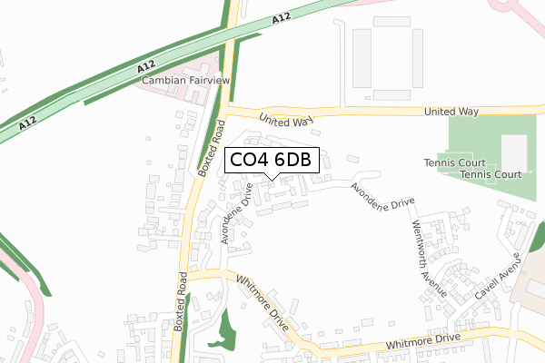
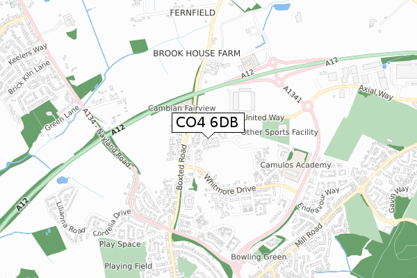
CO4 6DB maps


Licence: Open Government Licence (requires attribution)
Attribution: Contains OS data © Crown copyright and database right 2025
Source: Open Postcode Geo
Licence: Open Government Licence (requires attribution)
Attribution: Contains OS data © Crown copyright and database right 2025; Contains Royal Mail data © Royal Mail copyright and database right 2025; Source: Office for National Statistics licensed under the Open Government Licence v.3.0
CO4 6DB geodata
| Easting | 599194 |
| Northing | 228709 |
| Latitude | 51.921270 |
| Longitude | 0.895318 |
Where is CO4 6DB?
| Country | England |
| Postcode District | CO4 |
Politics
| Ward | Mile End |
|---|---|
| Constituency | Colchester |
House Prices
Sales of detached houses in CO4 6DB
2024 15 NOV £442,500 |
43, AVONDENE DRIVE, COLCHESTER, CO4 6DB 2022 29 MAR £445,000 |
37, AVONDENE DRIVE, COLCHESTER, CO4 6DB 2022 28 JAN £455,000 |
38, AVONDENE DRIVE, COLCHESTER, CO4 6DB 2021 24 DEC £459,000 |
49, AVONDENE DRIVE, COLCHESTER, CO4 6DB 2021 23 DEC £332,000 |
36, AVONDENE DRIVE, COLCHESTER, CO4 6DB 2021 20 DEC £455,000 |
2021 12 MAR £516,000 |
32, AVONDENE DRIVE, COLCHESTER, CO4 6DB 2019 31 OCT £234,995 |
2019 31 OCT £486,500 |
30, AVONDENE DRIVE, COLCHESTER, CO4 6DB 2019 26 JUL £329,995 |
Licence: Contains HM Land Registry data © Crown copyright and database right 2025. This data is licensed under the Open Government Licence v3.0.
Transport
Nearest bus stops to CO4 6DB
| Colchester United Fc (United Way) | Mile End | 115m |
| Colchester United Fc (United Way) | Mile End | 115m |
| Colchester United Fc (United Way) | Mile End | 117m |
| Colchester United Fc (United Way) | Mile End | 119m |
| Colchester United Fc (United Way) | Mile End | 122m |
Nearest railway stations to CO4 6DB
| Colchester Station | 2.3km |
| Colchester Town Station | 3.9km |
| Hythe (Essex) Station | 4.5km |
Broadband
Broadband access in CO4 6DB (2020 data)
| Percentage of properties with Next Generation Access | 100.0% |
| Percentage of properties with Superfast Broadband | 100.0% |
| Percentage of properties with Ultrafast Broadband | 100.0% |
| Percentage of properties with Full Fibre Broadband | 100.0% |
Superfast Broadband is between 30Mbps and 300Mbps
Ultrafast Broadband is > 300Mbps
Broadband speed in CO4 6DB (2019 data)
Download
| Median download speed | 360.0Mbps |
| Average download speed | 347.9Mbps |
| Maximum download speed | 360.00Mbps |
Upload
| Median upload speed | 360.0Mbps |
| Average upload speed | 347.6Mbps |
| Maximum upload speed | 360.00Mbps |
Broadband limitations in CO4 6DB (2020 data)
| Percentage of properties unable to receive 2Mbps | 0.0% |
| Percentage of properties unable to receive 5Mbps | 0.0% |
| Percentage of properties unable to receive 10Mbps | 0.0% |
| Percentage of properties unable to receive 30Mbps | 0.0% |
Deprivation
52.1% of English postcodes are less deprived than CO4 6DB:Food Standards Agency
Three nearest food hygiene ratings to CO4 6DB (metres)

➜ Get more ratings from the Food Standards Agency
Nearest post box to CO4 6DB
| Last Collection | |||
|---|---|---|---|
| Location | Mon-Fri | Sat | Distance |
| Defoe Crescent | 17:30 | 11:30 | 717m |
| Nayland Road | 17:30 | 11:30 | 955m |
| Bergholt Road | 17:30 | 11:30 | 1,939m |
CO4 6DB ITL and CO4 6DB LAU
The below table lists the International Territorial Level (ITL) codes (formerly Nomenclature of Territorial Units for Statistics (NUTS) codes) and Local Administrative Units (LAU) codes for CO4 6DB:
| ITL 1 Code | Name |
|---|---|
| TLH | East |
| ITL 2 Code | Name |
| TLH3 | Essex |
| ITL 3 Code | Name |
| TLH34 | Essex Haven Gateway |
| LAU 1 Code | Name |
| E07000071 | Colchester |
CO4 6DB census areas
The below table lists the Census Output Area (OA), Lower Layer Super Output Area (LSOA), and Middle Layer Super Output Area (MSOA) for CO4 6DB:
| Code | Name | |
|---|---|---|
| OA | E00110120 | |
| LSOA | E01021680 | Colchester 004B |
| MSOA | E02004509 | Colchester 004 |
Nearest postcodes to CO4 6DB
| CO4 5HF | Boxted Road | 227m |
| CO4 5FX | Chesterwell Mews | 284m |
| CO4 5HE | Boxted Road | 290m |
| CO4 5FB | Pleasant Plains Mews | 302m |
| CO4 5ES | Walnut Drive | 391m |
| CO4 5JH | Chestnut Close | 420m |
| CO4 5HB | Whitebeam Close | 476m |
| CO4 5HA | Nayland Road | 542m |
| CO4 5HH | Boxted Road | 588m |
| CO4 5YW | Venture Chase | 607m |