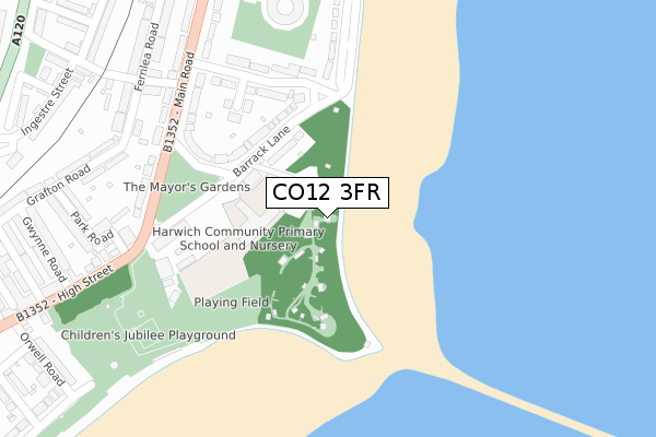
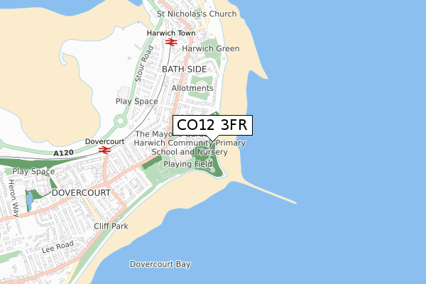
CO12 3FR is located in the Harwich & Kingsway electoral ward, within the local authority district of Tendring and the English Parliamentary constituency of Harwich and North Essex. The Sub Integrated Care Board (ICB) Location is NHS Suffolk and North East Essex ICB - 06T and the police force is Essex. This postcode has been in use since March 2018.


GetTheData
Source: OS Open Zoomstack (Ordnance Survey)
Licence: Open Government Licence (requires attribution)
Attribution: Contains OS data © Crown copyright and database right 2025
Source: Open Postcode Geo
Licence: Open Government Licence (requires attribution)
Attribution: Contains OS data © Crown copyright and database right 2025; Contains Royal Mail data © Royal Mail copyright and database right 2025; Source: Office for National Statistics licensed under the Open Government Licence v.3.0
| Easting | 626221 |
| Northing | 231837 |
| Latitude | 51.939036 |
| Longitude | 1.289743 |
GetTheData
Source: Open Postcode Geo
Licence: Open Government Licence
| Country | England |
| Postcode District | CO12 |
➜ See where CO12 is on a map | |
GetTheData
Source: Land Registry Price Paid Data
Licence: Open Government Licence
| Ward | Harwich & Kingsway |
| Constituency | Harwich And North Essex |
GetTheData
Source: ONS Postcode Database
Licence: Open Government Licence
| Barrack Lane (Main Road) | Harwich | 263m |
| Barrack Lane (Main Road) | Harwich | 269m |
| Mayflower Avenue (Main Road) | Harwich | 360m |
| Mayflower Avenue (Main Road) | Harwich | 367m |
| Dart Harwich (Fernlea Road) | Harwich | 428m |
| Harwich Town Station | 0.6km |
| Dovercourt Station | 0.6km |
| Harwich International Station | 2.6km |
GetTheData
Source: NaPTAN
Licence: Open Government Licence
GetTheData
Source: ONS Postcode Database
Licence: Open Government Licence


➜ Get more ratings from the Food Standards Agency
GetTheData
Source: Food Standards Agency
Licence: FSA terms & conditions
| Last Collection | |||
|---|---|---|---|
| Location | Mon-Fri | Sat | Distance |
| Mayflower Avenue | 17:30 | 11:30 | 310m |
| Bathside Ingestre Street | 17:00 | 11:30 | 447m |
| Harwich Post Office | 17:30 | 12:15 | 580m |
GetTheData
Source: Dracos
Licence: Creative Commons Attribution-ShareAlike
The below table lists the International Territorial Level (ITL) codes (formerly Nomenclature of Territorial Units for Statistics (NUTS) codes) and Local Administrative Units (LAU) codes for CO12 3FR:
| ITL 1 Code | Name |
|---|---|
| TLH | East |
| ITL 2 Code | Name |
| TLH3 | Essex |
| ITL 3 Code | Name |
| TLH34 | Essex Haven Gateway |
| LAU 1 Code | Name |
| E07000076 | Tendring |
GetTheData
Source: ONS Postcode Directory
Licence: Open Government Licence
The below table lists the Census Output Area (OA), Lower Layer Super Output Area (LSOA), and Middle Layer Super Output Area (MSOA) for CO12 3FR:
| Code | Name | |
|---|---|---|
| OA | E00111738 | |
| LSOA | E01021998 | Tendring 001B |
| MSOA | E02004573 | Tendring 001 |
GetTheData
Source: ONS Postcode Directory
Licence: Open Government Licence
| CO12 3NP | Barrack Lane | 169m |
| CO12 3NR | Beacon Hill Avenue | 211m |
| CO12 3NW | Mayflower Avenue | 228m |
| CO12 3NN | Mayflower Avenue | 243m |
| CO12 3LR | Main Road | 270m |
| CO12 3LJ | Main Road | 286m |
| CO12 3DF | Main Road | 307m |
| CO12 3LH | Main Road | 308m |
| CO12 3BS | Alexandra Road | 335m |
| CO12 3NL | Harbour Crescent | 336m |
GetTheData
Source: Open Postcode Geo; Land Registry Price Paid Data
Licence: Open Government Licence