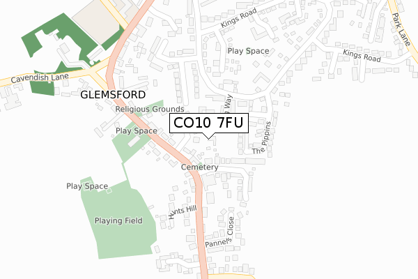
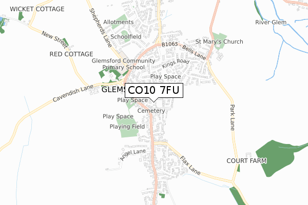
CO10 7FU is located in the Chadacre electoral ward, within the local authority district of Babergh and the English Parliamentary constituency of South Suffolk. The Sub Integrated Care Board (ICB) Location is NHS Suffolk and North East Essex ICB - 07K and the police force is Suffolk. This postcode has been in use since April 2020.


GetTheData
Source: OS Open Zoomstack (Ordnance Survey)
Licence: Open Government Licence (requires attribution)
Attribution: Contains OS data © Crown copyright and database right 2025
Source: Open Postcode Geo
Licence: Open Government Licence (requires attribution)
Attribution: Contains OS data © Crown copyright and database right 2025; Contains Royal Mail data © Royal Mail copyright and database right 2025; Source: Office for National Statistics licensed under the Open Government Licence v.3.0
| Easting | 582919 |
| Northing | 247918 |
| Latitude | 52.099369 |
| Longitude | 0.669184 |
GetTheData
Source: Open Postcode Geo
Licence: Open Government Licence
| Country | England |
| Postcode District | CO10 |
➜ See where CO10 is on a map ➜ Where is Glemsford? | |
GetTheData
Source: Land Registry Price Paid Data
Licence: Open Government Licence
| Ward | Chadacre |
| Constituency | South Suffolk |
GetTheData
Source: ONS Postcode Database
Licence: Open Government Licence
2024 15 NOV £350,000 |
2022 23 SEP £385,000 |
2021 26 FEB £234,129 |
4, RADFORD DRIVE, GLEMSFORD, SUDBURY, CO10 7FU 2021 21 JAN £335,000 |
3, RADFORD DRIVE, GLEMSFORD, SUDBURY, CO10 7FU 2020 18 DEC £325,000 |
2020 23 APR £340,000 |
GetTheData
Source: HM Land Registry Price Paid Data
Licence: Contains HM Land Registry data © Crown copyright and database right 2025. This data is licensed under the Open Government Licence v3.0.
| Social Club (Hunts Hill) | Glemsford | 132m |
| Social Club (Hunts Hill) | Glemsford | 137m |
| Village Hall (Tye Green) | Glemsford | 191m |
| Village Hall (Tye Green) | Glemsford | 195m |
| The Angel (Egremont Street) | Glemsford | 345m |
GetTheData
Source: NaPTAN
Licence: Open Government Licence
GetTheData
Source: ONS Postcode Database
Licence: Open Government Licence


➜ Get more ratings from the Food Standards Agency
GetTheData
Source: Food Standards Agency
Licence: FSA terms & conditions
| Last Collection | |||
|---|---|---|---|
| Location | Mon-Fri | Sat | Distance |
| Windmill Hill Long Melford | 16:30 | 10:30 | 2,998m |
| Long Melford Church | 16:45 | 10:30 | 3,819m |
| Liston | 16:45 | 10:30 | 3,922m |
GetTheData
Source: Dracos
Licence: Creative Commons Attribution-ShareAlike
The below table lists the International Territorial Level (ITL) codes (formerly Nomenclature of Territorial Units for Statistics (NUTS) codes) and Local Administrative Units (LAU) codes for CO10 7FU:
| ITL 1 Code | Name |
|---|---|
| TLH | East |
| ITL 2 Code | Name |
| TLH1 | East Anglia |
| ITL 3 Code | Name |
| TLH14 | Suffolk CC |
| LAU 1 Code | Name |
| E07000200 | Babergh |
GetTheData
Source: ONS Postcode Directory
Licence: Open Government Licence
The below table lists the Census Output Area (OA), Lower Layer Super Output Area (LSOA), and Middle Layer Super Output Area (MSOA) for CO10 7FU:
| Code | Name | |
|---|---|---|
| OA | E00152283 | |
| LSOA | E01029884 | Babergh 002B |
| MSOA | E02006228 | Babergh 002 |
GetTheData
Source: ONS Postcode Directory
Licence: Open Government Licence
| CO10 7UT | Golding Way | 62m |
| CO10 7RL | Hunts Hill | 82m |
| CO10 7RN | Harpurs Road | 82m |
| CO10 7RW | Drapery Common | 83m |
| CO10 7PQ | The Pippins | 116m |
| CO10 7TF | Pearsons Close | 131m |
| CO10 7RH | Tye Green | 191m |
| CO10 7RP | Hunts Hill | 191m |
| CO10 7QX | Kings Road | 191m |
| CO10 7UP | Brices Way | 196m |
GetTheData
Source: Open Postcode Geo; Land Registry Price Paid Data
Licence: Open Government Licence