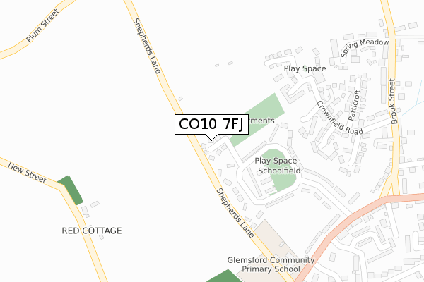
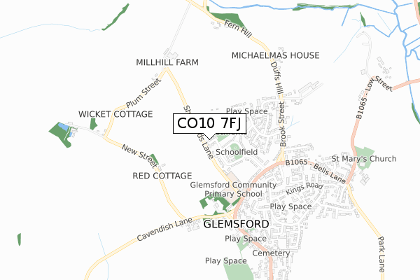
CO10 7FJ is located in the Chadacre electoral ward, within the local authority district of Babergh and the English Parliamentary constituency of South Suffolk. The Sub Integrated Care Board (ICB) Location is NHS Suffolk and North East Essex ICB - 07K and the police force is Suffolk. This postcode has been in use since January 2018.


GetTheData
Source: OS Open Zoomstack (Ordnance Survey)
Licence: Open Government Licence (requires attribution)
Attribution: Contains OS data © Crown copyright and database right 2025
Source: Open Postcode Geo
Licence: Open Government Licence (requires attribution)
Attribution: Contains OS data © Crown copyright and database right 2025; Contains Royal Mail data © Royal Mail copyright and database right 2025; Source: Office for National Statistics licensed under the Open Government Licence v.3.0
| Easting | 582510 |
| Northing | 248532 |
| Latitude | 52.105018 |
| Longitude | 0.663548 |
GetTheData
Source: Open Postcode Geo
Licence: Open Government Licence
| Country | England |
| Postcode District | CO10 |
➜ See where CO10 is on a map ➜ Where is Glemsford? | |
GetTheData
Source: Land Registry Price Paid Data
Licence: Open Government Licence
| Ward | Chadacre |
| Constituency | South Suffolk |
GetTheData
Source: ONS Postcode Database
Licence: Open Government Licence
| Black Lion (Lion Road) | Glemsford | 377m |
| Black Lion (Lion Road) | Glemsford | 386m |
| Shelter (Broadway) | Glemsford | 399m |
| Shelter (Broadway) | Glemsford | 402m |
| Village Hall (Tye Green) | Glemsford | 608m |
GetTheData
Source: NaPTAN
Licence: Open Government Licence
| Percentage of properties with Next Generation Access | 100.0% |
| Percentage of properties with Superfast Broadband | 100.0% |
| Percentage of properties with Ultrafast Broadband | 0.0% |
| Percentage of properties with Full Fibre Broadband | 0.0% |
Superfast Broadband is between 30Mbps and 300Mbps
Ultrafast Broadband is > 300Mbps
| Median download speed | 40.0Mbps |
| Average download speed | 37.5Mbps |
| Maximum download speed | 74.08Mbps |
| Median upload speed | 10.0Mbps |
| Average upload speed | 8.7Mbps |
| Maximum upload speed | 20.00Mbps |
| Percentage of properties unable to receive 2Mbps | 0.0% |
| Percentage of properties unable to receive 5Mbps | 0.0% |
| Percentage of properties unable to receive 10Mbps | 0.0% |
| Percentage of properties unable to receive 30Mbps | 0.0% |
GetTheData
Source: Ofcom
Licence: Ofcom Terms of Use (requires attribution)
GetTheData
Source: ONS Postcode Database
Licence: Open Government Licence


➜ Get more ratings from the Food Standards Agency
GetTheData
Source: Food Standards Agency
Licence: FSA terms & conditions
| Last Collection | |||
|---|---|---|---|
| Location | Mon-Fri | Sat | Distance |
| Windmill Hill Long Melford | 16:30 | 10:30 | 3,649m |
| Long Melford Church | 16:45 | 10:30 | 4,432m |
| High Street Long Melford | 16:45 | 10:30 | 4,574m |
GetTheData
Source: Dracos
Licence: Creative Commons Attribution-ShareAlike
The below table lists the International Territorial Level (ITL) codes (formerly Nomenclature of Territorial Units for Statistics (NUTS) codes) and Local Administrative Units (LAU) codes for CO10 7FJ:
| ITL 1 Code | Name |
|---|---|
| TLH | East |
| ITL 2 Code | Name |
| TLH1 | East Anglia |
| ITL 3 Code | Name |
| TLH14 | Suffolk CC |
| LAU 1 Code | Name |
| E07000200 | Babergh |
GetTheData
Source: ONS Postcode Directory
Licence: Open Government Licence
The below table lists the Census Output Area (OA), Lower Layer Super Output Area (LSOA), and Middle Layer Super Output Area (MSOA) for CO10 7FJ:
| Code | Name | |
|---|---|---|
| OA | E00152285 | |
| LSOA | E01029884 | Babergh 002B |
| MSOA | E02006228 | Babergh 002 |
GetTheData
Source: ONS Postcode Directory
Licence: Open Government Licence
| CO10 7UR | Scossels | 212m |
| CO10 7RE | Schoolfield | 221m |
| CO10 7UL | Crown Field Road | 264m |
| CO10 7UE | Kebbles | 275m |
| CO10 7FG | Abbitts Place | 298m |
| CO10 7UD | Whitlands | 331m |
| CO10 7RF | Lion Road | 338m |
| CO10 7UJ | Patticroft | 347m |
| CO10 7PY | New Street | 355m |
| CO10 7RB | Broadway | 364m |
GetTheData
Source: Open Postcode Geo; Land Registry Price Paid Data
Licence: Open Government Licence