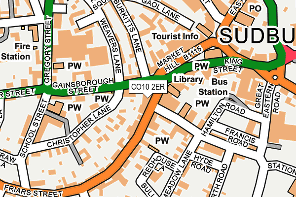
CO10 2ER is located in the Sudbury South West electoral ward, within the local authority district of Babergh and the English Parliamentary constituency of South Suffolk. The Sub Integrated Care Board (ICB) Location is NHS Suffolk and North East Essex ICB - 07K and the police force is Suffolk. This postcode has been in use since July 2017.


GetTheData
Source: OS OpenMap – Local (Ordnance Survey)
Source: OS VectorMap District (Ordnance Survey)
Licence: Open Government Licence (requires attribution)
| Easting | 587308 |
| Northing | 241243 |
| Latitude | 52.037956 |
| Longitude | 0.729526 |
GetTheData
Source: Open Postcode Geo
Licence: Open Government Licence
| Country | England |
| Postcode District | CO10 |
➜ See where CO10 is on a map ➜ Where is Sudbury? | |
GetTheData
Source: Land Registry Price Paid Data
Licence: Open Government Licence
| Ward | Sudbury South West |
| Constituency | South Suffolk |
GetTheData
Source: ONS Postcode Database
Licence: Open Government Licence
| Gregory Mills (Gregory Street) | Sudbury | 216m |
| Post Office (East Street) | Sudbury | 228m |
| Sports Ground (Friars Street) | Sudbury | 236m |
| Sports Ground (Friars Street) | Sudbury | 238m |
| Walnut Tree Lane (Gregory Street) | Sudbury | 263m |
| Sudbury (Suffolk) Station | 0.4km |
GetTheData
Source: NaPTAN
Licence: Open Government Licence
GetTheData
Source: ONS Postcode Database
Licence: Open Government Licence


➜ Get more ratings from the Food Standards Agency
GetTheData
Source: Food Standards Agency
Licence: FSA terms & conditions
| Last Collection | |||
|---|---|---|---|
| Location | Mon-Fri | Sat | Distance |
| Market Hill | 17:30 | 12:00 | 24m |
| Sudbury Post Office | 17:30 | 12:00 | 256m |
| Sudbury Post Office | 17:30 | 12:00 | 256m |
GetTheData
Source: Dracos
Licence: Creative Commons Attribution-ShareAlike
The below table lists the International Territorial Level (ITL) codes (formerly Nomenclature of Territorial Units for Statistics (NUTS) codes) and Local Administrative Units (LAU) codes for CO10 2ER:
| ITL 1 Code | Name |
|---|---|
| TLH | East |
| ITL 2 Code | Name |
| TLH1 | East Anglia |
| ITL 3 Code | Name |
| TLH14 | Suffolk CC |
| LAU 1 Code | Name |
| E07000200 | Babergh |
GetTheData
Source: ONS Postcode Directory
Licence: Open Government Licence
The below table lists the Census Output Area (OA), Lower Layer Super Output Area (LSOA), and Middle Layer Super Output Area (MSOA) for CO10 2ER:
| Code | Name | |
|---|---|---|
| OA | E00152471 | |
| LSOA | E01029920 | Babergh 007H |
| MSOA | E02006233 | Babergh 007 |
GetTheData
Source: ONS Postcode Directory
Licence: Open Government Licence
| CO10 2ET | Gainsborough Street | 23m |
| CO10 2EN | Market Hill | 66m |
| CO10 2SP | Station Road | 71m |
| CO10 2AA | Friars Street | 72m |
| CO10 1HD | Burkitts Lane | 88m |
| CO10 2EA | Market Hill | 94m |
| CO10 2FY | Christopher Court | 95m |
| CO10 1HA | Gainsborough Terrace | 117m |
| CO10 1JQ | Old Market Court | 123m |
| CO10 2SX | Bank Buildings | 124m |
GetTheData
Source: Open Postcode Geo; Land Registry Price Paid Data
Licence: Open Government Licence