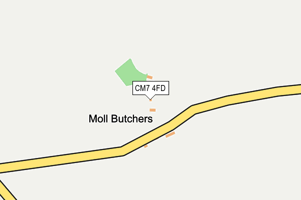
CM7 4FD is located in the Three Fields electoral ward, within the local authority district of Braintree and the English Parliamentary constituency of Braintree. The Sub Integrated Care Board (ICB) Location is NHS Mid and South Essex ICB - 06Q and the police force is Essex. This postcode has been in use since July 2017.


GetTheData
Source: OS OpenMap – Local (Ordnance Survey)
Source: OS VectorMap District (Ordnance Survey)
Licence: Open Government Licence (requires attribution)
| Easting | 573209 |
| Northing | 230314 |
| Latitude | 51.944369 |
| Longitude | 0.518671 |
GetTheData
Source: Open Postcode Geo
Licence: Open Government Licence
| Country | England |
| Postcode District | CM7 |
➜ See where CM7 is on a map | |
GetTheData
Source: Land Registry Price Paid Data
Licence: Open Government Licence
| Ward | Three Fields |
| Constituency | Braintree |
GetTheData
Source: ONS Postcode Database
Licence: Open Government Licence
| The Bull Inn (School Green Road) | Blackmore End | 890m |
| The Bull Inn (School Green Road) | Blackmore End | 893m |
| Blackmore End Road (Blackmore Road) | Blackmore End | 928m |
| Blackmore End Road (Blackmore Road) | Blackmore End | 934m |
| Boydell's Farm (Braintree Road) | Shalford | 1,184m |
GetTheData
Source: NaPTAN
Licence: Open Government Licence
| Percentage of properties with Next Generation Access | 0.0% |
| Percentage of properties with Superfast Broadband | 0.0% |
| Percentage of properties with Ultrafast Broadband | 0.0% |
| Percentage of properties with Full Fibre Broadband | 0.0% |
Superfast Broadband is between 30Mbps and 300Mbps
Ultrafast Broadband is > 300Mbps
| Percentage of properties unable to receive 2Mbps | 0.0% |
| Percentage of properties unable to receive 5Mbps | 0.0% |
| Percentage of properties unable to receive 10Mbps | 100.0% |
| Percentage of properties unable to receive 30Mbps | 100.0% |
GetTheData
Source: Ofcom
Licence: Ofcom Terms of Use (requires attribution)
GetTheData
Source: ONS Postcode Database
Licence: Open Government Licence


➜ Get more ratings from the Food Standards Agency
GetTheData
Source: Food Standards Agency
Licence: FSA terms & conditions
| Last Collection | |||
|---|---|---|---|
| Location | Mon-Fri | Sat | Distance |
| Rotten End | 16:00 | 08:00 | 720m |
| Wethersfield P.o. | 16:30 | 10:30 | 2,427m |
| Gosfield Caravan Park | 16:30 | 10:30 | 4,589m |
GetTheData
Source: Dracos
Licence: Creative Commons Attribution-ShareAlike
The below table lists the International Territorial Level (ITL) codes (formerly Nomenclature of Territorial Units for Statistics (NUTS) codes) and Local Administrative Units (LAU) codes for CM7 4FD:
| ITL 1 Code | Name |
|---|---|
| TLH | East |
| ITL 2 Code | Name |
| TLH3 | Essex |
| ITL 3 Code | Name |
| TLH34 | Essex Haven Gateway |
| LAU 1 Code | Name |
| E07000067 | Braintree |
GetTheData
Source: ONS Postcode Directory
Licence: Open Government Licence
The below table lists the Census Output Area (OA), Lower Layer Super Output Area (LSOA), and Middle Layer Super Output Area (MSOA) for CM7 4FD:
| Code | Name | |
|---|---|---|
| OA | E00108781 | |
| LSOA | E01021413 | Braintree 005D |
| MSOA | E02004450 | Braintree 005 |
GetTheData
Source: ONS Postcode Directory
Licence: Open Government Licence
| CM7 4AJ | Oak Hill | 533m |
| CM7 4AH | Gosfield Road | 597m |
| CM7 4DR | 715m | |
| CM7 4DF | 838m | |
| CM7 4DB | 887m | |
| CM7 4DE | Syers Field | 894m |
| CM7 4DD | 906m | |
| CM7 4DL | 909m | |
| CM7 4AL | Rotten End | 941m |
| CM7 4DG | 979m |
GetTheData
Source: Open Postcode Geo; Land Registry Price Paid Data
Licence: Open Government Licence